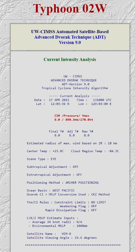
Super Typhoon Surigae has explosively intensified over the extremely warm waters of the Western Pacific just east of the Philippines. Satellite imagery using the Automated Dvorak Technique AND human Dvorak analysis both show T 8.0 which on the intensity scale is the top-end or apex. Few storms have reached this level of intensity to be observed on satellite.
While we do not have aircraft reconnaissance like in the Atlantic & Eastern Pacific, there is every reason to believe Surigae is packing winds well in excess of 175 mph, and could be significantly higher. T 8.0 usually means 170-knots while JTWC is analyzing at 155 knots. Yet, this is not Haiyan, so let’s leave that comparison alone as that epic November 2013 Typhoon remains at the top of the Super Typhoon rankings.
As mentioned in the previous post, we use satellite imagery to diagnose tropical cyclone intensity when we do not have planes in the area. Actually, routine aircraft recon ended in the Western Pacific in 1987 (!) and only short-duration research campaigns have invested resources into flying this monster storms. This is a shame because we could learn so much about tropical cyclones at their maximum intensity as well as their development. All of this knowledge could be directly translated to the Atlantic in order to calibrate instruments, improve modeling, and the holy grail of intensity prediction.
While the ECMWF model and its ensembles were warning about a potential Philippines landfall, that solution has again shifted eastward and there is much less concern about direct land impacts.
Why did Super Typhoon Surigae become so intense? Immense ocean heat available to fuel the storm.
We use a metric called Tropical Cyclone Heat Potential that diagnoses the amount of heat (storm fuel) in the upper-layer of the ocean. East of the Philippines lies the “warm pool” that remains an exceptional reservoir of ocean heat throughout the entire year. The ocean heat drops off markedly around 20°N.
Compare with the Atlantic Ocean and you’ll understand quickly why hurricanes do not form nor thrive in mid-April. However, it’s not impossible and if a disturbance somehow spun up in the Caribbean — and overcame insurmountable odds and strong vertical wind shear and dry air — then there is ample ocean heat to sustain a major hurricane. But, that’s just not happening in today’s climate. Also, this is an argument against beginning “hurricane season” earlier on May 15 — a topic of a coming post.
Here is the CIMMS ADT memorializing the amazing T 8.0.


