Two Hurricane Threats to the Gulf Coast
Laura and Marco aiming for Louisiana
The 2020 Atlantic hurricane season has seen a boatload of named storms as we have already burned through the M-storm. Many seasons don’t get to M let alone in middle-August. The peak of the season is around September 10th and another burst of tropical storm activity might be in the cards for the 2nd and 3rd weeks of September.
Tropical Storm Laura
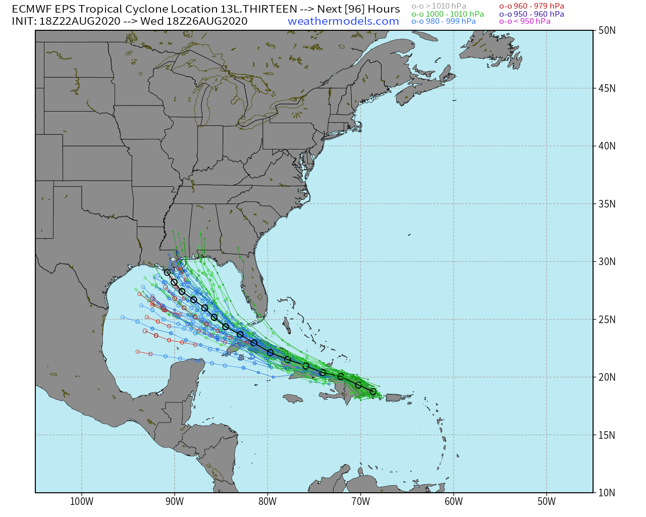
Laura has considerable land interaction ahead during the next 2-days but it is moving quite fast and that should allow the storm to maintain itself. The weather models have been rather insistent upon getting Laura into the Gulf of Mexico by late Monday and the NHC forecast track agrees.

The 11 PM EDT forecast track from the National Hurricane Center shows Laura tracking over land from Hispaniola to over Cuba the entire way. But, once it reaches the very warm Gulf of Mexico — hurricane fuel — the storm should intensify steadily into a hurricane. The central Gulf could be very favorable for intensification so I would not be surprised to see a major hurricane especially if the track is more westward than currently indicated.
The EPS (and GEFSv12) ensembles highlight this possibility: if Laura continues further westward, then the intensity will be at major strength. Since intensity and track are intimately related, a strong storm would head further west. But, right now we are looking at a Louisiana landfall at 90 mph so perhaps top-end Category 1. It’s worth pointing out that the HWRF hurricane model blows up Laura to a Category 4 but right now that scenario is being discounted. And, we probably would not pull the trigger on a major hurricane landfall until at least late Monday when the storm center emerges into the Gulf from Cuba.
And, oh yeah, this is only 48-hours after Marco makes landfall.
Tropical Storm Marco battling Wind Shear
At this time, southwesterly wind shear is tipping over Little Marco and intensification has stopped. I do not see an opportunity for wind shear to relax until perhaps near landfall. Thus, it would not surprise me that Marco impacts Louisiana a very wet, high-end tropical storm.
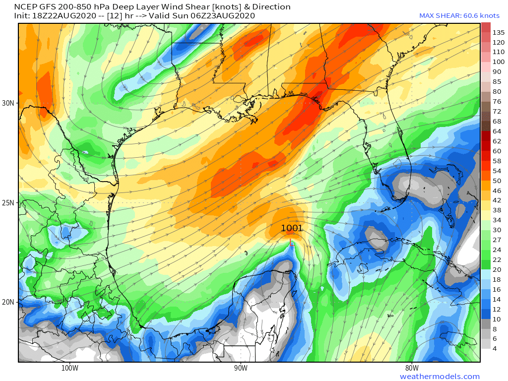
These two maps compare the wind shear early Sunday morning vs. early Wednesday morning when Laura will be in the central Gulf of Mexico. The conditions in a few days will be considerably more favorable for rapid intensification. However, that is dependent upon the convective structure of Laura and its ability to organize a central core & eyewall. I’ll be watching Laura much more closely than Marco unless something dramatically changes with the latter.

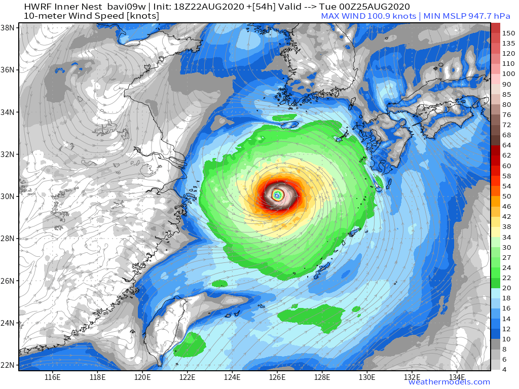
Typhoon Bavi
The Western Pacific has been historically quiet so far this year with only 15 units of ACE = 87% below normal as shown on my Global Tropical Cyclone ACE page.
But, Bavi is expected to reach at least 100-knots east of China before it encounters cooler water and wind shear heading up into the Korean Peninsula by mid-week.