


TS Isaias nearing Florida coast
Hurricane conditions possible on Sunday from West Palm Beach to Daytona Beach
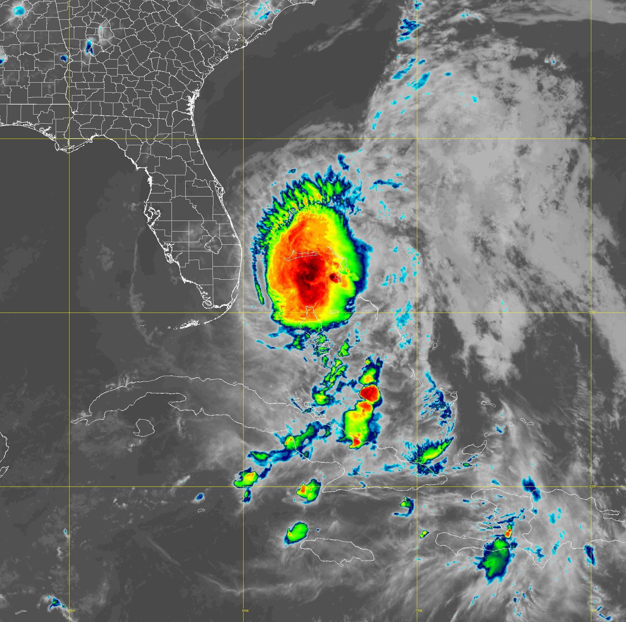
Wind shear, dry air and the passage over Andros Island in the Bahamas has stunted any intensification of Isaias. At 11 PM Saturday night, the storm is more symmetric but still struggling to keep itself vertically aligned in order to lower the central pressure quickly. But, even if Isaias does not regain hurricane status, wind gusts of 60-80 mph are certainly possible along the immediate coast.
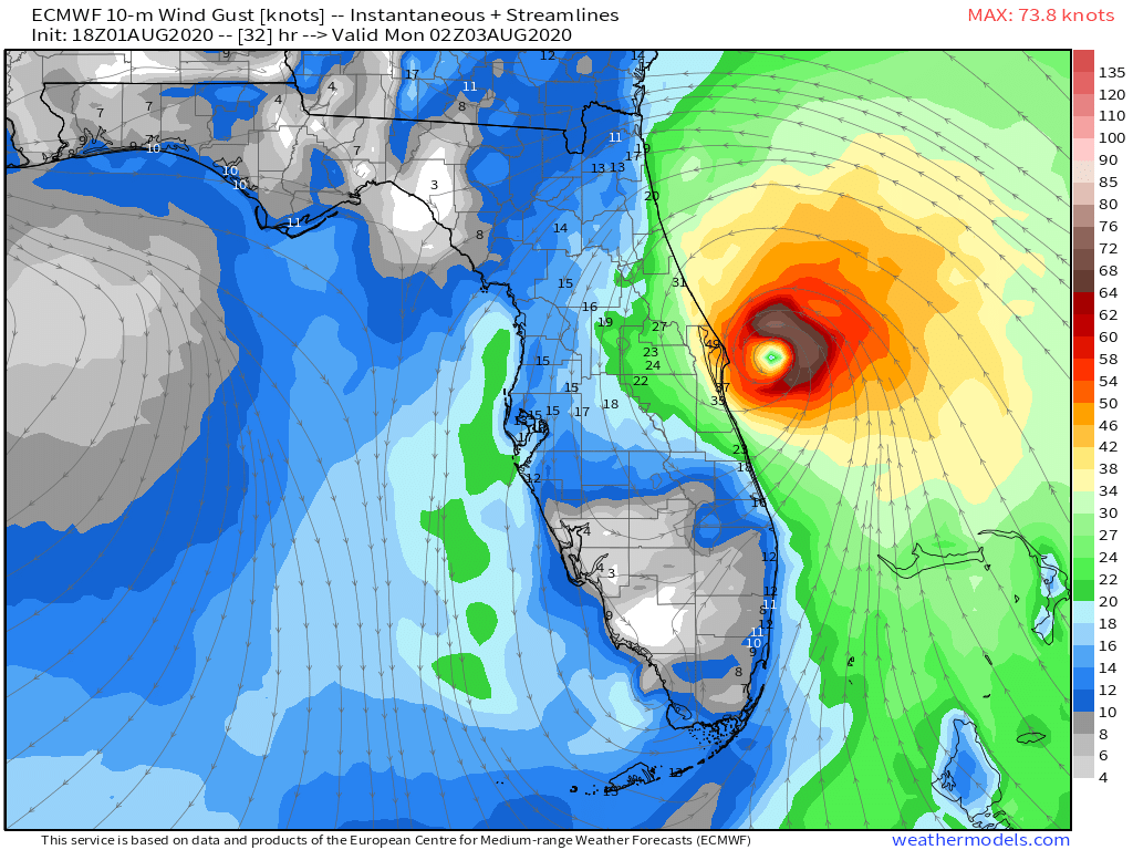
The National Weather Service offices put out wind gust forecasts and I mapped it as a maximum which produces a “swath” or footprint. There is considerable wind energy still available offshore and any rain bands could certainly bring gusty winds or a brief but weak tornado.

The National Hurricane Center is forecasting landfall near Melbourne — if it happens at all. There is some wiggle room in the recent models. But, the definition of landfall is if the center of the storm (lowest pressure) intersects the coast. Not the eyewall but the center. I’d say it’s a coin flip at best for landfall.
This could have been a lot worse as the waters are very warm in the Bahamas and other storms on similar paths have exploded into intense hurricanes. Thanks to an old Saharan air layer (dry air) and strong wind shear, the formation of a tight inner-core occurred but just couldn’t survive. Hurricanes are fickle in marginal environments during their formation stage.