Tropical Storm Bill forms off US East Coast
Watching Gulf of Mexico for another storm
Tropical Storm Bill was classified at 11 PM ET Monday (June 14th) at about 37°North latitude over the warm Gulf Stream. In mid-June, the ocean temperatures are warm enough for tropical development, being above 26°C. Bill is a small system but has another 24-hours to intensify a bit more — maybe 45-50 knots — before becoming post-frontal and crossing over Canadian Maritimes.
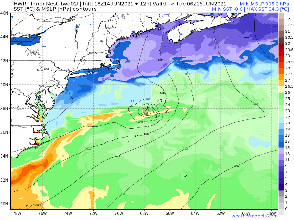
Map of Sea Surface Temperatures and Bill’s location from HWRF weather model.

Gulf of Mexico tropical disturbance
We’ve been watching the southern Gulf of Mexico for more than a week waiting for the gyre pattern to consolidate over water, generate convection (storms) and create an area of low pressure. The NHC gives the area a 70% chance of tropical cyclone development in next 5-days, and that’s a good signal that at least another Tropical Depression or Storm will form.
Until the area of low-pressure forms, there is low confidence on the actual track or landfall location of whatever develops. But by Friday, the most recent ECMWF 18z update provides a good idea that the system will be large, disorganized, and loaded with deep tropical moisture. That will be the story of this system — extremely heavy rainfall threat from Texas coast to Louisiana.
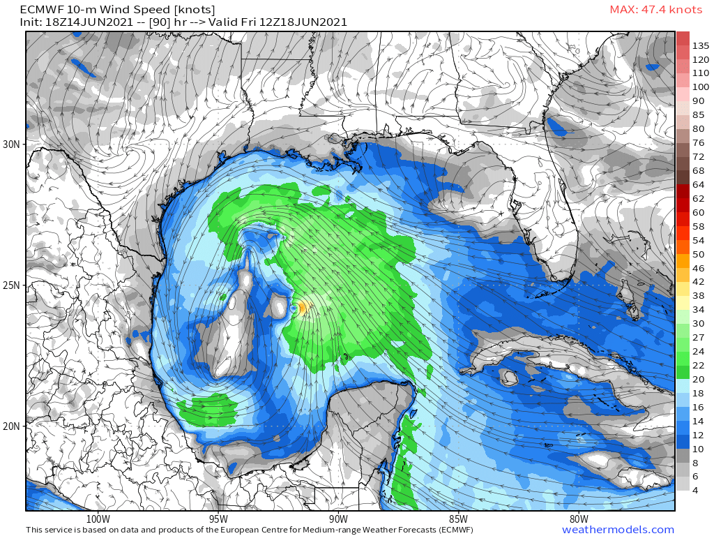
10-meter Wind speed map Friday morning 8 AM ET showing large area of 20-25 knot winds with embedded circulations, that are like little tropical storms in themselves.
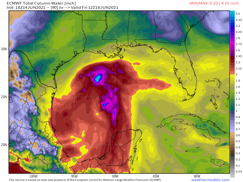
My favorite variable is precipitable water since it shows the moisture content of the entire atmosphere. 2-inches+ is usually tropical air and anything in the 2.5 - 3”+ is deep tropical convection usually seen with tropical cyclones.
Disorganized tropical storms are often a worse outcome than a Category 1 hurricane since the poorly developed structure allows for flooding rains. There are many examples of June tropical storms with weak winds but disastrous flooding. The Gulf coast states have been inundated with rain and do not need a tropical storm.
Death Valley and Southwestern Heat
Extreme heat is building across the Southwest including California, Nevada, Arizona and even Montana underneath a strong ridge or “heat dome” of high pressure.
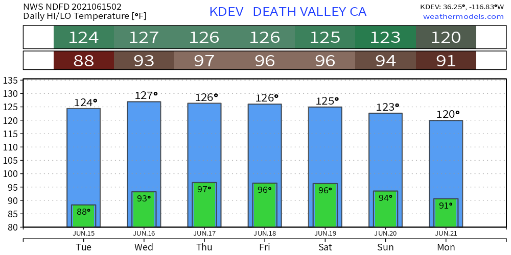
Death Valley forecast to 127°F by NWS.
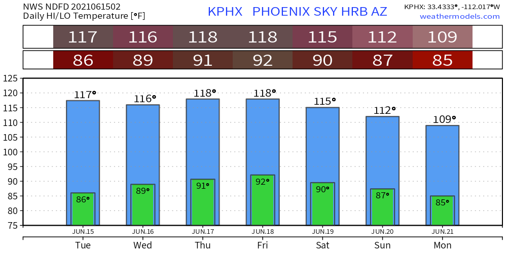
Phoenix to 118°F on Thursday and Friday. Note, the overnight lows are in the 90s which is brutal to human bodies unable to cool down. June monthly record highs could be threatened in some locations.
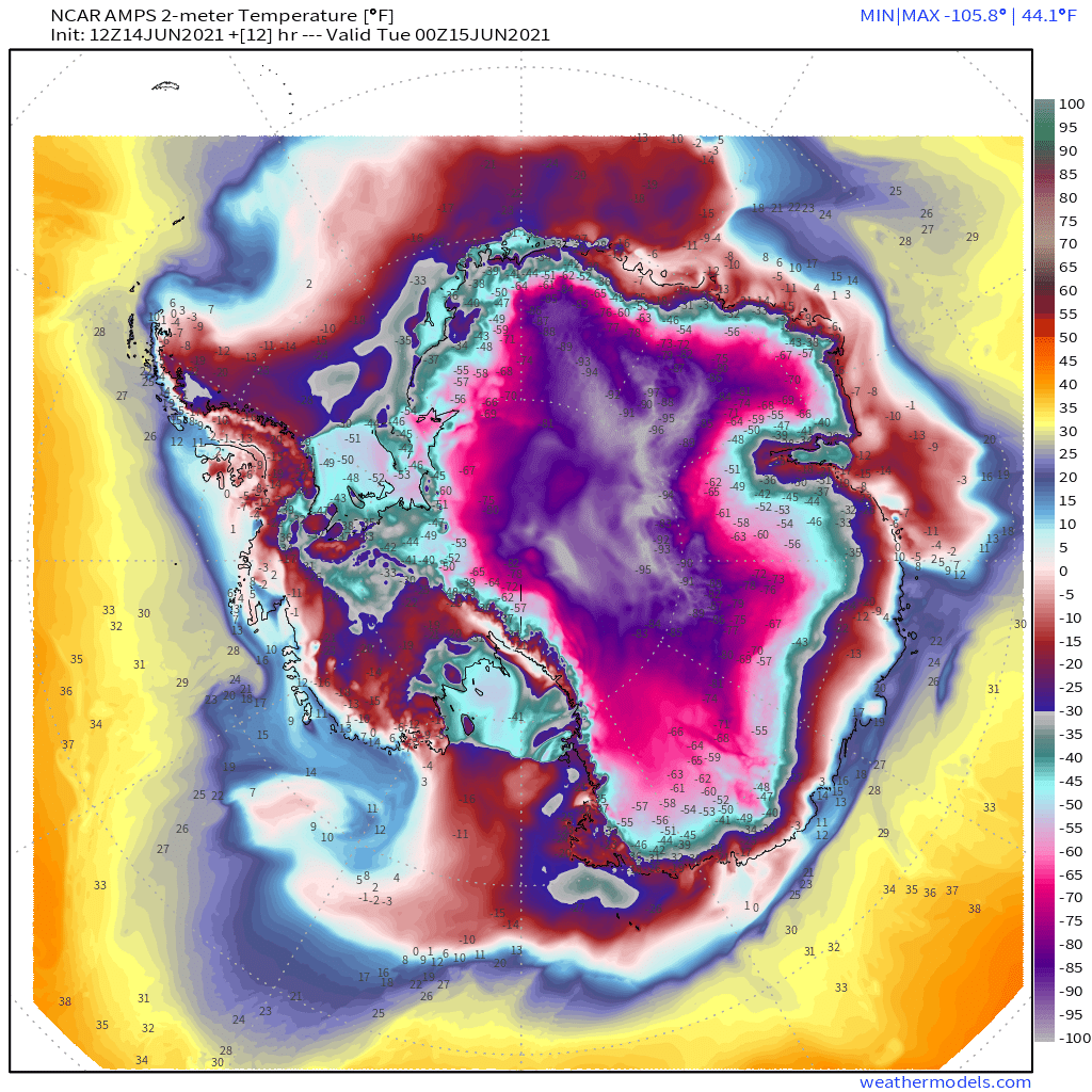
Antarctica Extreme Cold
It’s almost winter in Antarctica and the continent is running well-below normal temperatures due to a strong circumpolar vortex. Temperatures colder than -100°F are found over the elevated ice sheet. This is not habitable for humans.