


Tropical Depression 03L forms
Tropical Storm Cristobal expected soon but questions remain about the medium-range forecast
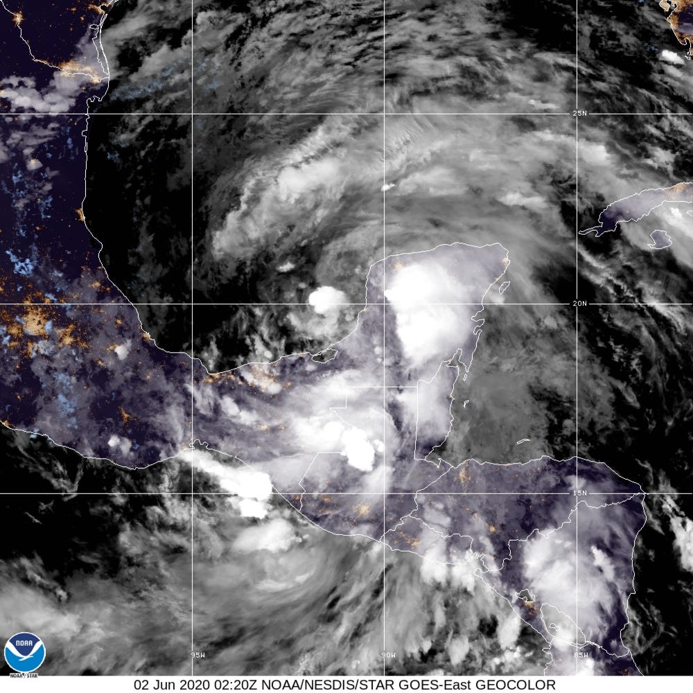
Tropical Depression 03L formed on Monday and remains a large, poorly organized circulation centered in the far southern Bay of Campeche. The National Hurricane Center is waiting to see what happens with TD 03L as there are two scenarios: the storm develops and drifts SSW into Mexico making landfall as a tropical storm, or it lingers in the southern Gulf of Mexico before being prodded northward as part of the overall gyre circulation.
What is alarming is the number of members of the very good ECMWF ensemble system that have red-coded tracks equivalent in central pressure powerful Category 2+ hurricane. I’d put this probability at 50% of a hurricane eventually making landfall after Sunday along the Texas Gulf Coast. It’s hard to ignore this strong ensemble signal.

But, we must pay deference to the GFS 18z which had a large hybrid system in the Northern Gulf. The wind speeds wouldn’t be all that impressive but boatloads of rain would occur with that deep-tropical plume of moisture driving north.


In conclusion, I have medium confidence in the track of this large system into the northern Gulf with preference to SE Texas following the general signal of the ECMWF ensembles. The intensity could be tropical storm to rather strong hurricane but climatology of early June would generally disfavor a high end system.