
Super Typhoon Dolphin
After eyewall replacement cycle, the powerful Western Pacific typhoon will become a buzzsaw at Category 5

This is Weather Wires post 3: Day 210 of 2026.
Day 59 of Atlantic Hurricane Season | To date: 2 Named Storms
Author: Dr. Ryan Maue (X @RyanWeather X @weathertrader)
Welcome to new paid subscribers and supporters. Your trust and support is greatly appreciated. Nearing forecast post 1,000.
Weather Trader is entirely reader-supported publication (no ads). To receive all new posts and support our work, consider becoming a paid subscriber.

Now Operational: Squall Cloud global weather satellite viewer.
Typhoon Dolphin (12W) with a much larger eye and very cold convective cloud canopy around it — satellite intensity > T 7.0 now
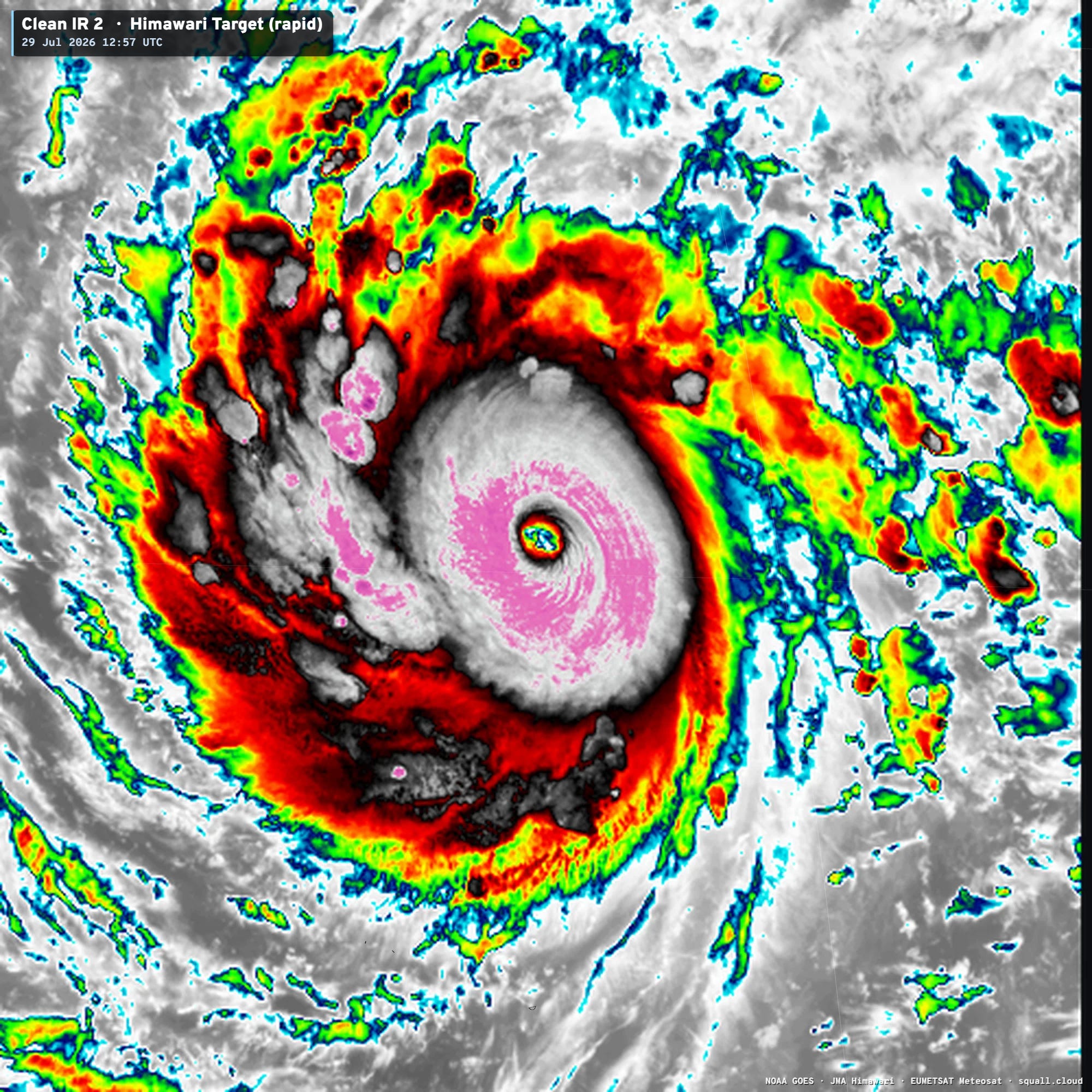
Satellite imagery at squall.cloud
Dolphin is way out in the far Western Pacific. This location for genesis of a tropical storm — actually coming out of the Central Pacific as Invest 92P — is typical during a strong El Niño. All of the real estate (ocean) ahead of Dolphin is record warm > 30°C or 31°C
Sea Surface Temperatures (Met Office OSTIA 0.05°)
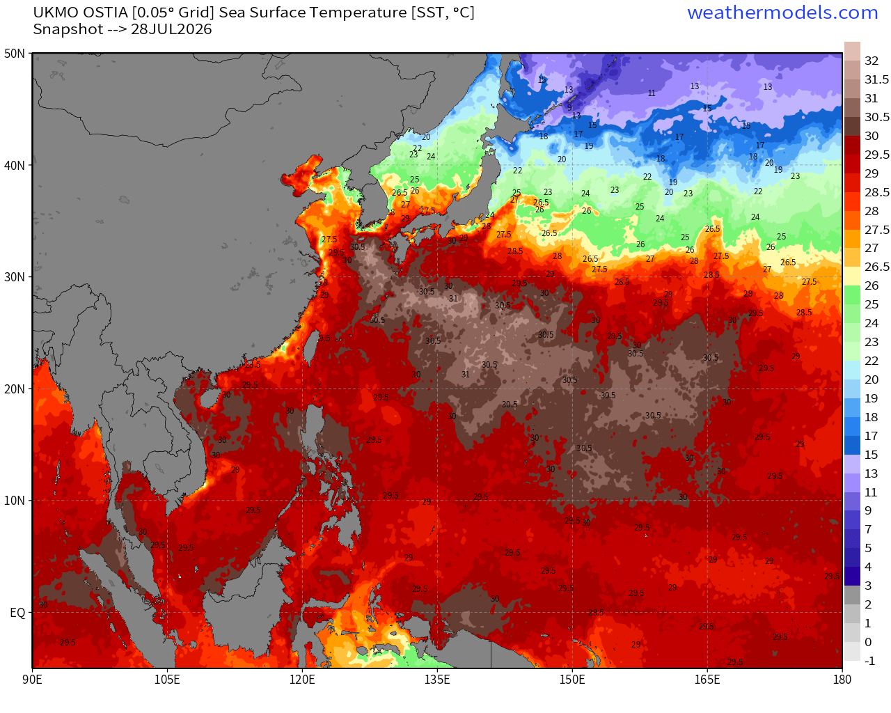
The track of Dolphin is coincidentally right over the very warm waters, so any inhibition to maximum intensity will be environmental dry air, wind shear, and any structural issues (eyewall replacement cycles) or expansion to a giant tractor tire type system while approaching the subtropics.
Typhoon 12W Automated Dvorak Technique (ADT)
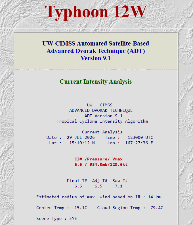
Satellites can infer the intensity of a tropical cyclone by examining the eye temperature and the “Cloud Region” temperature of the convection around it. Once the eye warms > 0°C while the cloud region hovers around -80°C, we can pretty much guarantee Category 5 (140-knots). If the eye warms to +20°C, then we can get to T 8.0 (170-knots) and Dolphin would become one of the most intense typhoons on record. Should get there in the next 24-36 hours, or sooner!
Track of Super Typhoon Dolphin
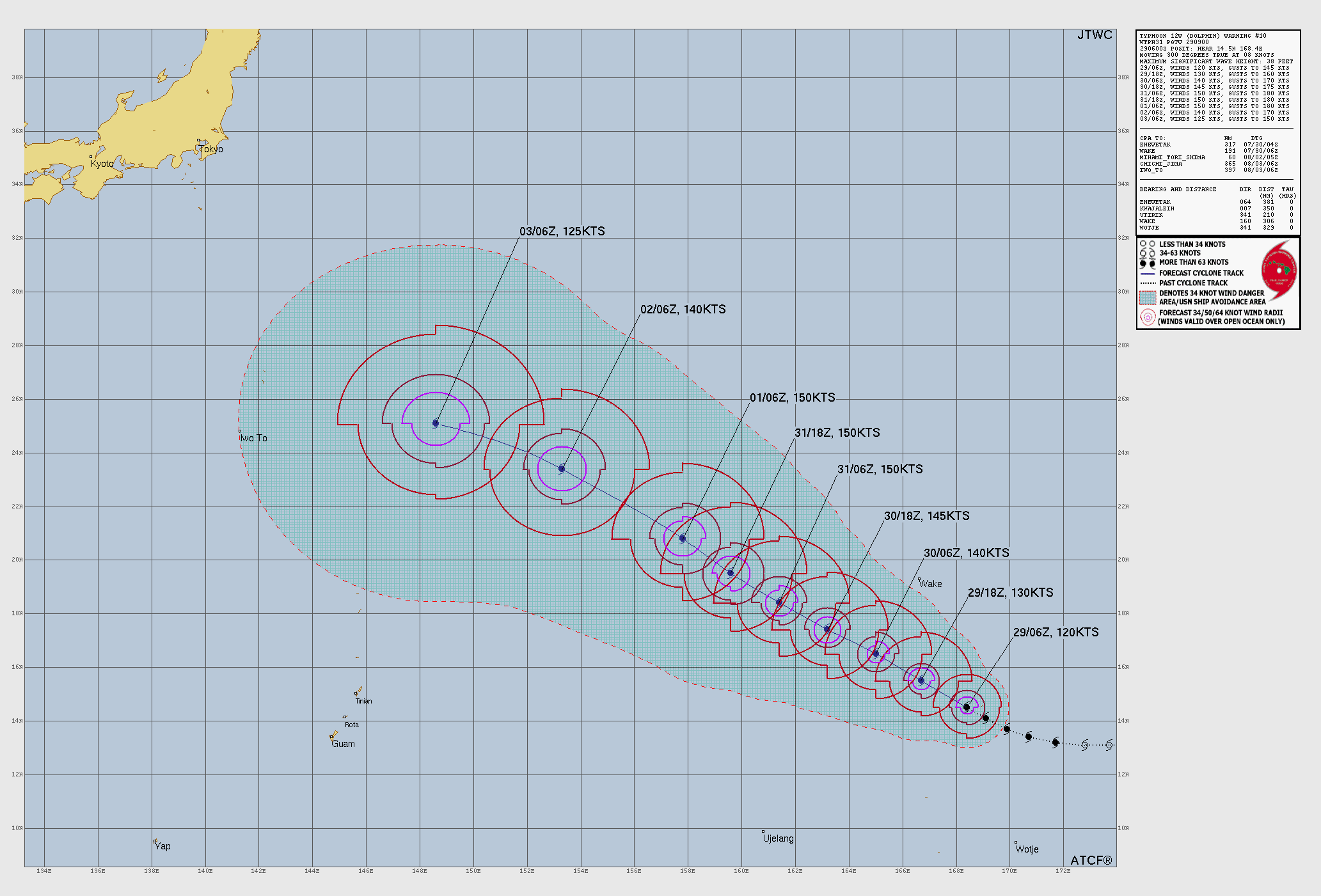
JTWC forecast — maximum winds of 150-knots on a WNW course
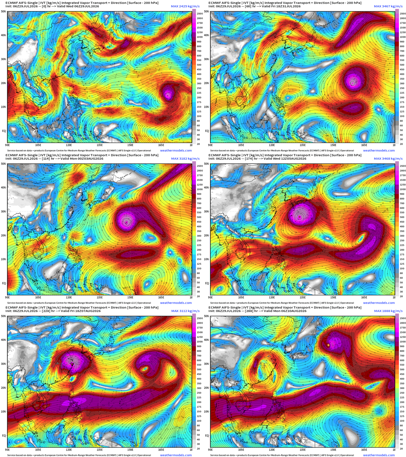
Over the next 12-days, Dolphin will approach southern Japan and then either continue along a more northerly course toward Korea, or perhaps bend westward into China.
Precipitable Water Next 6-days (ECMWF 06z)
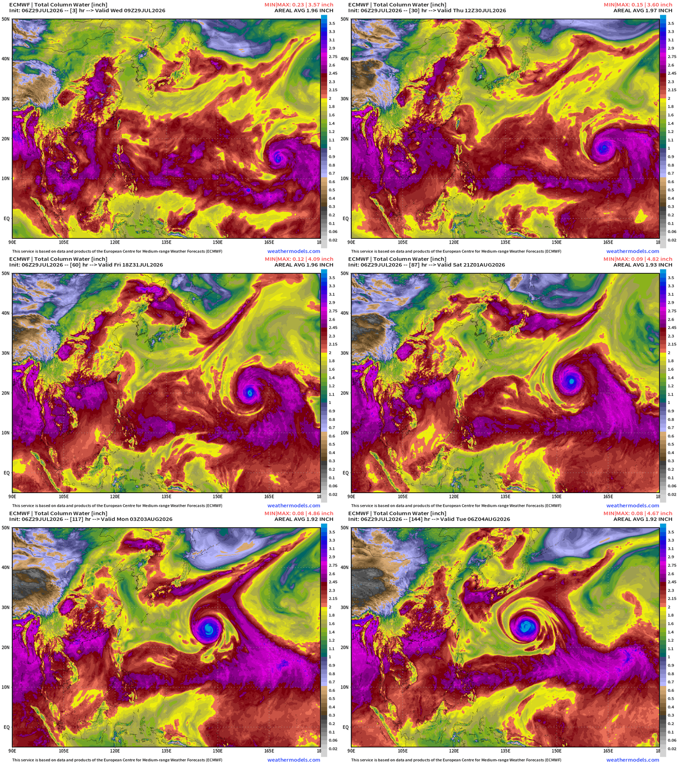
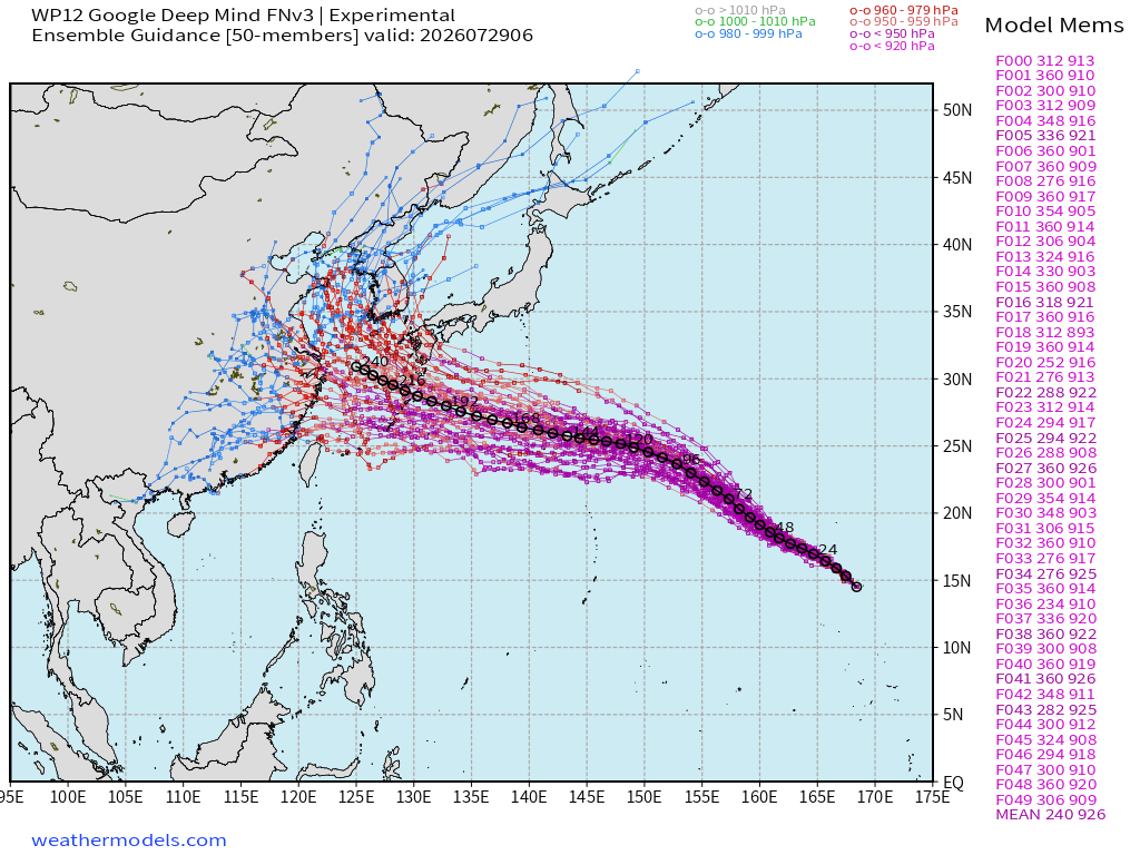
Google Deep Mind Ensembles (06z fresh) show most intensity outcomes in the 900-920 mb range with the ensemble mean outcome (that’s not an actual track forecast itself) heading south of Japan
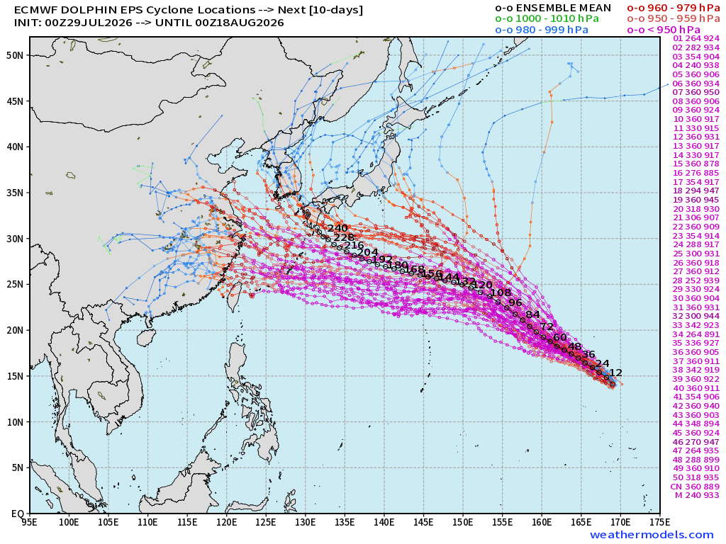
The full-physics ECMWF EPS 00z shows two track clusters but the most populated matches the Google Deep Mind southward track along 30°N latitude
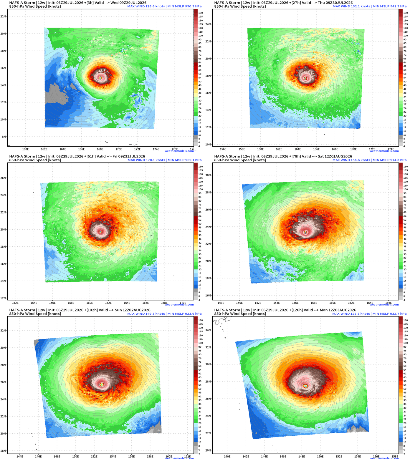
HAFS-A Mesoscale Model
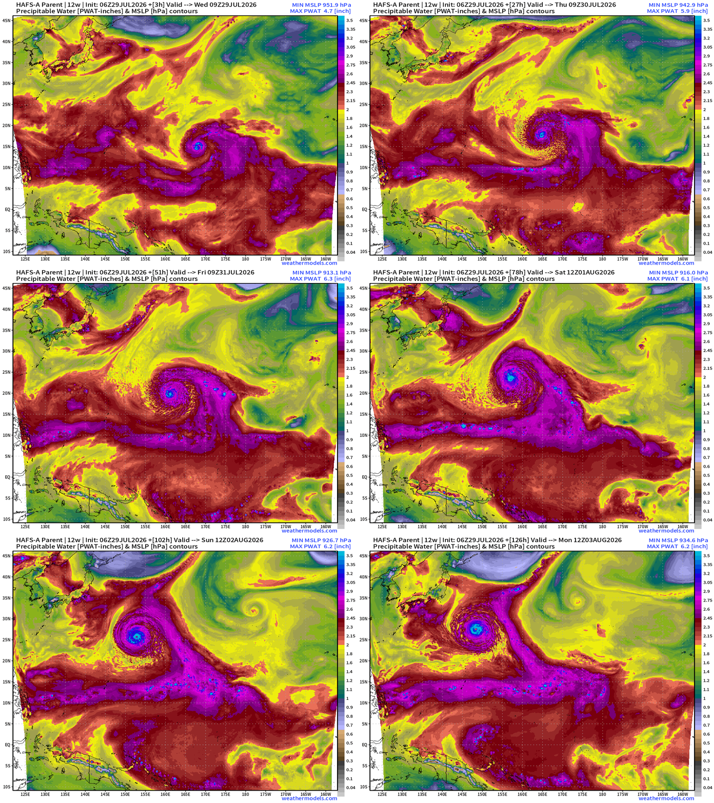
Dolphin will be well away for land for the next week, at least, so we can watch the massive Super Typhoon with awe from space.
During the next several days, Dolphin will become larger in size, dramatically.
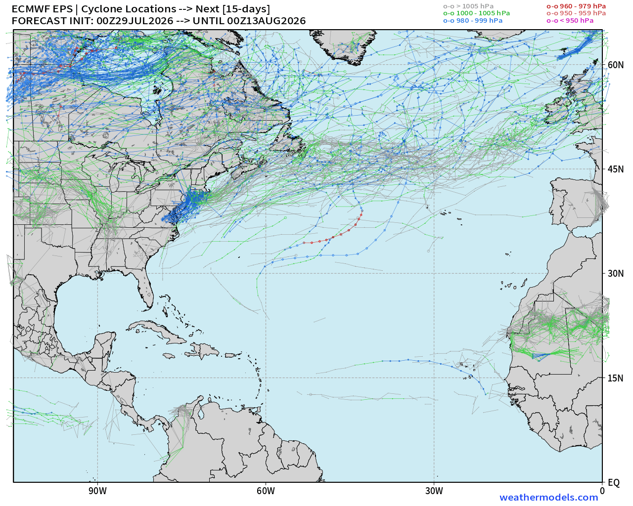
Atlantic Tropics —> ghost town into mid-August
Ensembles (50-members) through Aug 12th —> nothing stirring or threatening.
Maps sourced from weathermodels.com designed and innovated by yours truly! Please subscribe there for real-time access to the newest maps, charts from all of the weather models including ECMWF and AIFS, and NOAA GFS/GEFS, HRRR/RRFS and Blend of Models (NBM). NOAA WPC and SPC for fronts/convective outlooks. Our own content is now sourced from hottestsince.com and weather.city and celsius.earth, and soon squall.cloud and weather.football
My Atlantic Hurricane Season Forecast (2026)
From April 7, 2026: Atlantic Seasonal Hurricane Forecast: (11/5/2)
9-13 Named Storms (11 most likely)
4-7 Hurricanes (5 or 6 most likely)
1-3 Major Hurricanes (2 most likely)
Accumulated Cyclone Energy: 75-85 (well below normal)
NOAA 2026 Atlantic Hurricane Season Forecast