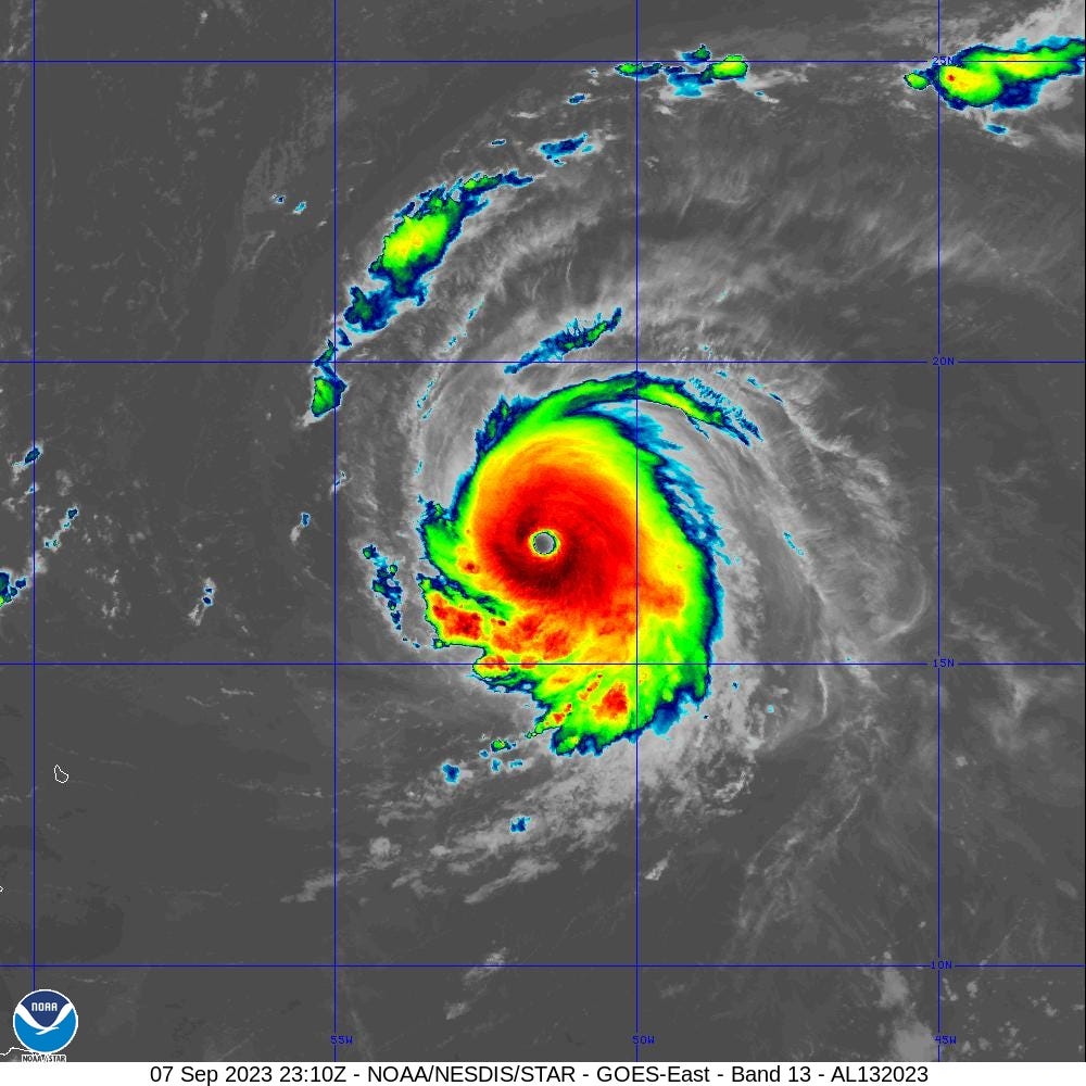
Hurricane Lee briefly reached Category 5 status before slightly weakening. The maximum intensity was 145-knots, but has fallen slightly. While NHC does not forecast explicitly reaching Category 5 again, Lee may intensify again as ocean heat content remains high/warm and wind shear decreases over Atlantic east of Bahamas and north of Puerto Rico. Currently, 1:10 PM ET, Hurricane Lee looks a little rough around the edges especially on the western half of the circulation. Some wind shear is eroding the convection and the eye has filled.
Compare to the peak intensity according to satellite algorithm (ADT) at 2310Z on Sept 07, 2023:
Reminder, that the most intense hurricanes can be rather fickle and internalize even minor perturbations into larger problems for the inner-core, triggering eyewall replacement cycles or disruptions. This was similar to what happened with Idalia just hours before landfall in Florida, thankfully.
At what longitude will Hurricane Lee reach 25°N? The NHC 11 AM forecast is at about 68°W which lines up closely with recent 12z GFS model update.
Keep reading with a 7-day free trial
Subscribe to Weather Trader to keep reading this post and get 7 days of free access to the full post archives.


