


September 28, 2023 Afternoon Update
NYC potential urban flooding threat
As hurricane season winds down, I am transitioning to more of a U.S. National weather overview similar to what you see on other blogs, but from a more technical and unique perspective. I’ll focus on the tropics, of course, but also spend more time on medium range extreme weather like Nor’easters, Arctic blasts, and western U.S. atmospheric rivers. You’ll also have ground-floor or Beta access to new forecasting products coming online shortly. The idea is to keep these updates concise but informative to provide a heads up on weather problems down the road.
Northeast Flooding Event
Heavy rain threat centered upon NYC Friday into Saturday with potential for 5+ inches of rain in the largely urban area. Mesoscale model output like RRFS/HRRR shows even higher localized amounts or bullseyes of 10-15” depending upon where the conveyor belt of persistent rainfall acts like a firehose from the Atlantic.


What changed with the forecast from yesterday? The rain shield shifted SW over NYC leaving Boston and northern New England much drier.
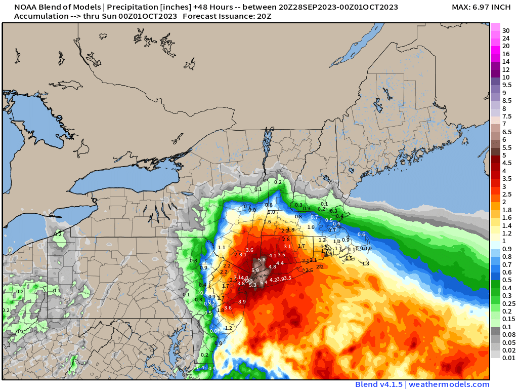
And, just like that, the Blend of Models zeroed in on the solution with the inclusion of the NAM-WRF and GFS/ECMWF updated by one day. The forecast is no longer “blurry” or a smooth depiction of conflicting model solutions but instead pegged or focused on the most-likely outcome within 36-48 hours.
2023 Atlantic Hurricane Season
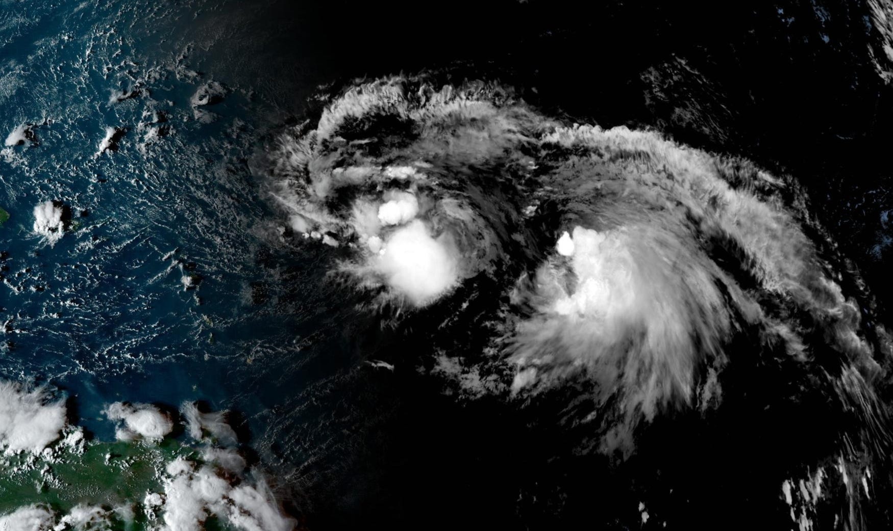
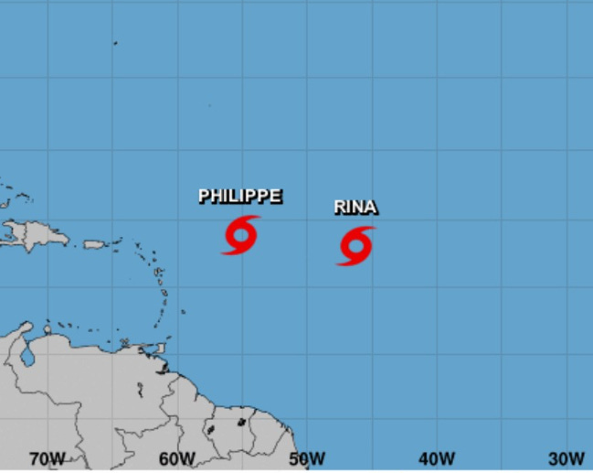
Philippe and Rina are unusually close together in the Atlantic basin east of the Leeward Islands. Normally, we see these storm couples or triplets in the Western Pacific, which has the ability to spin up multiple storms at once out of the monsoon trough.
...PHILIPPE'S FATE IS UNCERTAIN...
NHC doesn’t know what will happen to Philippe. My practice is to stick with the ECMWF in the near-term for tropical cyclogenesis or weak systems, and then blend the GFS + ensembles in the medium range.
ECMWF HRES (12Z) wipes them both out.

2023 Atlantic Hurricane Season | Medium Range Outlook
In the next 5-days, not much is expected out of Philippe and Rina. However, there is the opportunity for one of them to burst convection — and the stars align — with less hostile vertical wind shear for intensification. Out of the 51-EPS ensembles, the vast majority develop a major hurricane. Previous forecasts did show Rina developing so we shouldn’t write it off quite yet. No threat to land, so no worry or hurry.

2023 Eastern Pacific Hurricane Season
A weak disturbance has a very low chance (10%) to develop the next few days well out in the open Eastern Pacific.
2023 Western Pacific Typhoon Season
Invest 93W is expected to develop in the next few days and likely will become a Typhoon heading WSW between Taiwan and Luzon.


Thank you for subscribing! Your support pays for my servers and product development. Feel free to say hello and follow on Twitter (@RyanMaue)