


September 2, 2023 Hurricane Season
Tropical wave in Main Development Region ready to roll
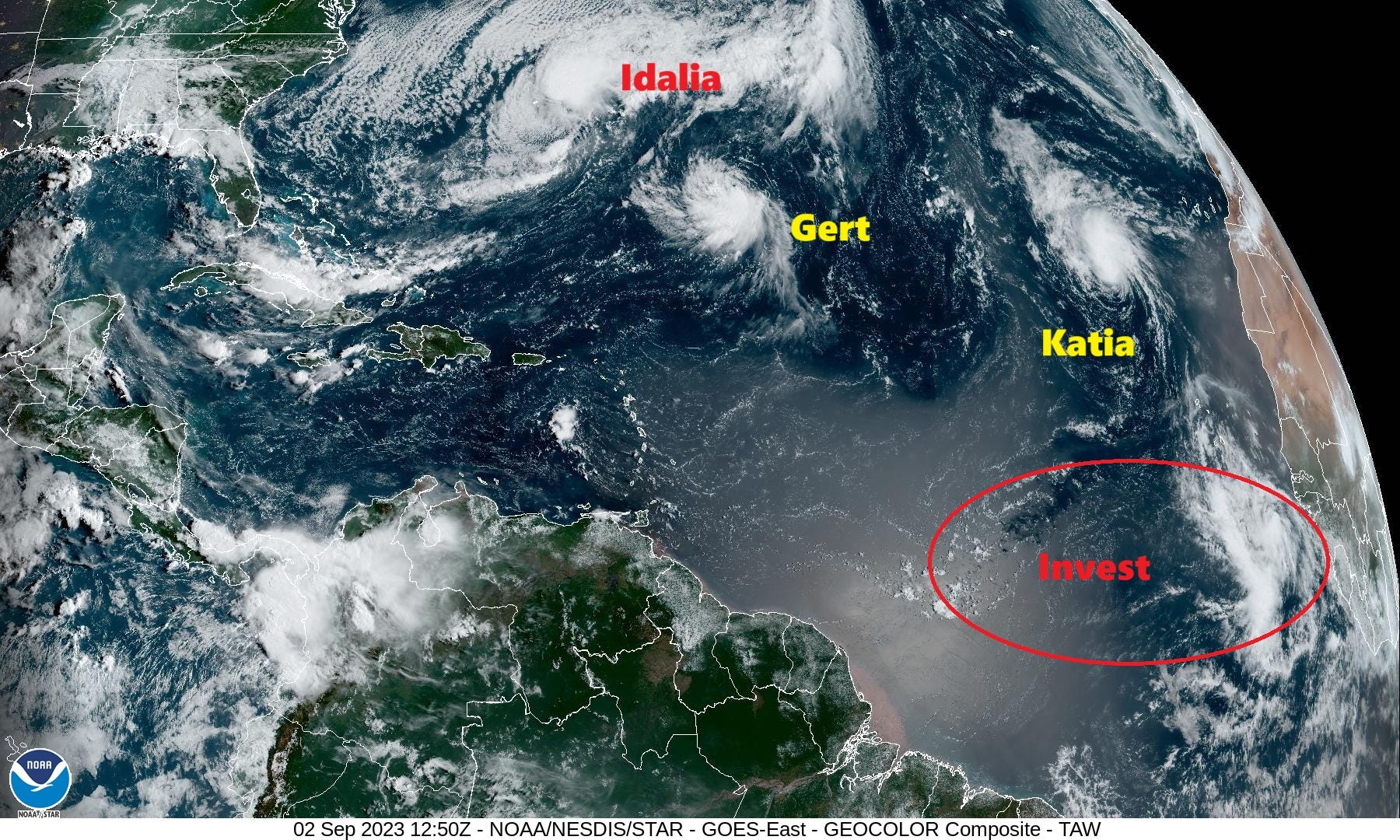
The ranks thinned since yesterday as Franklin and Jose departed into the North Atlantic as post-tropical systems. Katia and Gert are both small but handsome tropical storms. Idalia is about to regain tropical storm status briefly as it lashes Bermuda with gusty winds and rain.
The main event is off the coast of Africa with a tropical wave expected to develop next week into a powerful Cabo Verde hurricane to herald in the peak of the season.

2023 Medium Range Atlantic Tropics
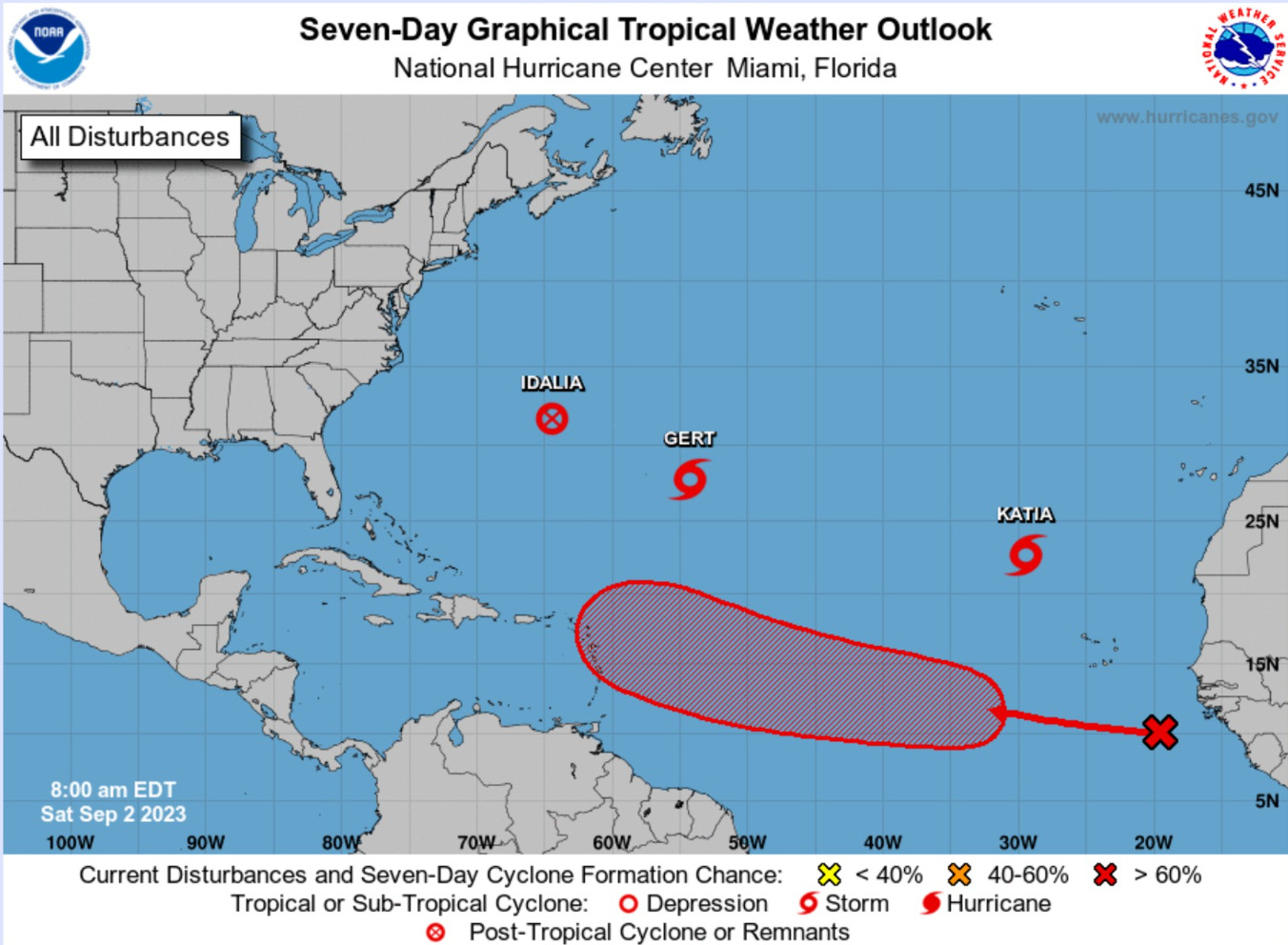
Idalia is lingering as a post-tropical system and will shed its front to become subtropical or tropical again. Gert and Katia are heading out to sea but will not last much longer. Gert was upgraded to a tropical storm after 11-days of wandering around the subtropical Atlantic somehow managing to maintain its low-level circulation.

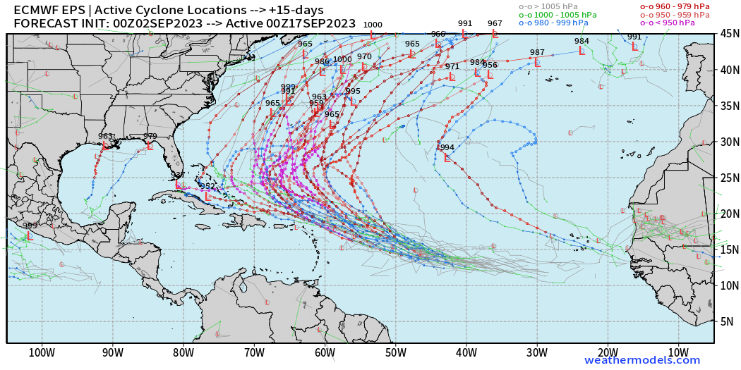
The tropical wave in the far eastern MDR is expected to become a major hurricane according to the vast majority of ECMWF EPS ensembles. The track at 10-days is to the north of the Leeward Islands and Puerto Rico. Let’s hope this remains a fish storm. The next name is Lee.
There’s usually a small, random chance of a tropical storm or hurricane development elsewhere like in the Gulf of Mexico in 2-weeks. However, this is just too small of a chance to consider. We are probably 10-years away from having confident 10-day track and intensity guidance. The next week looks quiet for the United States.
Atlantic 2023 Year to Date | ACE: 55 (153% normal | 36)
Unnamed Subtropical Storm [January 2023]
Arlene 02L: 35 knots, Bret 03L: 60 knots, Cindy 04L: 50 knots
Don 05L: 65 knots, Emily 07L: 45 knots, Franklin 08L: 130 knots
Gert 06L: 40+ knots, Harold 09L: 45-knots, Idalia: 115-knots
Jose: 50-knots, Katia: tropical storm, Lee and Margot are next
2023 Eastern Pacific Hurricane Season
Formation chance through 7 days...high...80 percent.
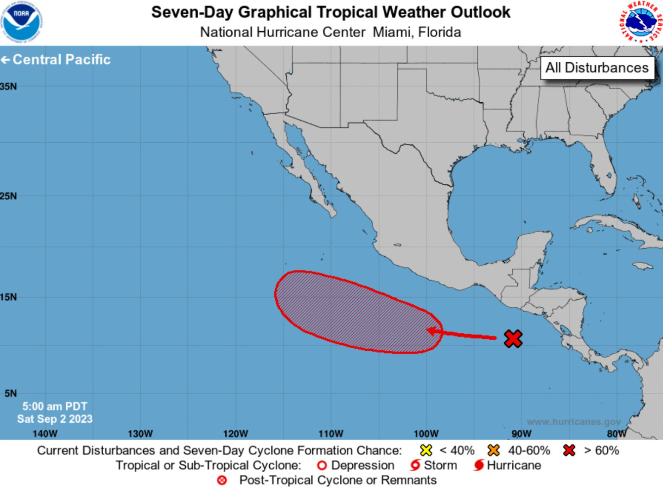
Area of low pressure likely to develop later next week, but no impacts to land are expected.
Eastern Pacific 2023 | Year to Date ACE 106 (130% of normal | 81)
Adrian 01E: 90 knots, Beatriz 02E: 75 knots, Calvin 03E: 110 knots
Four 04E: 30 knots, Dora 05E: 125 knots, Eugene 06E: 60 knots
Fernanda 07E: 115 knots, Greg 08E: 45 knots
Hilary 09E: 125 knots, Irwin 10E: 40 knots
2023 Western Pacific Typhoon Season
Saola (09W) brushed Hong Kong with 80-90 mph winds and then made landfall in China on Friday.
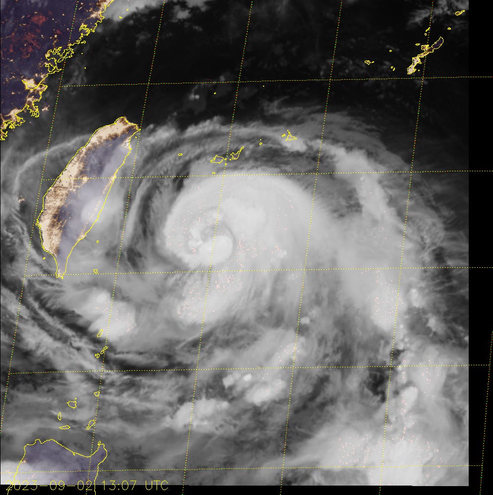
Typhoon Haikui (10W) is now forecast to directly impact Taiwan as a Category 3 or 4 Typhoon depending upon its battle with wind shear preventing the eye from organizing. Ocean waters east of Taiwan are very warm so this is an ideal location for the most intense Typhoons. Kirogi (11W) has fallen apart.
Western Pacific Typhoon 2023 YTD ACE: 205 (151% normal | 136)
Sanvu 01W: 30 knots, Mawar 02W: 160 knots, Guchol 03W: 90 knots
Talim 04W: 85 knots, Doksuri 05W: 130 knots, Khanun 06W: 120 knots
Lan 07W: 115 knots, Damrey 08W: 65 knots, Saola 09W: 135 knots
Haikui 10W: typhoon, Kirogi 11W: tropical storm
Thank you for subscribing! Your support pays for my servers and product development. Feel free to say hello and follow on Twitter (@RyanMaue)