


September 18, 2023 Hurricane Season
Area off Southeast US coast could become tropical this weekend
Top story this week across the United States: early-fall weather large-scale frontal pattern with a rainmaker across the Northeast bringing the blustery weather that Lee did not during the weekend. Large area of 1-2 inches+ across New England including Boston.
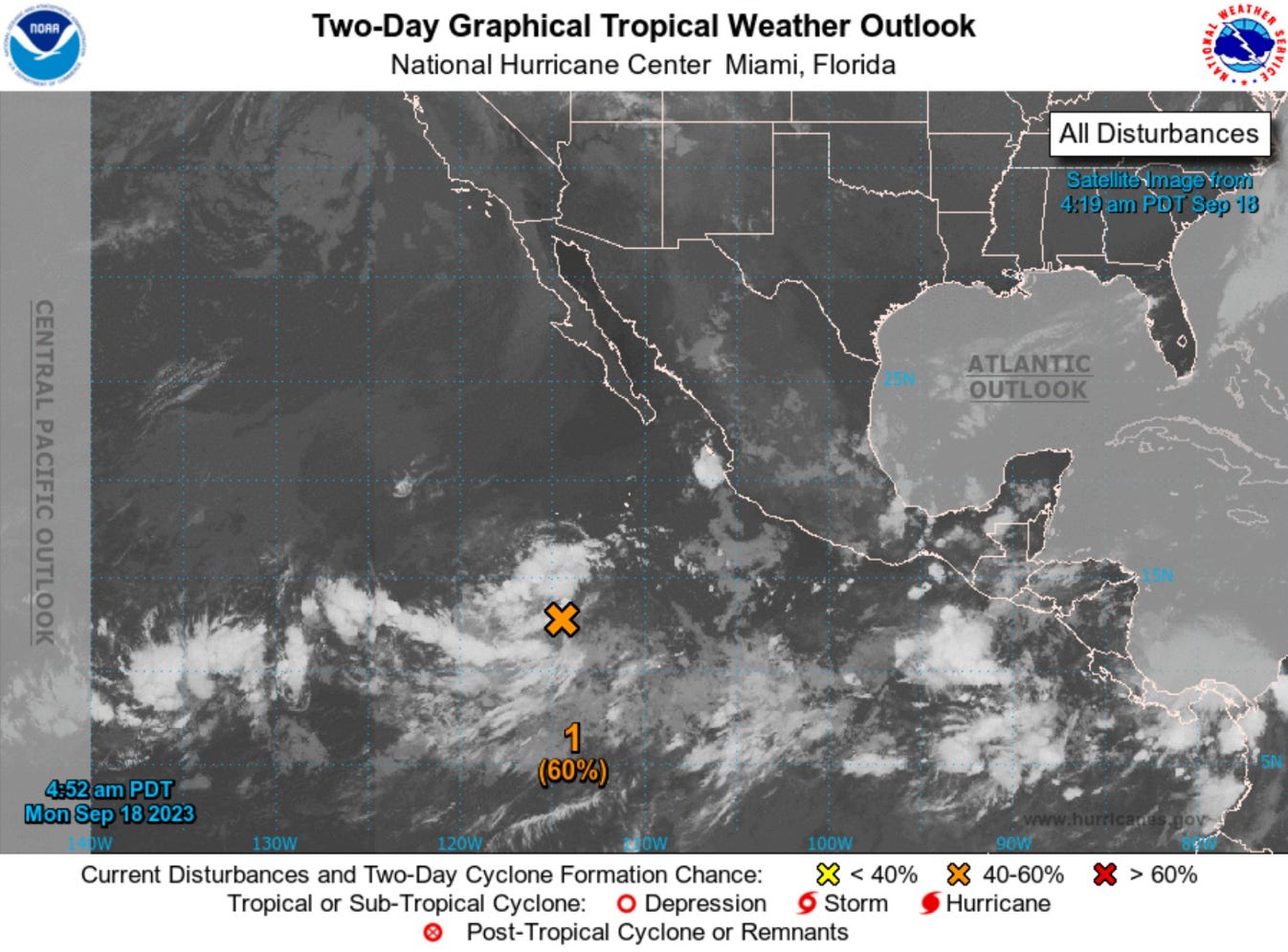
Then, an area of low pressure will develop along a trailing cold front extending into Florida. The onshore flow will provide considerable rainfall from FL to VA. There is a chance this system develops into a Tropical Depression or Tropical Storm this weekend.
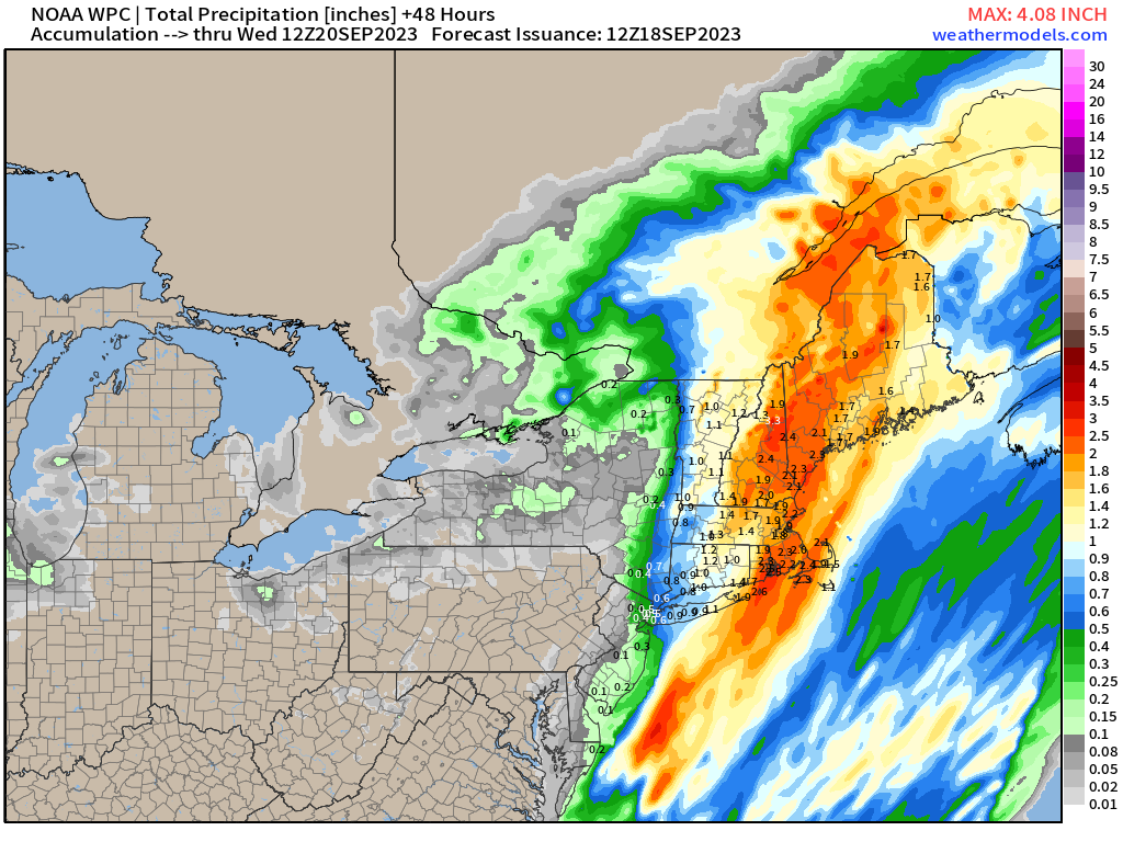
During the next 7-days, thankfully an extended dry period for Nashville and Atlanta, but look at all that rain for Florida I-95 corridor up to the Carolinas.


Plenty of rainfall for the Central Plains as well with a powerful storm system with potential severe weather. Here’s the precipitable water (moisture) on Sunday from GFS. This looks like an early fall storm. See the onshore moisture plume out of the tropics along the Mid-Atlantic coast, which could become our tropical storm.

2023 Atlantic Hurricane Season
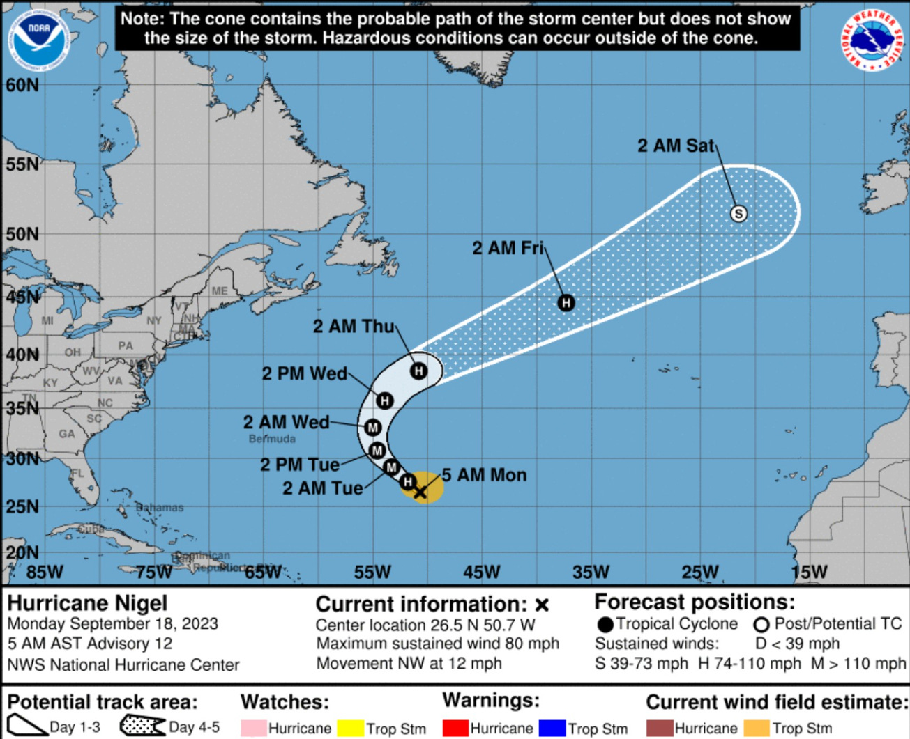
Hurricane Nigel has improved organization dramatically, now at 70-knots (Category 1). As forecast a week ago, Nigel should reach major hurricane strength by Tuesday with maximum around 105-knots.
It seems like the long-awaited rapid intensification phase of Nigel
is underway.
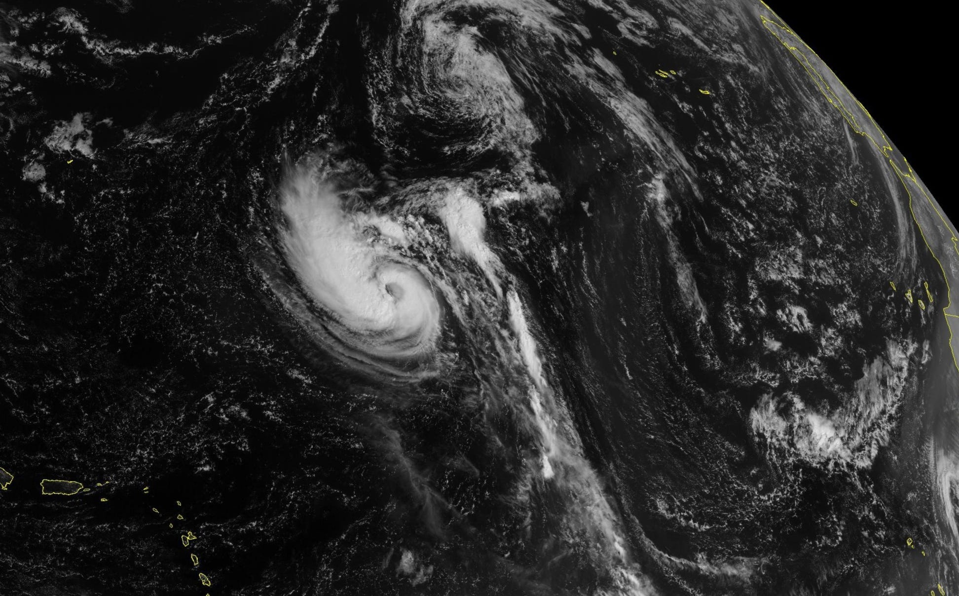
No surprise if Nigel reaches Category 4. The track is out to sea missing Bermuda by a wide margin to the east. Nigel could reinvigorate as a post-tropical system in the North Atlantic, but that solution seen with GFS has not been picked up by ECMWF as strongly.
Atlantic Basin Medium Range Outlook
Southeast US Coast
This weekend, a frontal boundary could spin up a weak tropical depression or storm (30% chance NHC) and slowly meander north across the Carolinas. Regardless of any classification, this storm will provide deep tropical moisture flow into the coast from Florida to the Mid-Atlantic resulting in heavy rain for many days.
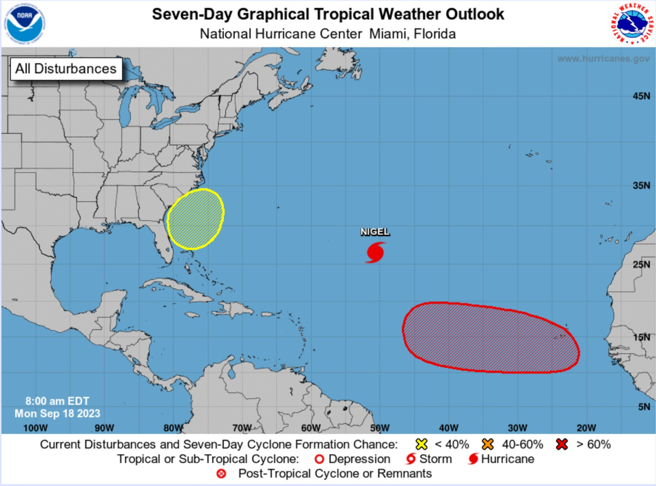
A tropical wave coming off Africa has a high potential to become a tropical cyclone and likely hurricane, perhaps major or intense by next week. There could be a threat to the Leeward Islands if the system — next names are Ophelia and Philippe — fails to recurve out to sea. That is not a sure thing, but the most likely solution.

2023 Eastern Pacific Hurricane Season
Invest 95E expected to become a tropical storm in the next few days, but no threat to land. The next name is still Kenneth.
2023 Western Pacific Typhoon Season
Quiet for the next few days. Invest 96W is being monitored for development. The last week of September should be more active across the WPAC.

Atlantic ACE is now 110 and will finish the season above average/median for the past 30-years. Assuming the African easterly wave does develop into a major hurricane, we can add another 40-50 points from Nigel and that storm to the seasonal total, now in the 160+ range for 2023.
Thank you for subscribing! Your support pays for my servers and product development. Feel free to say hello and follow on Twitter (@RyanMaue)
The Mississippi basin can use the rain, as the river is running very low at this time.