September 11, 2023 Hurricane Season
Hurricane Lee winds and waves to impact Northeast US this weekend
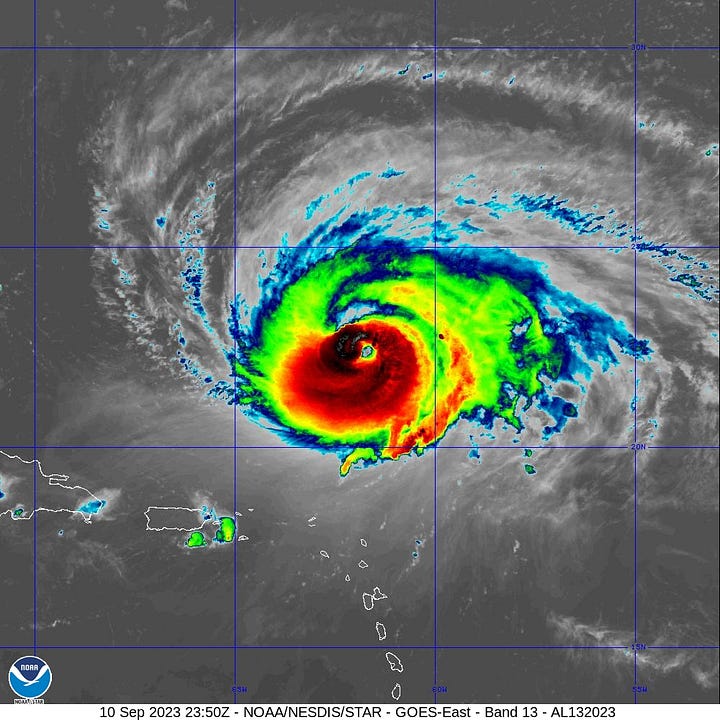
Hurricane Lee looked great on satellite Sunday evening with a clear eye surrounded by deep convection. And, then it all went sideways for Lee, again. Dry air and wind shear seems to cause Lee to sputter after it intensifies or spins up. Central pressure remains around 948 mb consistent with a major hurricane [105-knots] but certainty not Category 4 or 5.


Impacts to the East Coast of the U.S. from Hurricane Lee: late Friday and Saturday
The track of Hurricane Lee is due north until about 40°N latitude when a trough interaction could pull it toward the Maine coast slightly before landfalling into Nova Scotia. However, the large size of Lee makes the actual center location less important especially since the worst weather will be on the back-side of storm as it undergoes extratropical transition.
Enormous Waves: Hurricane Lee’s very large wind field with push enormous waves into the Gulf of Maine. The entire East Coast will see 10-20 feet near-shore waves, but significantly higher near the center of Lee potentially 60-80 feet. Cruise ships should avoid Lee.


Hurricane Force Wind Gusts: even with Hurricane Lee 100-200 miles off the tip of Cape Cod, significant risk of sustained winds 50-70 mph with higher gusts to 80-100 mph are possible across New England. The wind direction into Boston would be from the N and NNE.
ECMWF 00z model trough interaction is astounding — an impressive example with extremely dry mid-level air enveloping the still-tropical Lee. A kick of energy from baroclinic or jet-stream dynamics would keep Lee invigorated as it heads over too-cold water for a hurricane off the Northeast U.S.


Forecast Track of Hurricane Lee
Keep reading with a 7-day free trial
Subscribe to Weather Trader to keep reading this post and get 7 days of free access to the full post archives.


