


Sept 9, 2024 Tropical Storm Francine
Francine expected to intensity into a hurricane

Thank you to Subscribers and Supporters into Year 2 of this newsletter. For my maps users, this is Year 8 of Weather Models, and 22 years since starting grad school at Florida State after Michigan!
Tropical Storm Francine named in the Gulf of Mexico
The tropical wave tracked for almost 2-weeks across the Atlantic has finally reached the cyclogenesis stage in the southern Gulf of Mexico. ECMWF AIFS guidance was leading the way along with the ensembles showing development for 7-10 days.
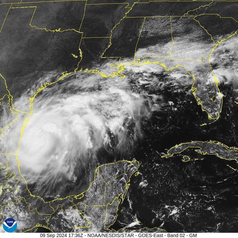
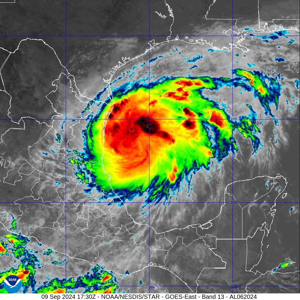
Satellite imagery at 1:30 PM ET showed banding and deep convection around the center of circulation. Francine is well on its way to becoming a hurricane and could be rapidly intensifying for the next 24-hours. However, wind shear will increase as Francine reaches the Gulf coast perhaps causing a weakening or dismantling of the storm on Wednesday. While some trough interactions are favorable, the angle of attack is perpendicular with Francine, so unlikely to get much beneficial phasing. That is good news keeping the ceiling of Francine in the Cat 1-2 range rather than Major Hurricane.
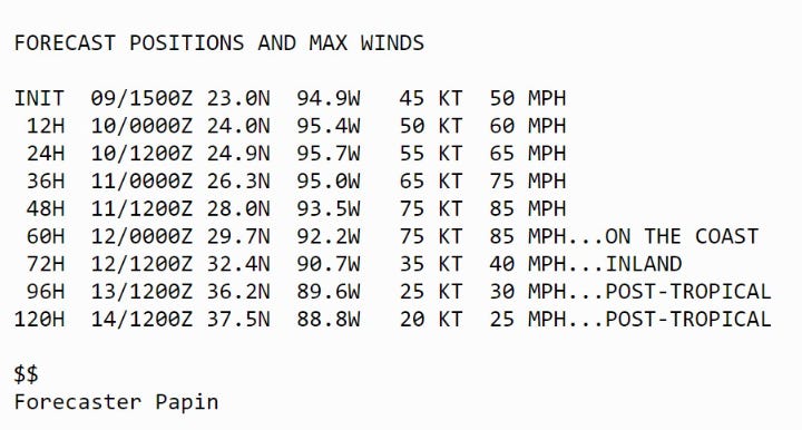
Morning forecast track/cone from NHC took Francine into the central Louisiana Gulf Coast on Wednesday later in the evening at 75-knots (Category 1).
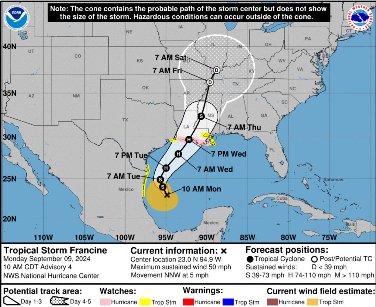
The NHC intensity forecast shows hurricane strength by Tuesday evening, but I’d expect we’ll get the upgrade in the next 18-hours, so in the morning.
ECMWF HRES 12z
Central pressure at 977 mb prior to landfall is typical of Category 2 hurricanes.

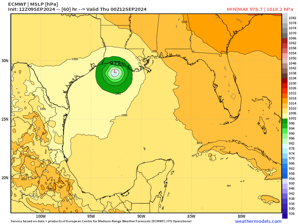
The simulated satellite (IR) forecast late Wednesday evening looks a bit messy due to wind shear eroding the western half of the circulation, but the timing is tricky.

Looking at the Water Vapor at +60 and +66 hours


The structure of Francine will be significantly disrupted right around landfall. Let’s hope it’s 6-12 hours prior to the center reaching the coast.
Atlantic IR Satellite
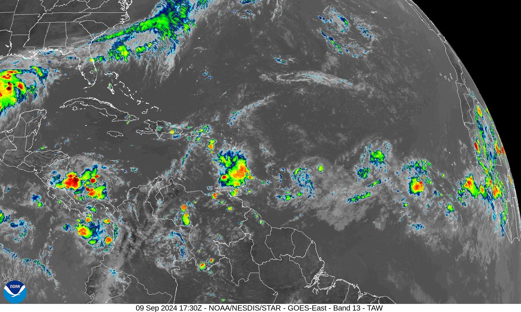
All of a sudden the tropical Atlantic is filled with tropical waves. This is more typical of mid-September and the peak of the season.
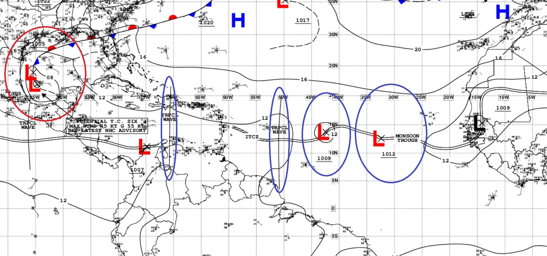
There are 2 moderate chance waves in the central MDR that are best positioned to develop further. It’s likely at least one will become a powerful hurricane heading WNW and then NW —> North into the open Atlantic in the 7-10 day period.
The 7-Day NHC Outlook
Keep reading with a 7-day free trial
Subscribe to Weather Trader to keep reading this post and get 7 days of free access to the full post archives.