


Sept 7, 2024 Saturday Tropical Update
Second half of Atlantic season starts with Francine

Thank you to Subscribers and Supporters into Year 2 of this newsletter. For my maps users, this is Year 8 of Weather Models, and 22 years since starting grad school at Florida State after Michigan!
Atlantic tropics will wake up for the second half of the season
September 10-11 is the midpoint of the Hurricane Season when looking at the historical records — with a bit of a secondary peak later in October.
Even though we’ve only seen 5 named storms (through E) — even in quiet seasons, mid-September usually has good atmospheric / environmental conditions for storm genesis — from the Gulf into the Caribbean and the deep tropics.
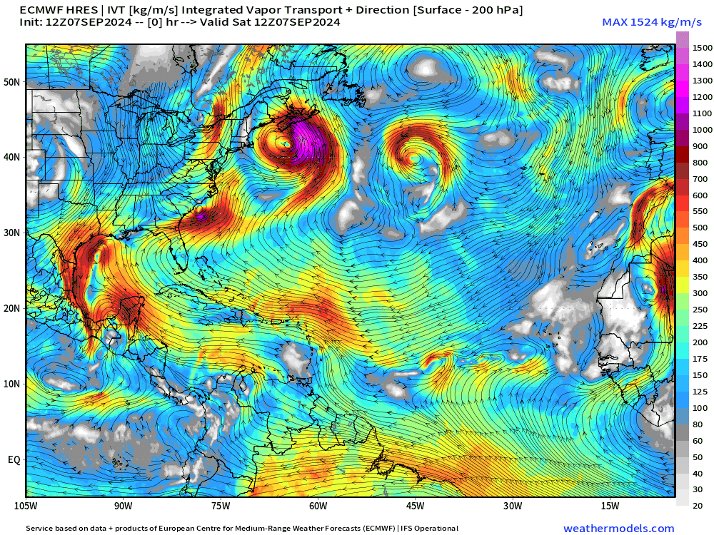
Over the next few days, Invest 91L will likely become Francine — and potentially become a hurricane if it remains far enough off the coast. There will be several days to watch it organize and then move northward — grazing the Texas coastline into Louisiana.
Finally for the Main Development Region (MDR), a tropical wave and a monsoon trough will either spawn 2 separate systems (each with 40-50% chance of development) or combine into a powerful Cape Verde hurricane — likely recurving northward out to sea.
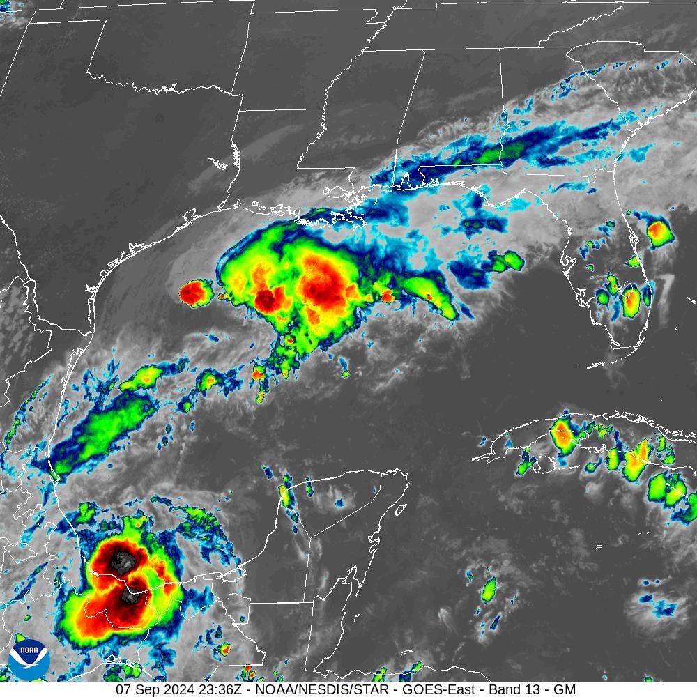
Invest 91L in Bay of Campeche (Southern Gulf of Mexico)
The little surface circulation w/Invest 90L is underneath a thunderstorm [yellow circle] but still connected to the front and won’t be classified.
Invest 91L (red) is still in formative stages tucked away in the southern Gulf of Mexico. The waters are very warm but the proximity to land and hostile upper-level winds will probably slow development until it heads north a bit.

Deep convection with Invest 91L is partly over Mexico. The blob over the northern Gulf is related to the frontal boundary.
Until something is named, the Atlantic tropics remain [historically] quiet overall.
Model forecast tracks are tightly clustered through the next 4-5 days with landfall of likely Francine along the TX/LA border around middle of next week.

GFS 18z had a central pressure of 989 mb — close to a Category 1 hurricane. That seems about right for this system — TS to H1.

Atlantic IR Satellite
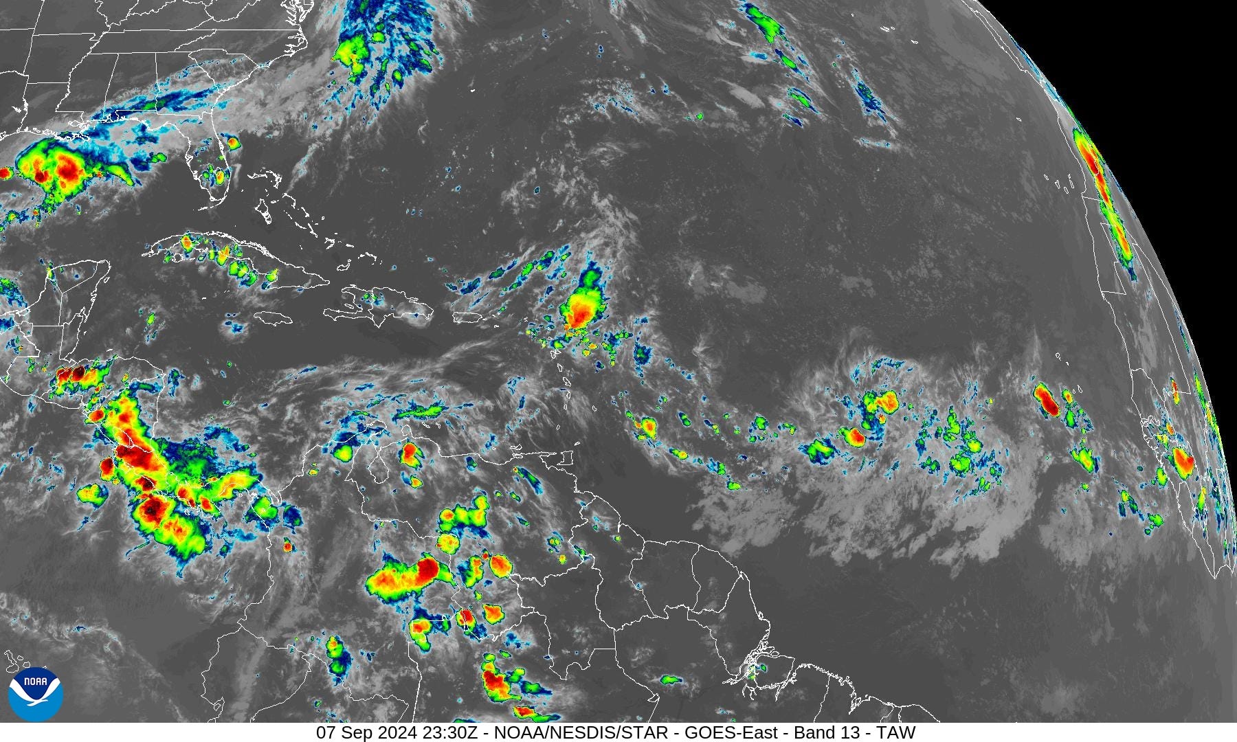
Some patchy convection in the deep tropics, but nothing imminent for the next few days. Then we’ll see if another Invest can develop — next name is Gordon.
The 7-Day NHC Outlook
Keep reading with a 7-day free trial
Subscribe to Weather Trader to keep reading this post and get 7 days of free access to the full post archives.