


Sept 6, 2024 Friday Tropical Update
Invest 90L next best chance at Francine next week

Thank you to Subscribers and Supporters into Year 2 of this newsletter. For my maps users, this is Year 8 of Weather Models, and 22 years since starting grad school at Florida State after Michigan (Go Blue)!
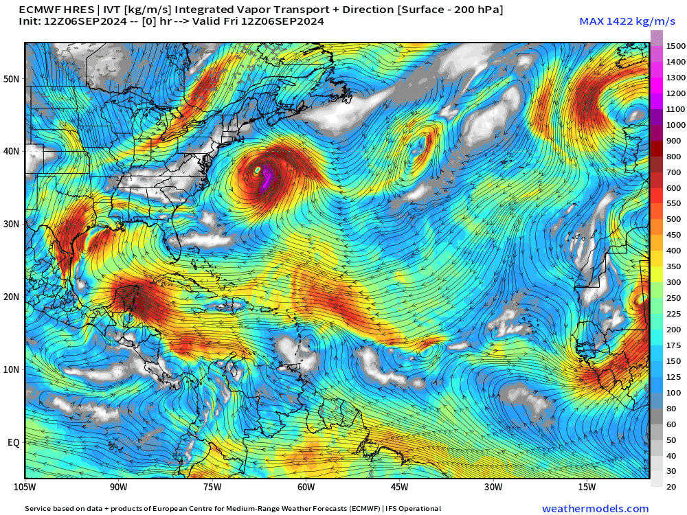
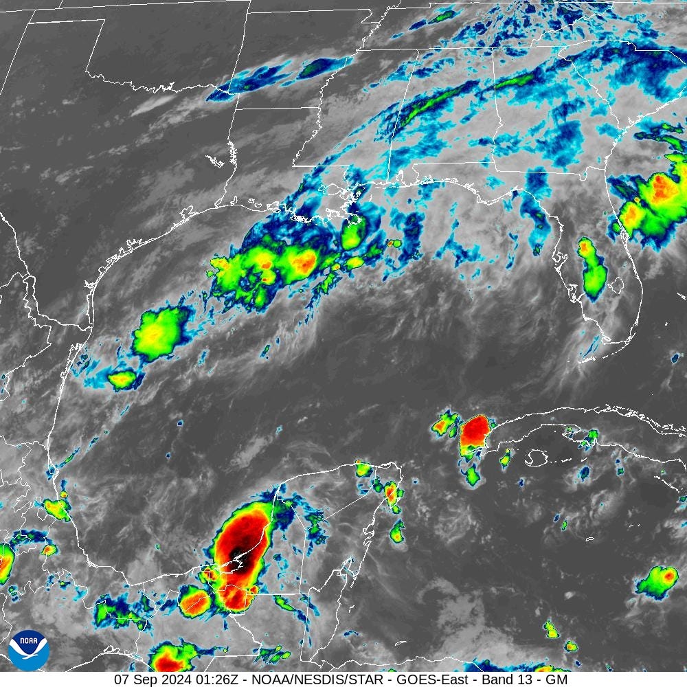
Atlantic tropics remain [historically] quiet overall. Only show in town in Invest 90L soon to be developing in the southern Gulf of Mexico with 50% chance of becoming a named storm (Francine). The system will linger / meander for a few days before moving north either into Texas or Louisiana as a huge rainmaker.
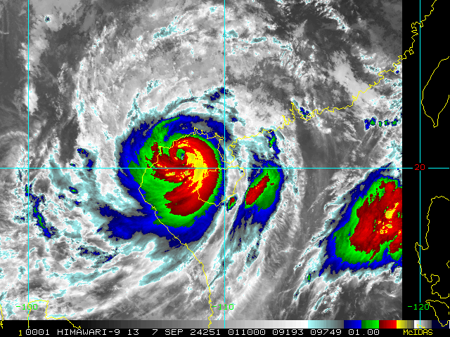
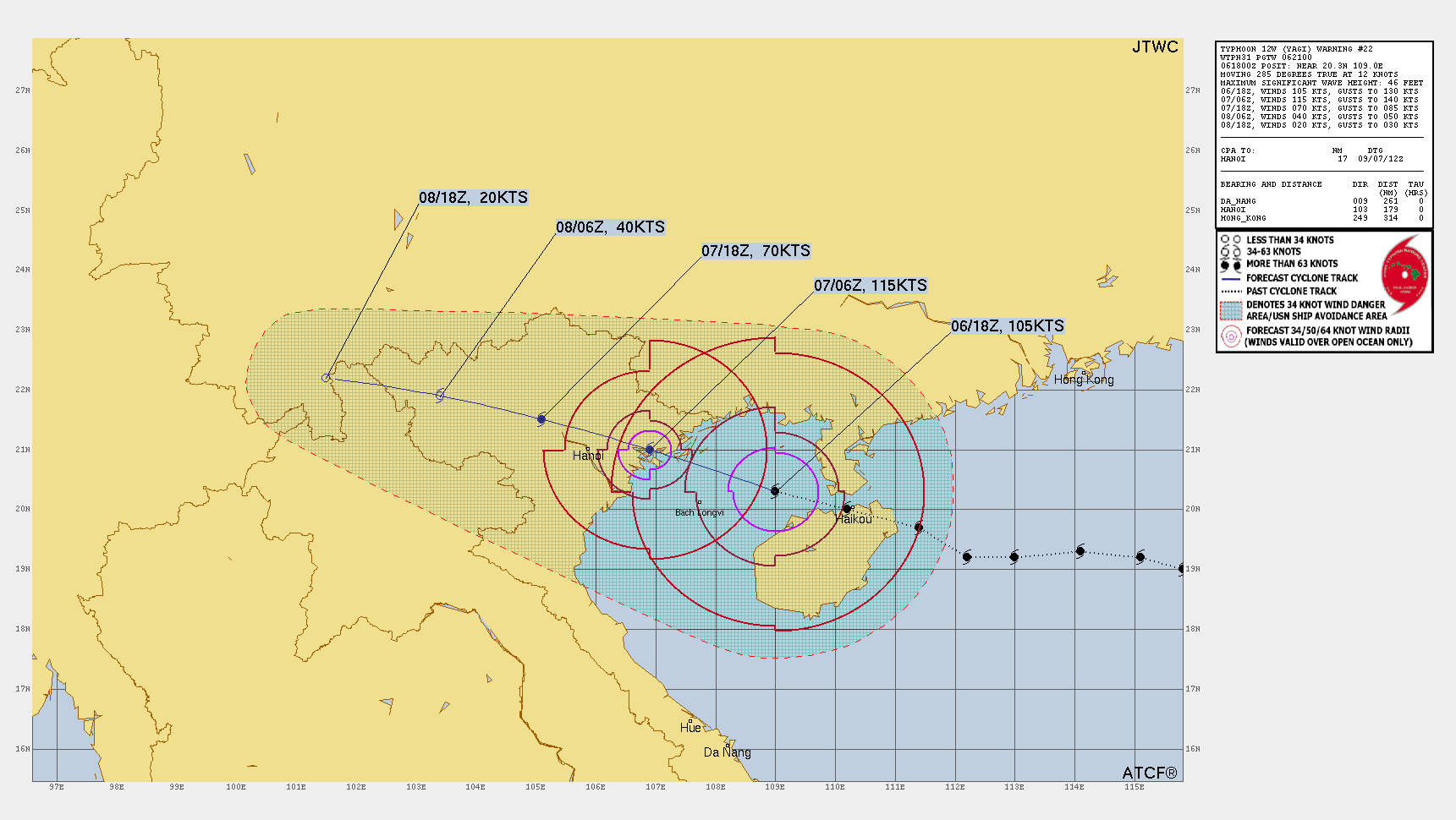
Typhoon Yagi to landfall Vietnam at Category 4 after clipping Hainan island at even higher intensity, perhaps 140-knots (Category 5)
The eye is not entirely clear but still a few hours over the Gulf of Tonkin before reaching the coast.

Rest of the Atlantic
Bit of a traffic jam of tropical waves coming off Africa bumping into a disturbance that lifts out of the monsoon trough. Might see some development in the far central Atlantic in 8-10 days, well away from land. The ECMWF HRES isn’t too interested in Invest 90L — so that might not be a done deal, either.
The frontal boundary across the northern Gulf of Mexico is also bringing sprinkles and cloud cover to the Southeast.
Model Guidance for Invest 90L is spaghetti with looping and eventual northward track.

United States Weather
Keep reading with a 7-day free trial
Subscribe to Weather Trader to keep reading this post and get 7 days of free access to the full post archives.