


Sept 4, 2024 Wednesday Tropical Update
Gulf of Mexico only show in town for impactful storm development

Thank you to Subscribers and Supporters into Year 2 of this newsletter. For my maps users, this is Year 8 of Weather Models, and 22 years since starting grad school at Florida State after Michigan (Go Blue)!
Atlantic tropics remain [historically] quiet overall. Next interesting chance of development in southern Gulf of Mexico
Super Typhoon Yagi to landfall China likely at Category 4, 2 more storms on way in Western Pacific
Frontal boundary keeps Gulf Coast wet and unsettled
The Lower 48 is under the influence of northerly flow keeping tropical moisture bottled up in the Gulf of Mexico and off the East Coast. This is a sign of the switch to Fall with much more Canadian / Arctic influence to mid-latitude weather especially with lobes of the tropospheric polar vortex draping strong troughs across the Pacific NW and Northeast.

ECMWF HRES 12z did not develop the Gulf of Mexico system instead shunting the vorticity into the Eastern Pacific to ride up Baja California.
United States Weather
Low Temperatures on Thursday

Warmer across the central U.S. and Great Lakes with more 50s and 60s instead of 40s. Still chilly across the Northeast.
High Temperatures on Thursday
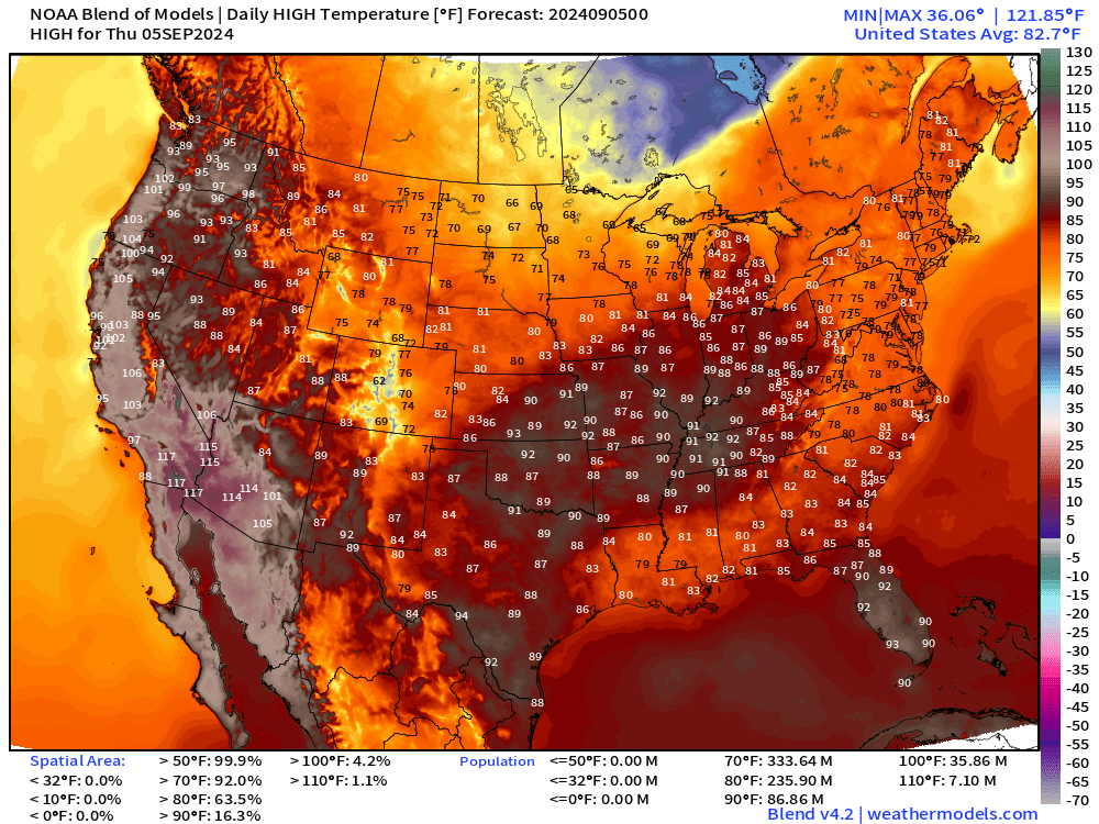
Blazing hot across the Western U.S. again with 100s and 110s centered on Yuma.
87 million at/above 90°F and 36 million at/above 100°F especially across California but also extending up into Oregon.

Weather on Thursday

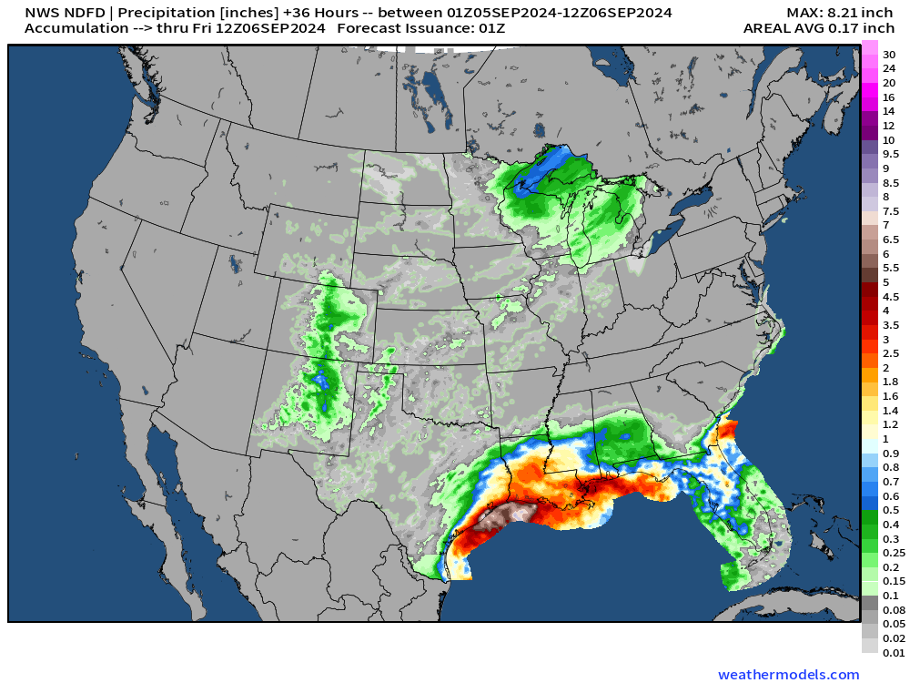
The stationary front draped across the Gulf Coast continues to fire thunderstorms and dump heavy rain with highest amounts from Houston to New Orleans. Next 36-hours precipitation:
Gulf of Mexico Disturbance Down the Road
Keep reading with a 7-day free trial
Subscribe to Weather Trader to keep reading this post and get 7 days of free access to the full post archives.