


Sept 3, 2024 Tuesday Tropical Update
Southern Gulf of Mexico bears close watching next week

Thank you to Subscribers and Supporters into Year 2 of this newsletter. For my maps users, this is Year 8 of Weather Models, and 22 years since starting grad school at Florida State (yikes to that performance last night)
This is a Subscriber post with Paywall preview enabled. Please consider subscribing to receive all daily updates for the next year (10% off promotion) to support this newsletter and my time/efforts with weather model analysis and development.
Headlines for Tuesday Evening
Heat wave continues across Western U.S.
Atlantic tropics remain [historically] quiet overall. Next interesting chance of development in southern Gulf of Mexico
Typhoon Yagi to landfall China likely at Category 3 or 4, more storms on way in Western Pacific
Evening Temperatures | 7 PM ET

Temperatures well into the 100s across the U.S. Southwest with another “hot spot” in the Dakotas and Mississippi. Only in the 60s in the Northeast with 70s elsewhere.
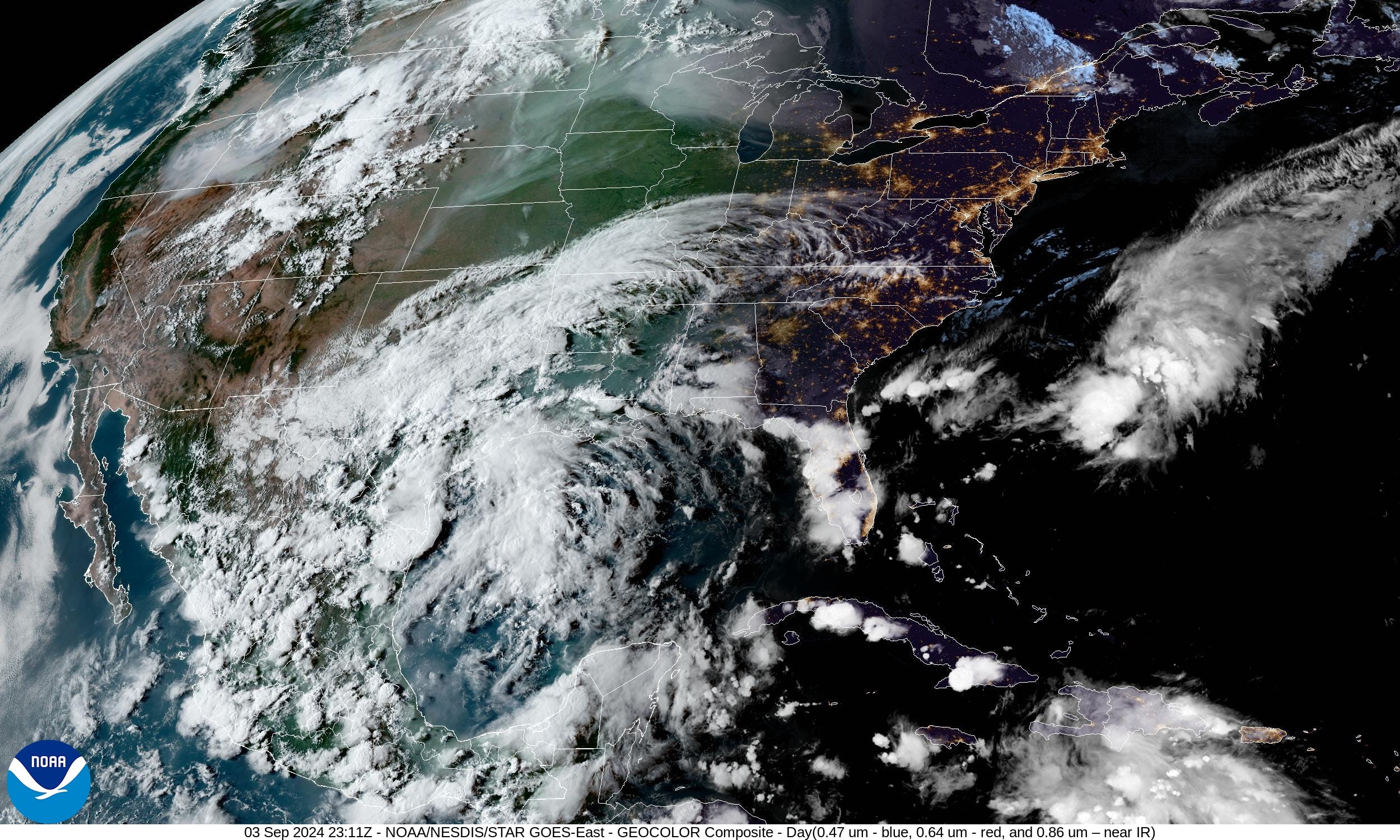
Temperatures kept down under cloud cover and rainfall in Texas with a disturbance off the coast remaining stationary for the next few days — moisture will stream eastward across the Gulf Coast into Florida.
Low Temperatures on Wednesday

40s and 50s — blue and gray colors across the Great Lakes into the Northeast.
Cooler across the Southeast as well with 60s into Atlanta and Macon.
High Temperatures on Wednesday

70 million at/above 90°F and 26.5 million at/above 100°F especially across California.
Weather on Wednesday

Heavy rain continues across the Gulf Coast with the stationary front or boundary fed by various disturbances.
Atlantic Tropics Slumber as African Waves Head WNW

Amazing to see the African tropical waves so vigorous over the continent — even moving northward into Algeria to provide rain to the Sahara. A wave at Days 8-10 does move off the coast into the Atlantic but heads NW over cooler water. The African wave train is turned off for the next 10-days across the Atlantic deep tropics / Main Development Region.
Gulf of Mexico Disturbed
Keep reading with a 7-day free trial
Subscribe to Weather Trader to keep reading this post and get 7 days of free access to the full post archives.