


Sept 23, 2024 Monday Tropical Update: Powerful Gulf of Mexico Hurricane Helene
Advisories have started on a potentially historical storm

Major Hurricane Helene forecast to landfall Florida panhandle coast on Thursday
Mesoscale Model Solutions are Category 5 with sub-900 mb pressures, insane
Inland wind threat into Georgia into Friday potentially affecting Atlanta
Atlantic tropics remain active for the next 2-weeks into early October.
GFS gets props for forecasting the development, track and intensity of 09L (Helene) over the past few days. The model has done quite well with the convective nature of Helene’s genesis in the NW Caribbean. In terms of track, the ECMWF HRES has also remained consistent on the Florida panhandle but the intensity has been biased quite low.

GFS is in the 940s at minimum pressure in the southern Gulf of Mexico west of Key West, but this is still biased low because of the 13-km grid spacing (resolution) of the model. I’d expect 920s mb at this juncture. Indeed, Helene could be a Category 4+ hurricane in under 60 hours.
NHC 5 PM Advisory
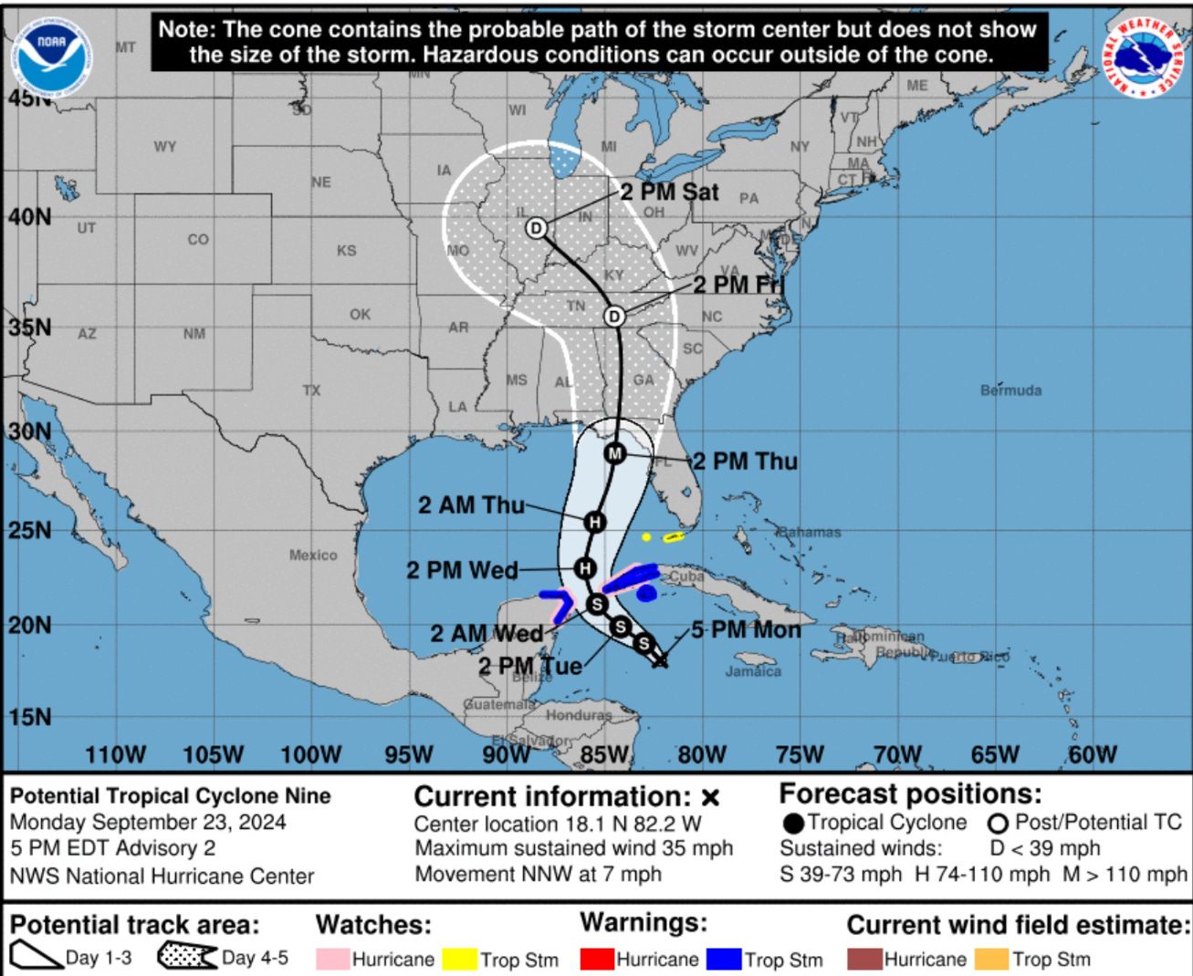
The (near) landfall intensity is now Major (M) at 100-knots but could be higher, unfortunately into the Florida Gulf Coast just south of Tallahassee into Wakulla County. Storm surge along the west coast of Florida into the Big Bend will be unbelievable and damaging a la Dennis (2004).
NHC Intensity Discussion
Keep reading with a 7-day free trial
Subscribe to Weather Trader to keep reading this post and get 7 days of free access to the full post archives.