


Sept 22, 2024 Sunday Tropical Update
Hurricane likely in Gulf of Mexico with Florida landfall Thursday

GFS gets the victory parade [most probably] for skillfully forecasting the formation, intensification and track of soon-to-be Tropical Storm and then Hurricane Helene in the Gulf of Mexico. The ECMWF AIFS also has shown remarkable consistency with the system. The likely landfall is somewhere along the Florida Gulf Coast right not centered on Panama City to the Big Bend.
GFS 18z is the most intense global model to about 941 mb pressure — easy Category 4. We will have more detailed guidance from the mesoscale models in the coming hours.
Note: threat of inland gusty winds [50-60 mph] into Georgia including Atlanta

ECMWF AIFS is a lower resolution system but still shows 978 mb, which is a major hurricane once you remove the intensity bias.

ECMWF 12z HRES has a similar track — there’s no much spread in the guidance now that we are 96-108 hours prior to landfall. We went from highly uncertain to very certain once the center of circulation and convection showed upon the Western Caribbean.
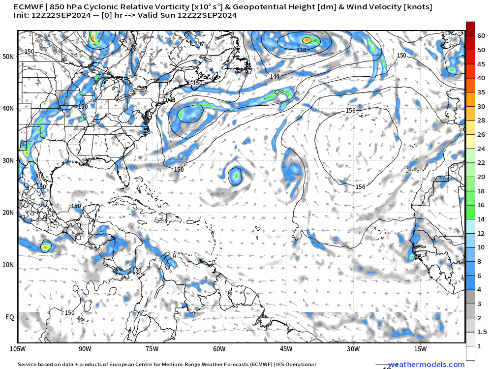
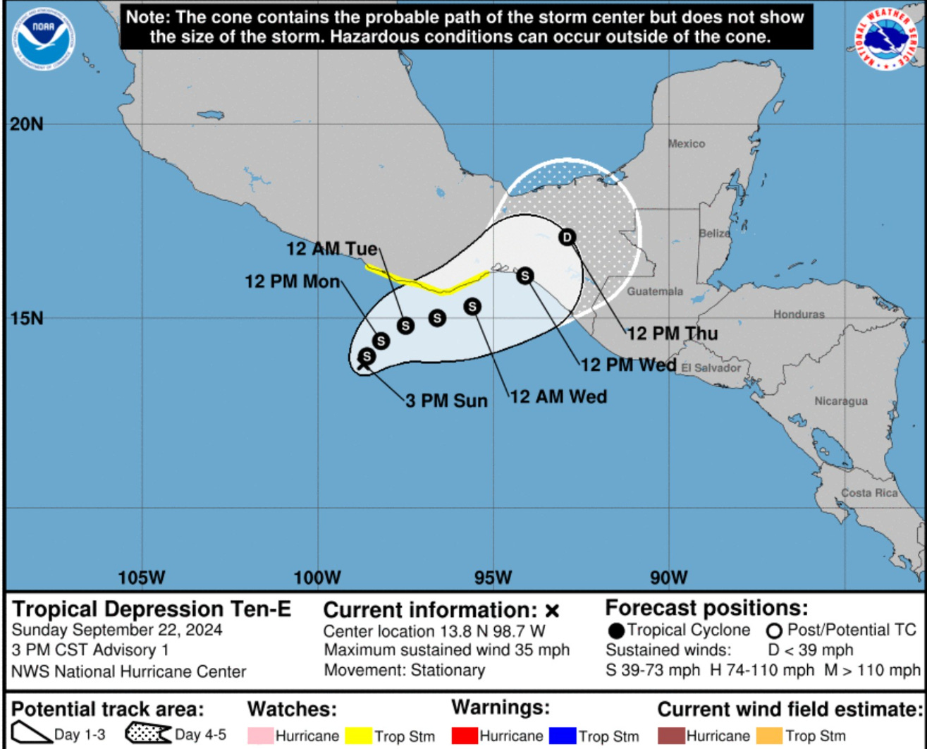
From the vorticity animation through 10-days, we see Tropical Storm John impacting Mexico and then several days later, some spin crosses into the Bay of Campeche for a little follow-up TD/TS in Florida by next Monday (?)
Good chance of a Cape Verde Hurricane — finally in the far Eastern Atlantic. That will likely get the dreaded I name.
I ran the EPS 12z tracker for “09L.HELENE” which is Invest 97L to show the rather tight clustering of solutions into Florida.

In summary, my intuition was right to lean to the GFS/AIFS solution as the ECMWF HRES seems to be an inferior model in its current cycle. However, an upgrade is coming shortly (November 2024) that will hopefully solve the tropical cyclone performance issues. Note — these issues are relative to the previous high level of trust and skill of the model. Nevertheless, we should always use the full-ensemble suite for proper forecasting methods.
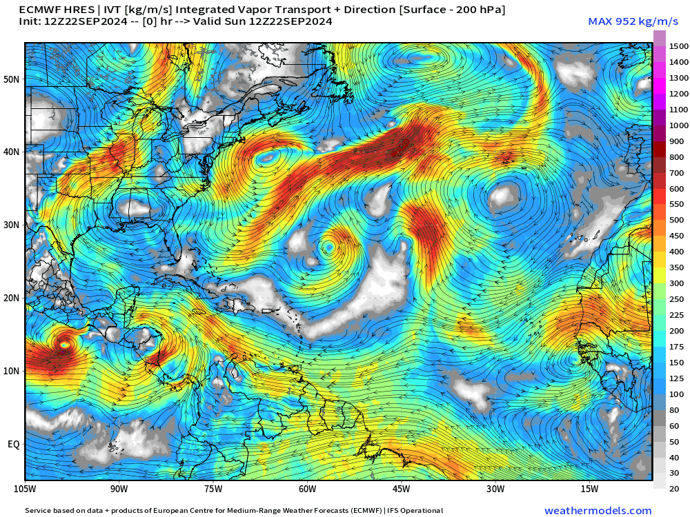
ECMWF 12z IVT | Next 10-days
Helene will move quickly northward in response to the flow ahead of a cut-off low or trough dipping out of Canada into the mid-Mississippi River valley.
Next 10-day Upper Level Pattern | North America

The trough + Helene will combine into a larger system that will linger over the Ohio Valley.
NHC 7-day Outlook

NHC is at 80% for Invest 97L. The next system (Cape Verde) is at 50% and will likely become a storm or hurricane in 5-7 days.
Atlantic Satellite
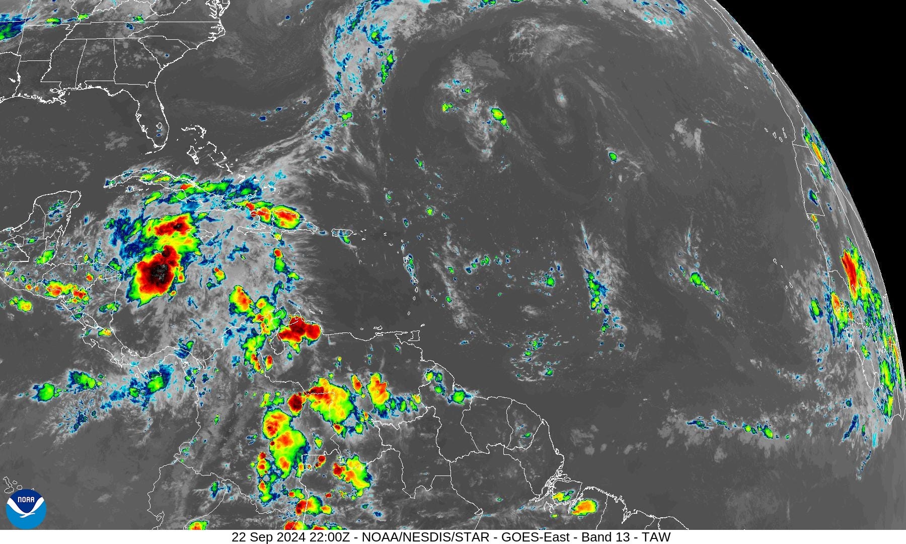
Plenty of convection in the western Caribbean.
Eastern Pacific Satellite
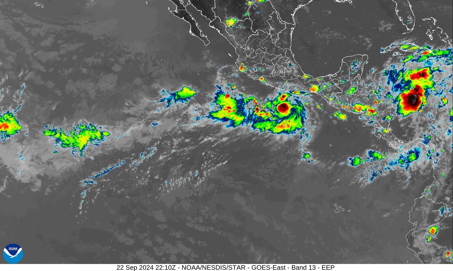
We can see TD 10E —> Tropical Storm John by Monday south of Mexico.
John could become a hurricane as it parallels the coast until landfall on Wed/Thurs.
ECMWF EPS Active Tracks
Day 4.75: September 27

The landfall of Invest 97L —> Helene into Florida shown by the EPS ensembles with many members quite intense in the major category 3+
Day 8: September 30

The next Cape Verde hurricane should safely turn out-to-sea by the end of the month.
Total Rainfall next 7-Days | NOAA WPC

The combination of trough + Helene will mean extremely heavy rainfall for the Southeast U.S. and that’s not a problem for Georgia, which needs it desperately. We can do without the extreme winds.
Coming soon: Weather in My Backyard
Maps sourced from weathermodels.com designed and innovated by yours truly! I actually create all of my content from scratch.
Thanks for update. Looks like a big storm.....
I'm enjoying your Substack.