


Sept 17, 2024 Tuesday Tropical Update
Caribbean long-range threat increasing

This post is entirely unlocked for all. Please consider subscribing for all emailed updates daily as we head into the final stretch of hurricane season and start the Winter of 2024-25. Thanks to my subscribers for allowing me to fill your inbox with maps.
The no-name tropical storm [08L] almost entirely inundated North Carolina with very heavy rainfall totaling about 3 Trillion gallons in the past 48-72 hours. The rain shield did extend west into the Smoky Mountains — further west than anticipated — leaving a cloud shield over the Southeast and wedge into Atlanta this morning. Thankfully, that soggy pattern is departing for the next several days.

NHC 7-day Outlook
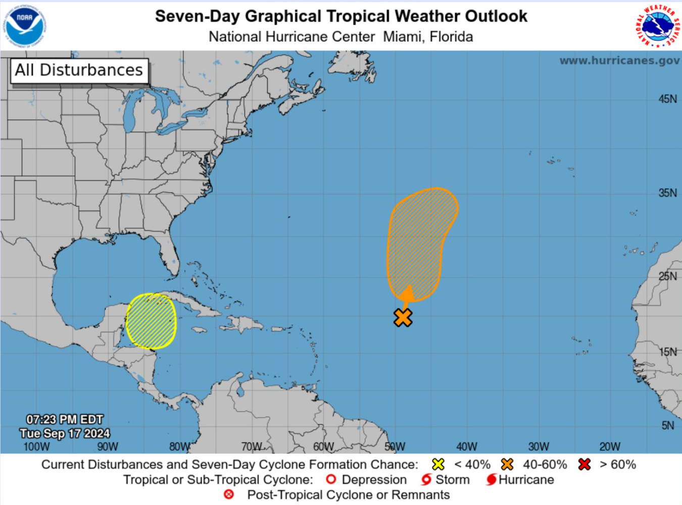
Down the road — we are looking at a low-chance (10-20%) of development in 7-days in the western Caribbean. That’s the only show in town for tropical storms near land for the rest of September.
There is a tropical wave well out in the Atlantic behind the remnants of Gordon, but we might be ready to put a fork in the Cape Verde (non-) season — or maybe not!
Atlantic Satellite
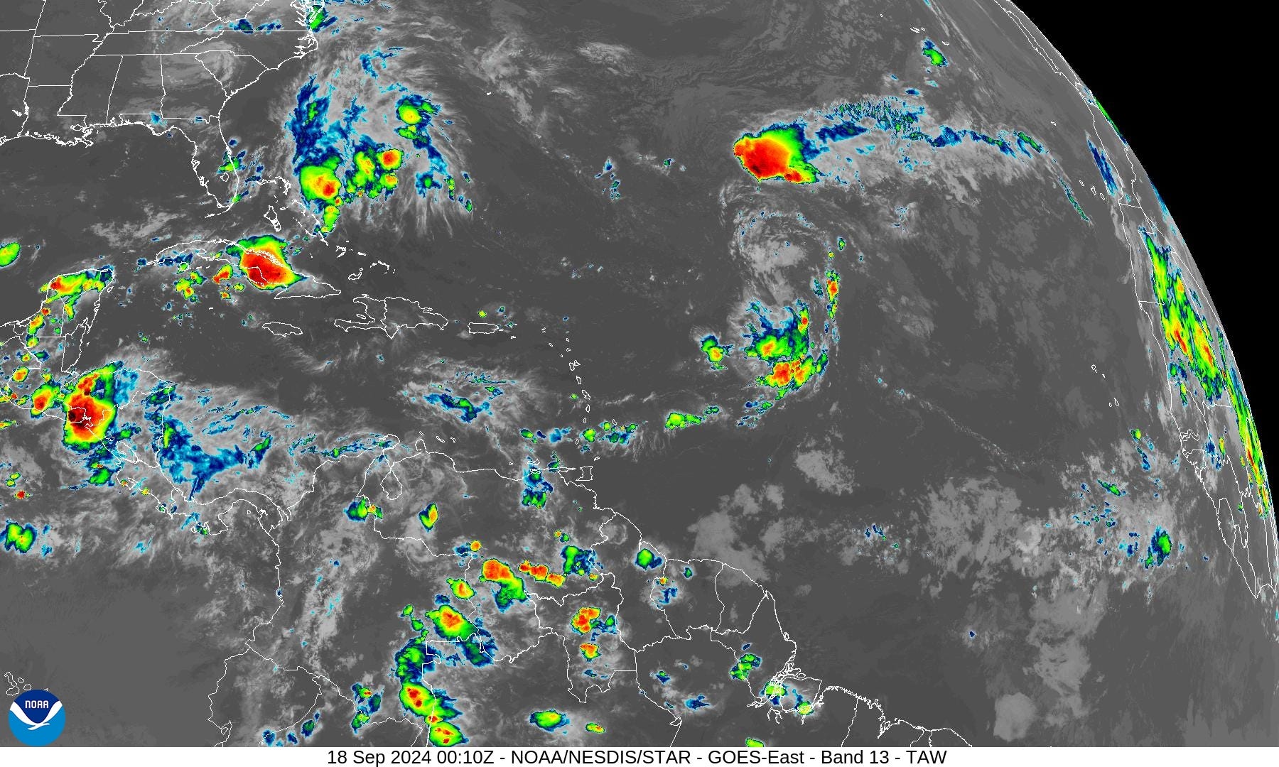
Nothing percolating in the Atlantic — at all. 2024 is down bad!
Next 10-Days Atlantic Integrated Vapor Transport
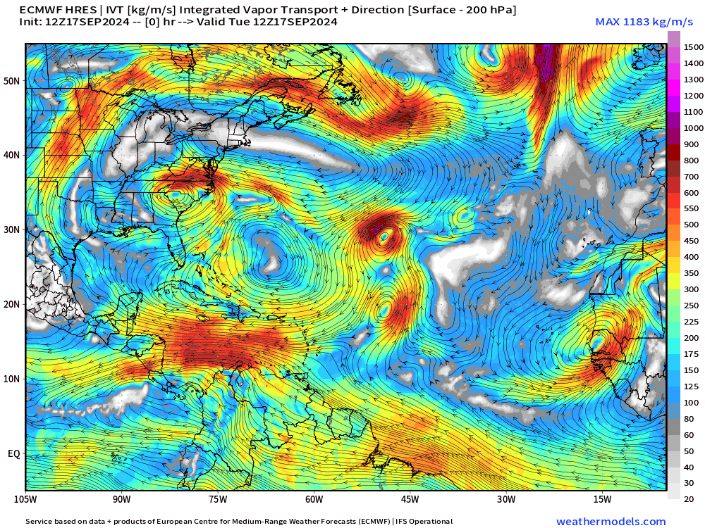
The Caribbean gyre sets up shop over the Yucatan peninsula for several days starting next week. We need to watch this cyclonic circulation for vorticity maxima and convection — over water — that can generate into a tropical cyclone. ECMWF HRES 12z did not develop a named storm through Day 10, but many ensembles most certainly did.
GFS 18z: Day 8
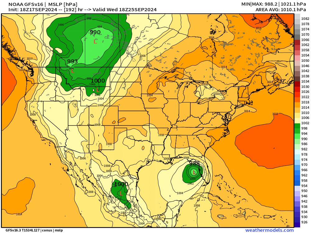
I normally don’t advertise or promote the NOAA GFS model because it has significantly lower skill than ECMWF, but it’s worth pointing out consistency. In this model, the Caribbean gyre quickly spawns a hurricane into the Gulf of Mexico. Some solutions in previous runs really went ballistic, but thankfully, tempered down to management TS or H1.
Canadian GEM 12z: Day 8

The Canadian GEM is a very good global model with better skill than GFS (trust me). It also generates a strong hurricane in the Gulf of Mexico at Day 8.
ECMWF AIFS 12z: Day 11

As I’ve mentioned over the past few days, the ECMWF AIFS has been sniffing out the Gulf of Mexico hurricane. This is an A.I. trained system so tropical storms formed as a result of large-scale patterns seem to be rather predictable. I think we can be much more confident of this outcome if the Hurricane remains in the same location / timing in future forecasts made into Friday.
Next 10-day Upper Level Pattern | North America
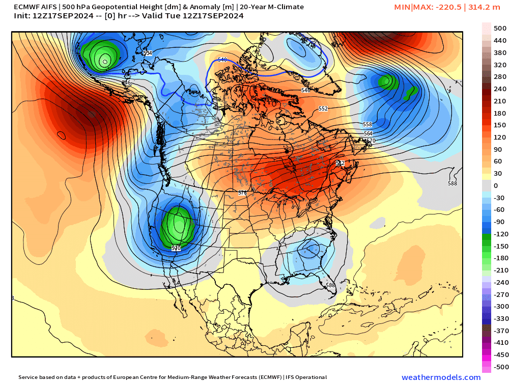
The system in the Caribbean forms in response to a ridge in the Gulf of Mexico.
A strong ridge develops over the Western U.S. for a significant pattern shift into the final days of September.
Low Temperatures on Wednesday

Chilly in the Rockies — 20s and 30s — typical of mid-September.
High Temperatures on Wednesday

The 100s are almost entirely gone across the Lower 48. 90s in Texas and Florida = 54 million population.
ECMWF EPS Active Tracks
Day 7: September 24

I’m not holding much hope for Gordon’s return to glory.
By Day 7, we should see the beginning of a system in the western Caribbean.
Day 10: September 26
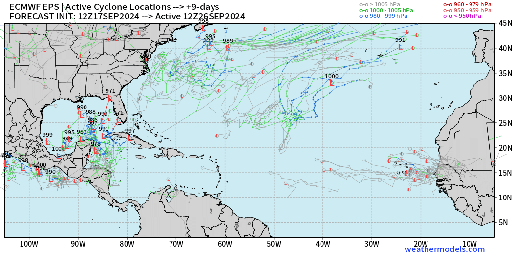
More members spawn a tropical storm or hurricane in the Gulf of Mexico.
Day 12: September 29

Even at Day 12, we’re still in “watch and see” mode for potential development in the Gulf of Mexico. This is going to be a long road ahead to end September in the Atlantic tropics close to home.
Total Rainfall next 7-Days | NOAA WPC

Heavy central plains rainfall this weekend. Also, South Florida up to 6-inches!
PRISM Temperature Anomaly September MTD

Like to point out the temperature pattern over the past 2-weeks showing my electric bill savings in Atlanta.
EPS Weekly Temperature Anomaly
Week 1: September 17-23

Week 2: September 24-30

The ridge across the Western U.S. really goes strongly above normal.
Coming soon: Weather in My Backyard
Maps sourced from weathermodels.com designed and innovated by yours truly! I actually create all of my content from scratch.
In GEM we should trust? -Good news. GFS has always disappointed. I'm going contrarian and dare to suggest that the Caribbean storm doesn't develop to hurricane strength.
Gulf storm seems like it could develop into something major.