


Sept 12, 2024 Francine Drenches Southeast
Gordon expected to be a fish storm, potentially a major hurricane

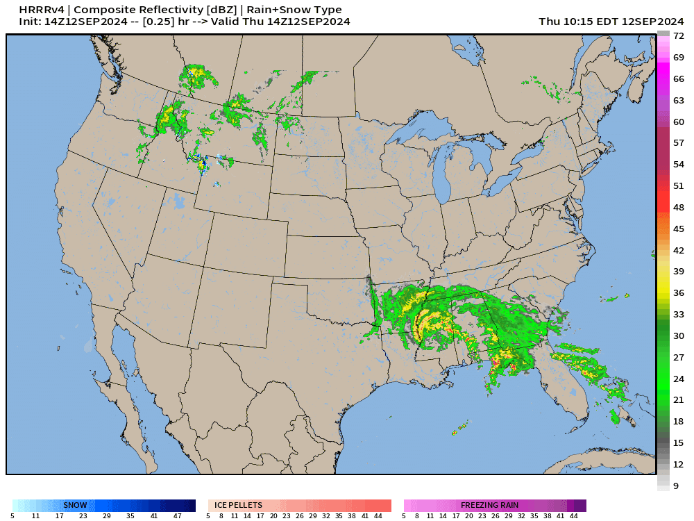
Hurricane Francine made landfall on Wednesday as a Category 2 (100 mph) in line with model and statistical forecasts. HAFS mesoscale models picked up on the burst of convection and deepening into the low-970s pressure. NHC nailed the landfall intensity.
Francine was baked in the cake > 1 week prior with A.I. model guidance showing the development and track up to 10-days in advance. The predictability of tropical storm formation seems much higher with circulation induced systems like Francine that are a product of large-scale patterns rather than convective whims of the monsoon trough.
Heavy rain will move inland through the Mississippi River valley with exceptional amounts of 6-8” in northern Alabama during the next 48-hours. 2-inches in Atlanta will be most welcome with thunderstorms into Friday.

The core of Francine spins to Memphis later on Thursday.
An area of low pressure over Montana is the other weather maker across the Lower 48.
Atlantic Tropics Next 10-days
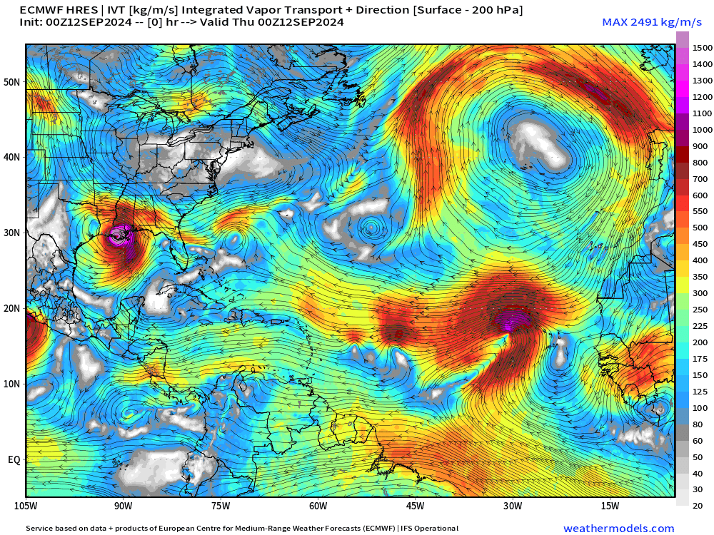
The only show in town is Tropical Depression 07L — to become Tropical Storm Gordon. In 5-days, the forward motion slows but the environment becomes more favorable for further intensification into a hurricane. Ensembles hint at non-tropical origin development off the Southeast U.S. coast, but that seems to have largely gone away in the models otherwise.
Europe Cut-Off Low
A wave breaking event will spawn a cut-off low over central Europe in the next few days. The slow moving system will dump enormous rainfall in Czech Republic up/over 12-15”.

Keep reading with a 7-day free trial
Subscribe to Weather Trader to keep reading this post and get 7 days of free access to the full post archives.