


October 5, 2023 Afternoon Update
Cold front finally ending summer

May be a couple weeks delayed, but the onset of Fall 2023 begins in earnest behind a strong cold front extending from Texas into the Great Lakes this evening. The moisture and energy from Philippe will combine with an area of low pressure off the East Coast to produce a powerful Nor’easter / hybrid system (< 980 mb central pressure) directly impacting New England this weekend. Gone are the balmy 80s in the Midwest and Great Lakes! Instead, frost and freeze watches/warnings into the weekend across the upper Plains and Midwest.
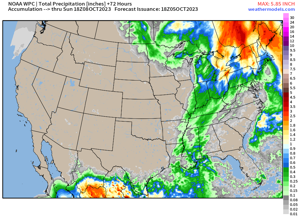
Rainfall through Sunday evening shows the progression of the front, but really disappointing in the Southeast. My lawn was so nice and green all summer here in Atlanta, and now it’s gone a bit crispy and dry. The next chance of significant rain will be related to a tropical system of some sort coming out of the Gulf of Mexico by middle of next week.

Very impressive rainfall totals across Quebec and Maine, in the 2-3” range. Of course, we can only dream about this being snow: we’d be talking 3-feet and a blizzard with this storm system.
Chilly air behind the front in the 20s in Nebraska by Saturday morning. 40s into Atlanta. This weekend with highs in the 60s will be refreshing, but chilly.


2023 Atlantic Hurricane Season
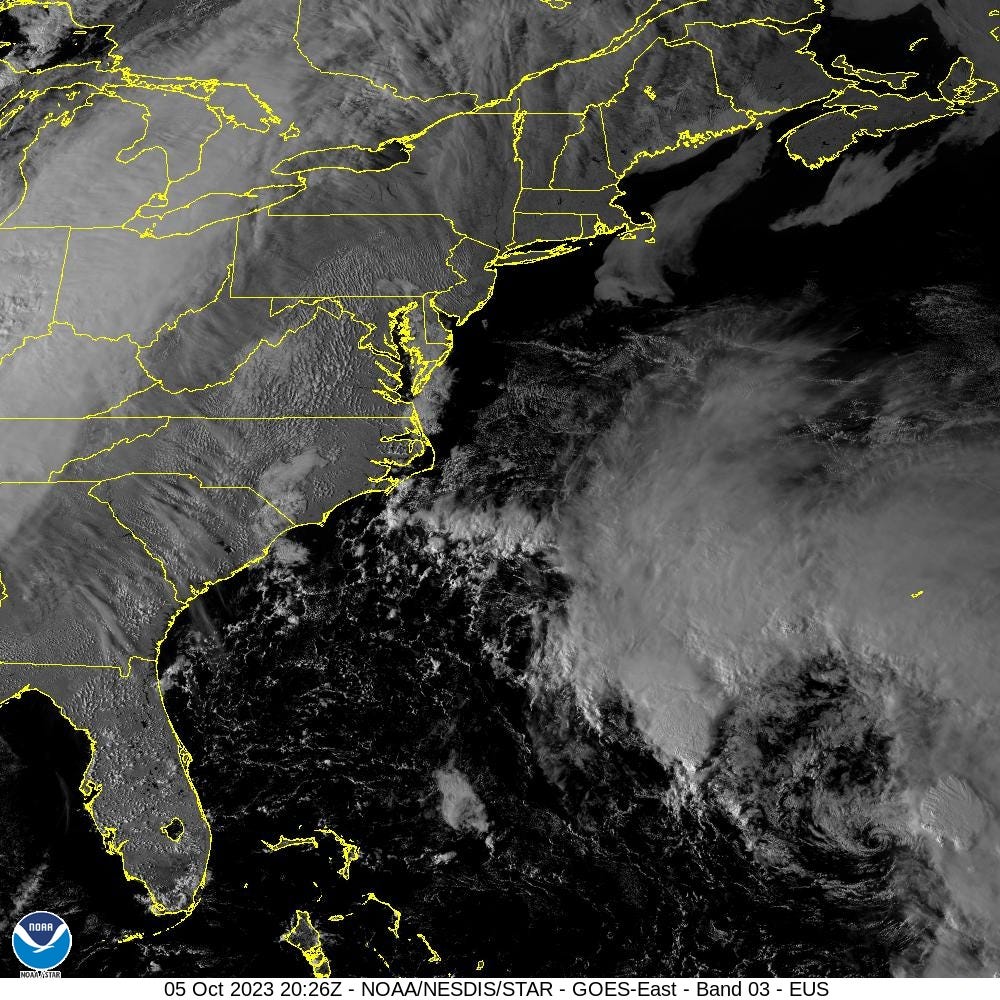
Before the sun set, the exposed center of Tropical Storm Philippe was visible surrounded by a large convective shield more characteristic of a subtropical storm. Winds are up to 50-mph, but not expected to increase until after Philippe becomes post-tropical. Philippe’s maximum wind speed has been 45-knots yet produced almost 9 points of ACE, remarkable for a disorganized mess. However, it will continue to be impactful with the center coming close to Bermuda on Friday, then racing into northern New England as a powerful extratropical storm.
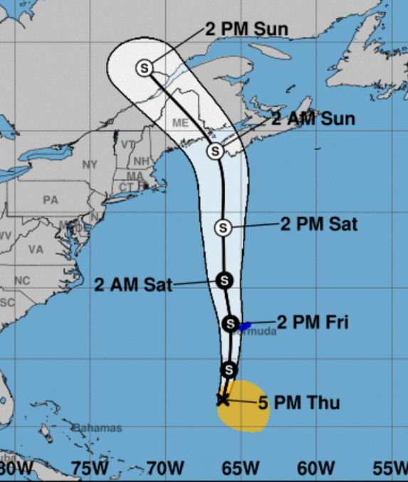


ECMWF HRES goes down to 978 mb prior to landfall of the area of low-pressure designated as post-tropical Philippe. The system matures over Quebec and sprawls out in the 500 mb trough as a major circulation driver for eastern North America. It’s likely this happens without Philippe, but the added tropical moisture and energy surely provides a diabatic kick. With strong winds aloft, there could be significant impacts to Maine, NB, and NS with gusty winds and rainfall — on the heels of former Hurricane Lee.
2023 Atlantic Hurricane Season | Medium Range Outlook
Keep reading with a 7-day free trial
Subscribe to Weather Trader to keep reading this post and get 7 days of free access to the full post archives.