


October 24, 2024 Thursday Weather Update
Hints of Caribbean tropical activity in 8-10 days

Election Day Forecast | Tuesday November 5th
Updated Election Day forecast now at under 300-hours. The vast majority of the Lower 48 will be rather quiet, but chance of a frontal boundary moving along the east coast and tropical disturbance in Florida. The precipitation looks to be all rain with mild temperatures.
The worst case impact to elections would be heavy snowfall or brutal wind chills. Not seeing any threat of either.

High temperatures on Tuesday November 5th

ECMWF AIFS 00z | Next 10-days | Height Anomaly

Looking into week 2, significant troughing across the Western U.S. results in ridging across the Eastern U.S. Not much more complicated than that!
—> Well above normal temperatures for early November east of the Mississippi.
Temperatures 11:30 AM ET
Coldest air in the Pacific Northwest with freezing conditions into northern Nevada.
Chilly in Seattle and Portland mainly in the 40s this morning.
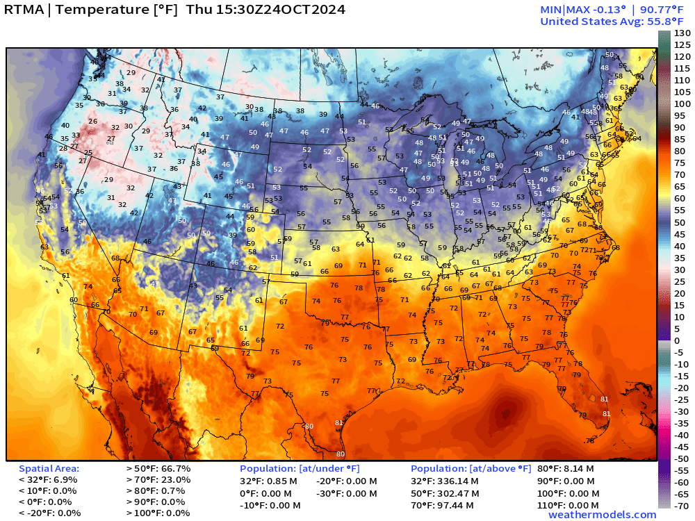
Overall the Lower 48 is 2°F above normal for October 24th at 11:30 AM.
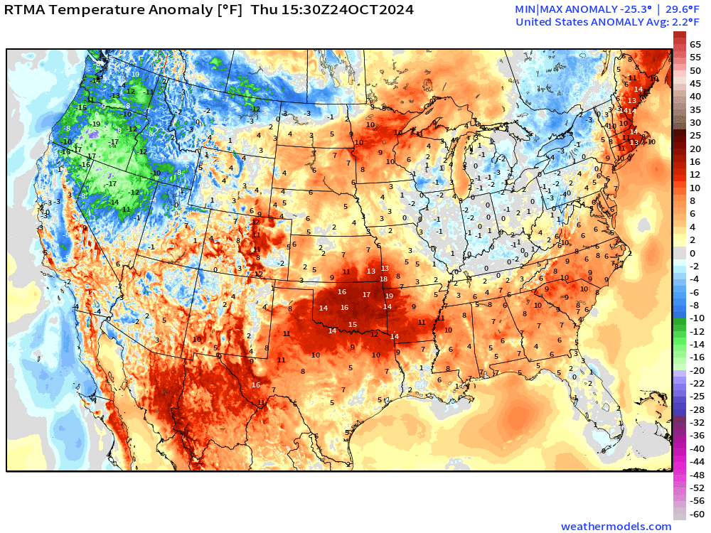
70s already across the Central Plains = 15-20°F above normal.
New and Renewal Subscribers [2025] can upgrade to Annual for 10% off through October 31.
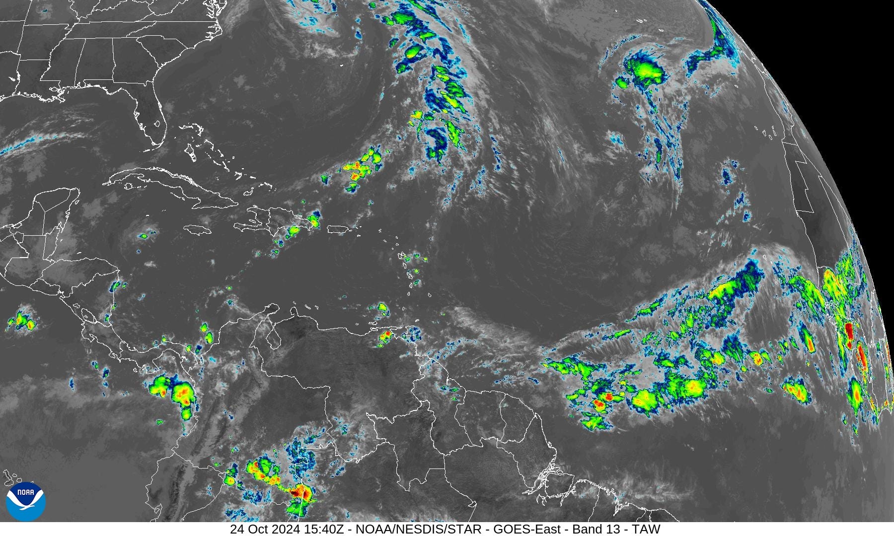
Atlantic Tropical Update
Whatever was left of Oscar was entrained into a new extratropical storm near Bermuda with a cold front spreading into the Bahamas. No other areas being monitored in the tropical Atlantic by NHC for the next 7-days. However … by next weekend, we could have a tropical system (Patty) in the Caribbean.
Atlantic Satellite
ECMWF Integrated Vapor Transport

The ECMWF HRES does develop a large “gyre” over the SW Caribbean by Day 10. The overall pattern of enhanced easterlies through the Caribbean is similar between ECMWF and NOAA GFS. However, there is a significant difference in development chances with GFS being very aggressive. I think this is a long-standing problem associated with flow over the northern Andes that generates spurious vorticity in the southern Caribbean.
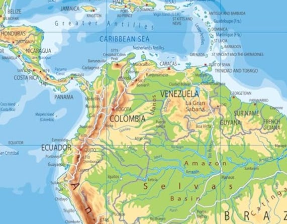
Vorticity Animation with GFS 06z
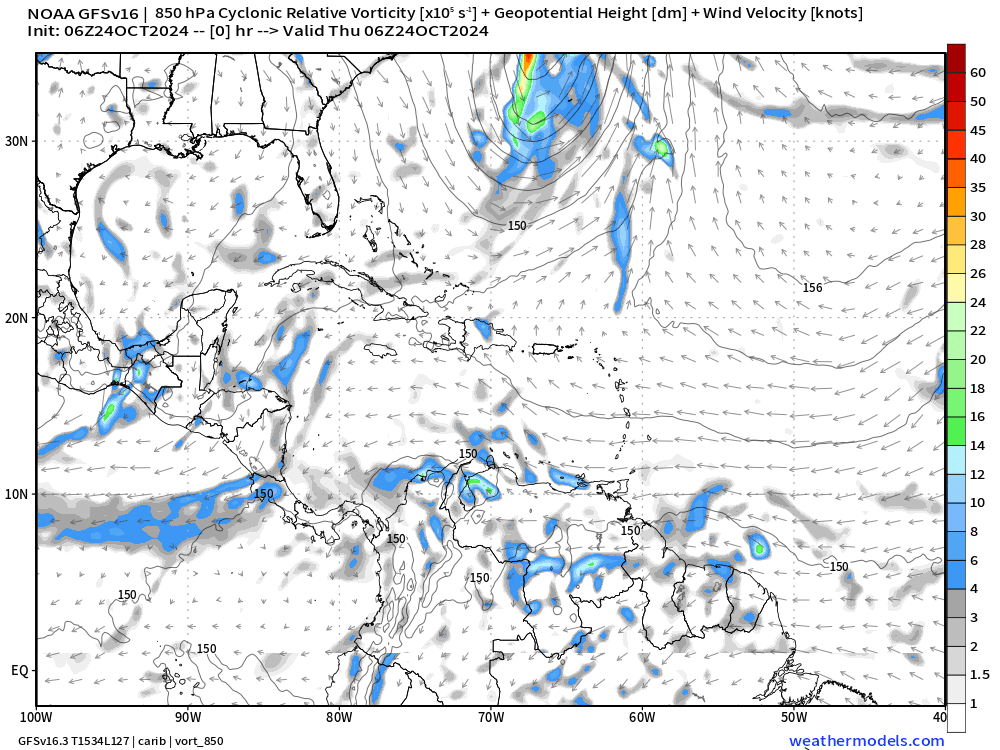
Watch as the vorticity is generated off Colombia and Venezuela and quickly ramped up into a powerful hurricane within 7-8 days, and then a northward track into the eastern Gulf of Mexico and Florida.
I think this intense development is unlikely as GFS has significant bias in generating and exploding systems in this particular pattern.

Hurricane Kristy

NHC 11 AM ET kept Kristy at 135-knots = Category 4 … but I think the storm has now twice reached Category 5 status based upon satellite imagery.
The maximum of T 7.5 = 155 knots earlier this morning, and currently at 7.3 … I suspect Kristy will be upgraded in post-season analysis if not bumped up later this afternoon at 5 pm.
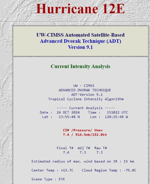
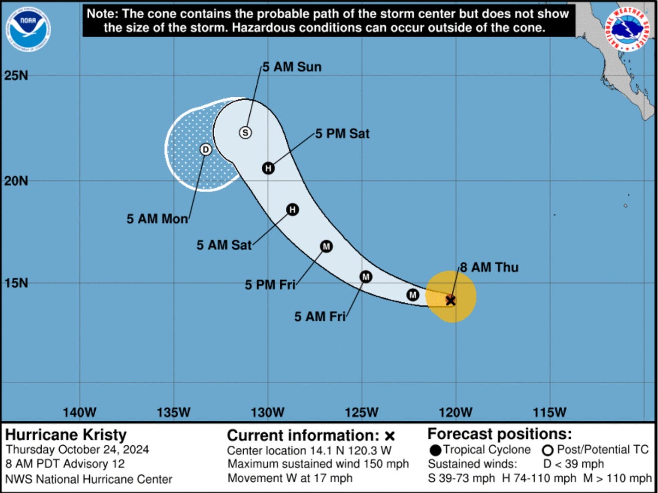
No threat to land … and it will likely come apart due to colder water and wind shear by Sunday.
ECMWF EPS Forecast Active Tracks
Day 10: November 3

EPS ensembles show some development signals < 20% in the western Caribbean by Day 10.
Day 13: November 6

Quite a few members pop with TS/Hurricanes by Day 13. While not as aggressive as GFS forecasts, the EPS signal is significant and can’t be ignored.
High Temperatures on Thursday

Mild temperatures in the 60s now across the Great Lakes. Still 90s in the central Plains including OKC. 80s in Atlanta feel wonderful!
Low Temperatures on Friday

Snowfall
15-day Ensemble Median Snowfall Forecast

Mountain snow but nothing much east of the Rockies — way too warm through 2-weeks.
Probability of 1” snowfall through 15-days

Scant chances of 1” of snow across vast populated areas of Lower 48 but noticing some more Lake Effect % showing up.
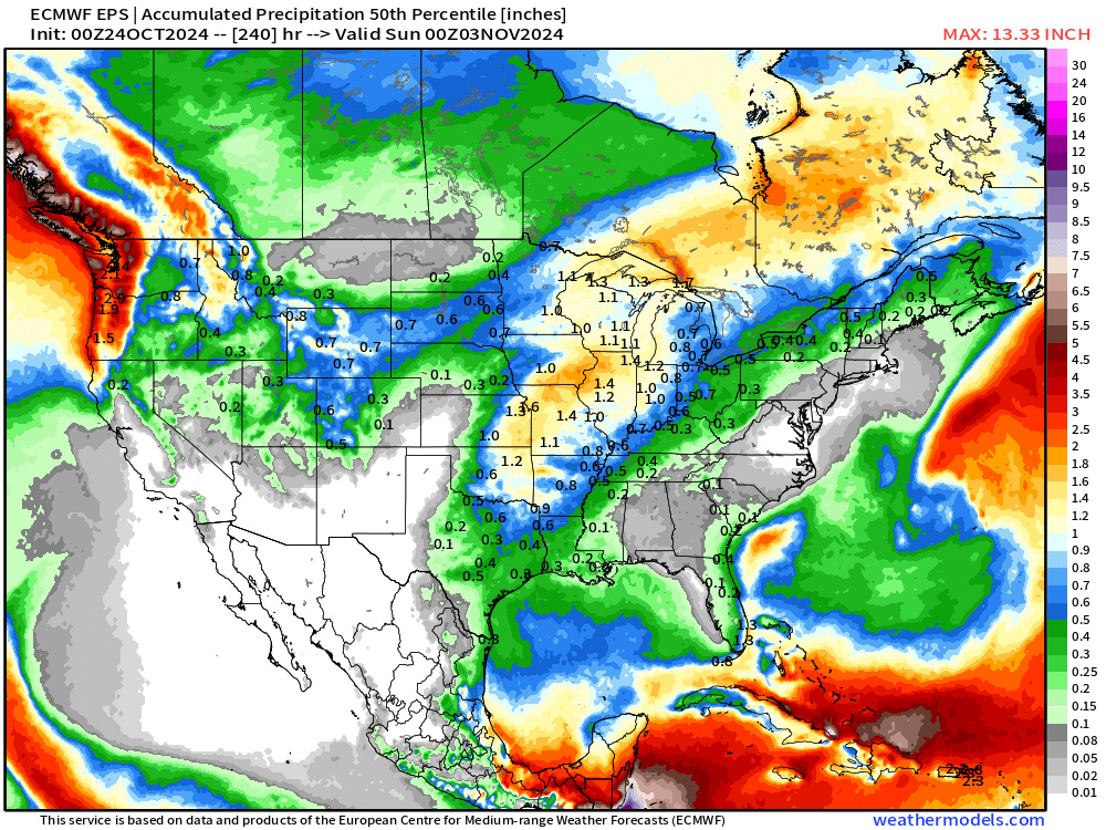
Precipitation 50% Percentile through 10-days
Total Rainfall next 7-Days | NOAA WPC

EPS | Weekly Temperature Anomaly
Week 1: October 24-30

Week 2: October 31 - November 6

Coming soon: Weather in My Backyard
Maps sourced from weathermodels.com designed and innovated by yours truly! I actually create all of my content from scratch.
"70s already across the Central Plains = 15-20°F above normal."
70s already across the Central Plains = 15-20°F above AVERAGE.
There is no such thing as normal
Looks like a warm in Halloween in the Southeast