


October 23, 2023 Afternoon Update
Arctic blast with wintry weather to erase wonderful warmth next week
Mid-Autumn warm weather continues for the eastern half of the U.S. due a strong ridge. However, troughing over the Pacific NW will continue to introduce cold Arctic air around an Omega block anchored over Alaska. However, it will take another 7-days to break down the ridge and allow a powerful Arctic blast to crash through the Lower 48 and sweep the warmth away.
Wednesday morning (12z)

Friday morning (12z)

Sunday (00z) + 132 hours — winter is staging its forces over Montana.


10-Day GFS and ECMWF snowfall forecasts are rather similar with significant accumulations in the Lower 48 especially in the Rockies but also into the upper-Midwest, Great Lakes, and Northeast as colder air arrives from the Canadian Arctic.


2023 Atlantic Hurricane Season | Medium Range Outlook
Hurricane Tammy (20L) is forecast to eventually become post-tropical near Bermuda in the open central Atlantic. Not much more needs to be said about it even though some ensembles showed a bizarre long-lived looping track to the SW into the Caribbean. That’s highly unlikely that any tropical vortex can survive that gauntlet heading into November.
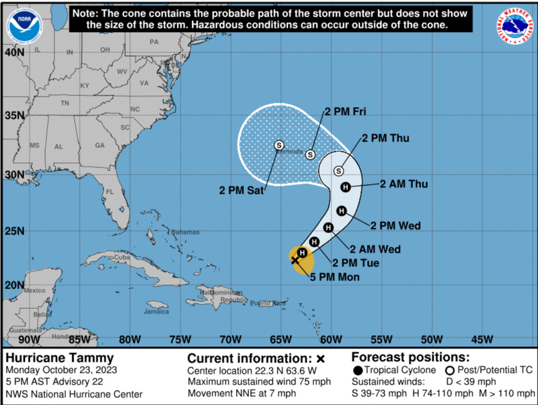
On Friday, I was wrong about no other TC formation during the next 7-10 days as Tropical Depression 21L formed at 5 PM Monday and moved inland. Winds are only 25-knots so there is no name. The system will dissipate over Nicaragua and Honduras with the threat of heavy rains.


Looking at the EPS active cyclones at Day 15, a small number of ensembles have a hurricane, but only 4/51, so under 10% chance. Heading through the first week of November, if something does develop, then the Caribbean or SW Atlantic is the place to look. However, the season is winding down. The Gulf of Mexico has already seen two strong cold-fronts that dramatically cooled off sea surface temperatures. Note the < 26°C coastal shelf SSTs along the northern Gulf Coast — too cool for intensifying hurricanes.

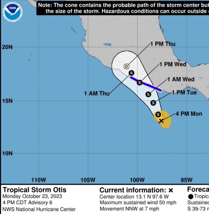
2023 Eastern Pacific Hurricane Season
Hurricane Norma fell apart before making landfall in Mexico. Further SE down the coast, Tropical Storm Otis (18E) has developed but is not expected to reach hurricane strength before making landfall on Wednesday. No other activity is expected during the next 7-10 days.
2023 Western Pacific Typhoon Season
No activity.
2023 North Indian Ocean Cyclone Season
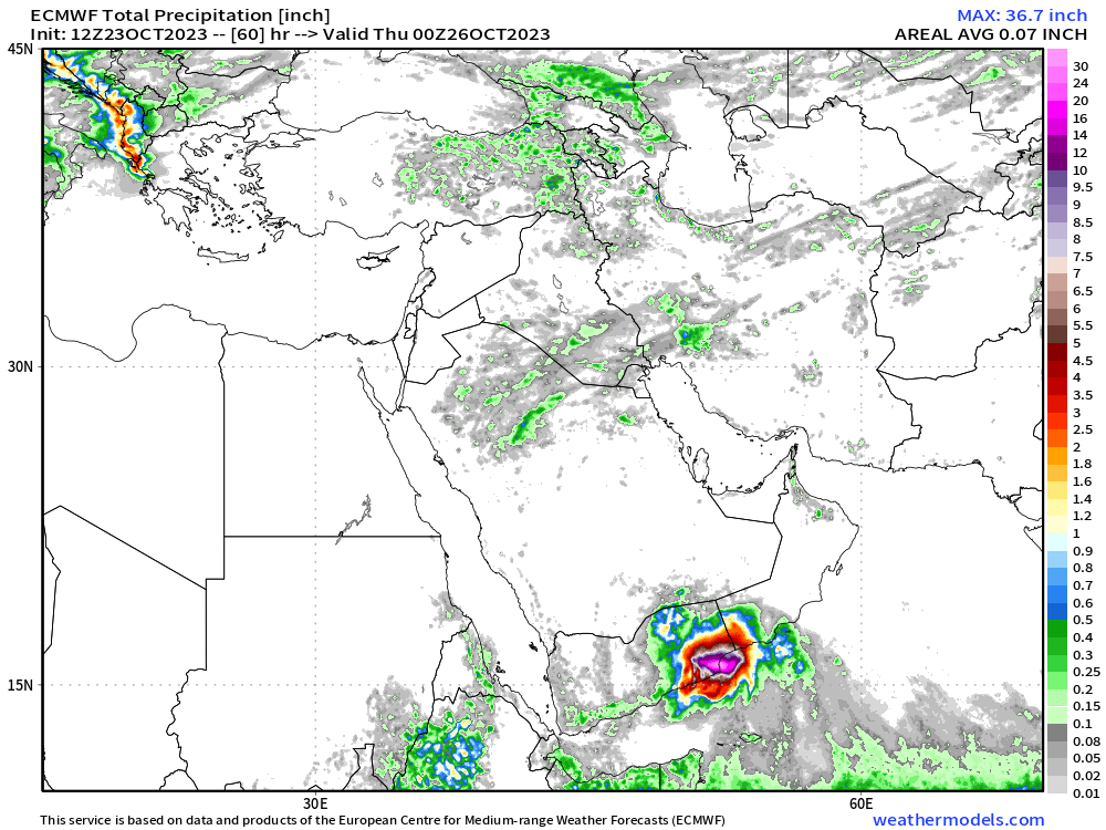
Tropical Storm (05A) Tej is currently making landfall in Yemen at 65-70 knots or Category 1 hurricane strength. JTWC working best track has Tej maximum intensity at 110-knots yesterday at 18z (high end Category 3).
The area along the coast is sparsely populated and desert terrain. ECMWF HRES has an insane amount of rainfall in the gridded output > 36-inches. Not clear how this could be verified except by satellite derived precipitation algorithms. Cyclones in Yemen are relatively rare but probably went largely unobserved or unmentioned to history since the systems largely rain out near the coast like Tej.
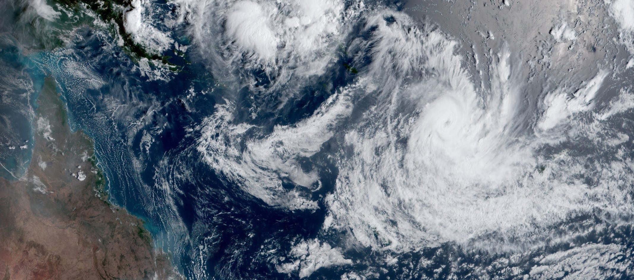
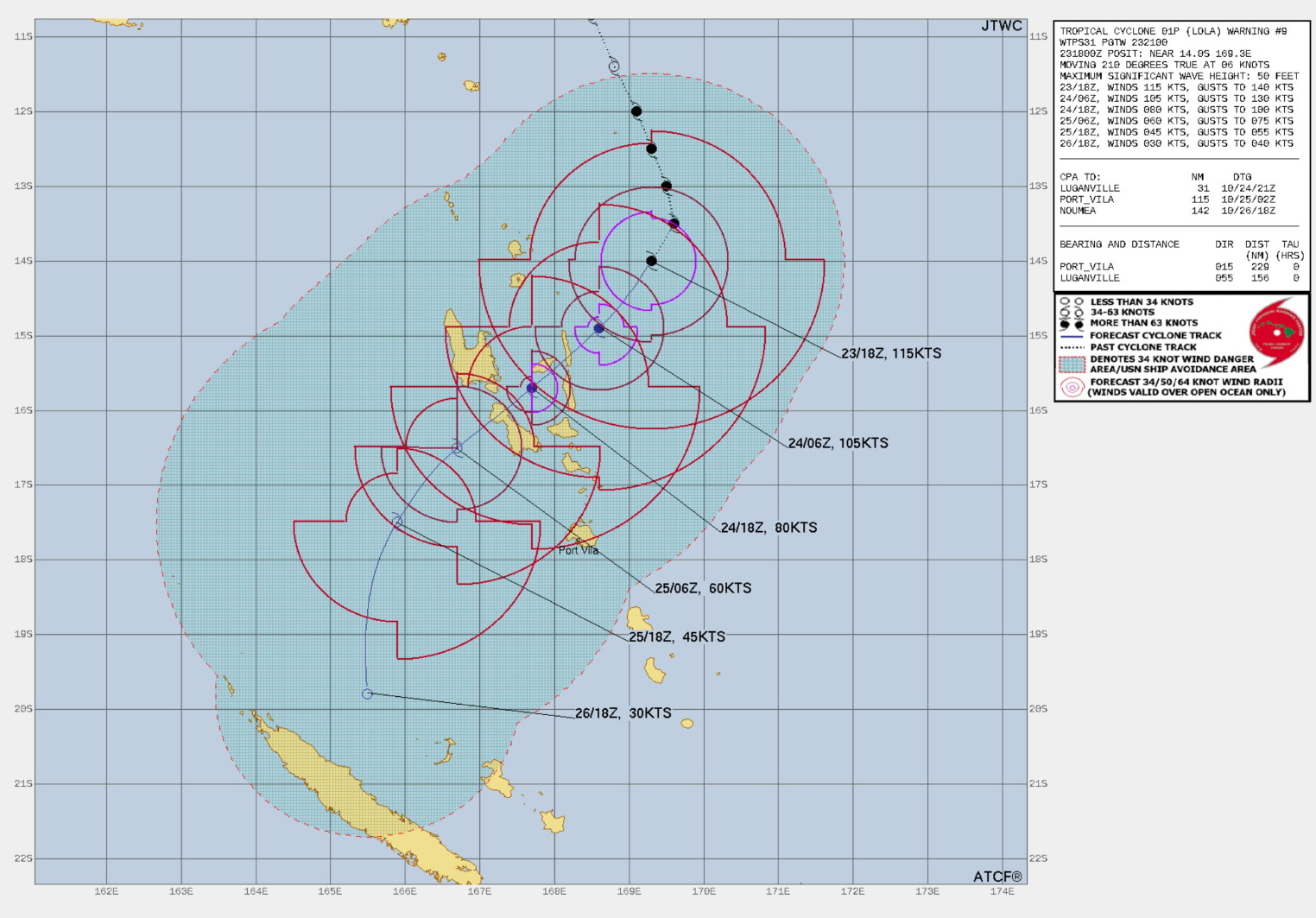
2023-24 South Pacific Cyclone Season
Cyclone Lola (01P) formed and rapidly intensified to Category 4 *115-knots) near Vanuatu. The ocean heat content rapidly falls off as Lola tracks SW, so weakening is expected in a couple days. Luganville, Vanuatu (population 18K) is in the current path of Lola.
Thank you to my paying subscribers! Your support pays for my servers and product development. Feel free to say hello and follow on Twitter (@RyanMaue)
Thanks for the information. We are expecting the arctic blast by next Sunday night here in Kansas.