


October 22, 2024 Tuesday Weather Update
Very warm and dry weather continues into November

Quiet weather continues for the next 10-14 days into November.
Election Day Forecast | Tuesday November 5th
There is some research that inclement early November weather can depress turnout especially when there’s a snowstorm or brutally cold temperatures. However, whatever impact that may have had is probably moot since so many Americans will have already voted by 2 weeks from now.
However, if we did have an indication of a blizzard, hurricane or brutal cold snap, then it would be great to alert folks to vote now, anyway!
The 14-day forecast is outside our typical skillful forecast range but we can still gaze into the future and then watch the forecast trends as the date (November 5th) approaches.
The ECMWF ensemble control is one such outcome of 51-ensembles, and we can compare to other models or the ensemble mean. Here’s the example Tuesday morning forecast. Not much going on — and that’s probably a good bet considering the very stagnant pattern over the past 2-3 weeks (minus Milton).


ECMWF AIFS 12z represents a smoothed view of the weather pattern 2-weeks from now. Might be a Canadian/Arctic cold blast waiting in the wings, but unlikely to see a hurricane or a blizzard along the East Coast.

ECMWF AIFS 12z | Next 10-days | Height Anomaly
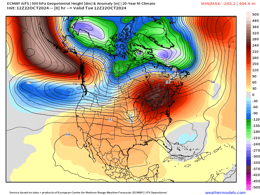
Ridging builds in the west the moves to the east coast by Day 10. That means very warm / above normal temperatures continue for Lower 48 east of the Rockies.
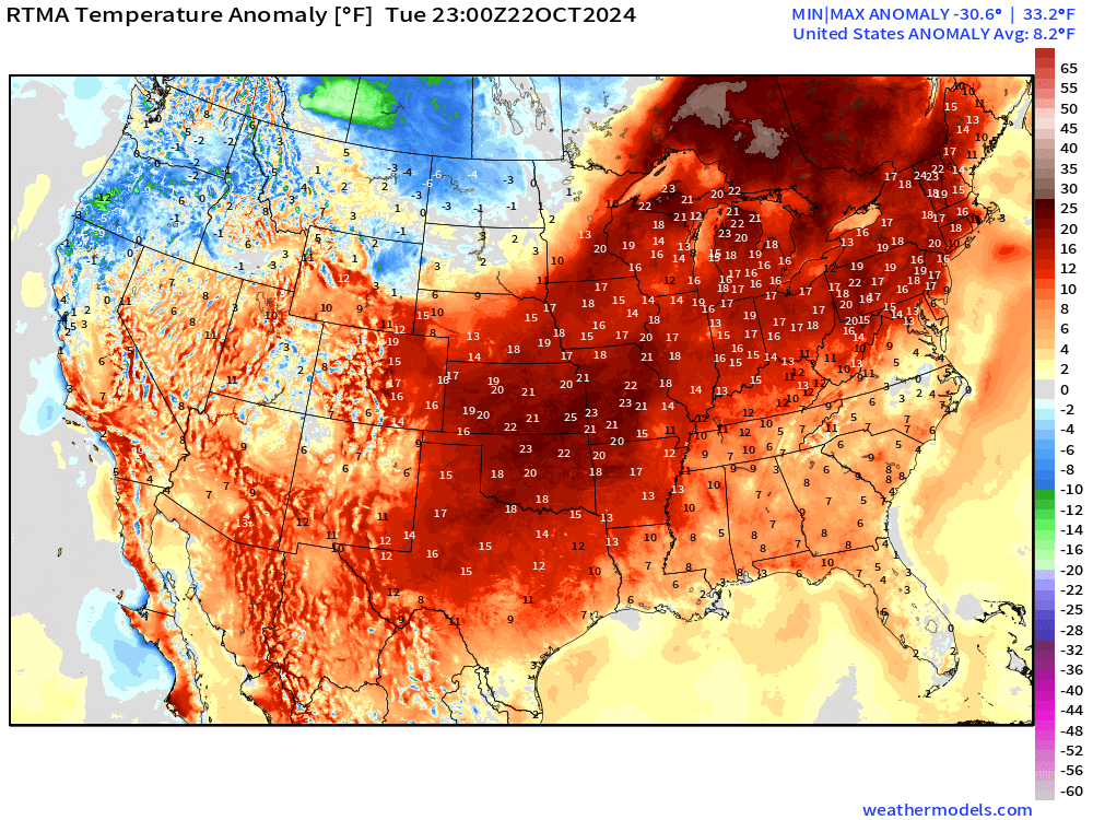
Temperatures 7:00 PM ET

Amazing to see such warmth on October 22 at 7 PM with > 200 Million at/above 70°F.
Overall, that’s 8°F above normal for the Lower 48. Warmest is > 20°F normal centered on Kansas City into Ontario.
New and Renewal Subscribers [2025] can upgrade to Annual for 10% off through October 31.
Keep reading with a 7-day free trial
Subscribe to Weather Trader to keep reading this post and get 7 days of free access to the full post archives.