


October 18, 2023 Afternoon Update
Tropical Storm Tammy finally named
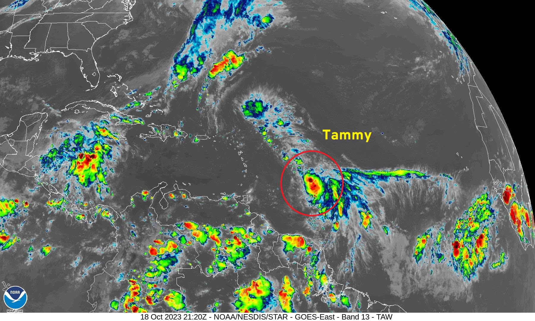
Tropical Storm Tammy
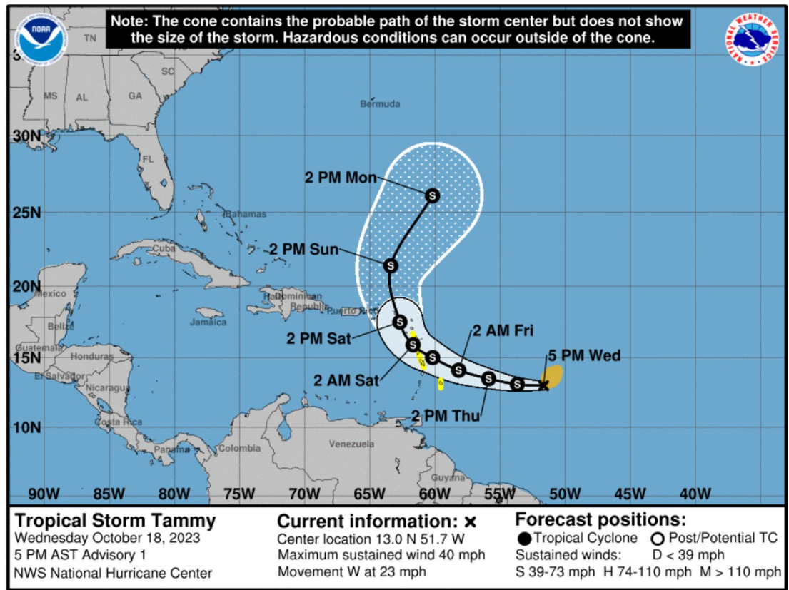
After several days watching a tropical wave in the Atlantic east of the Lesser Antilles, Tropical Storm Tammy [20L] was finally named this afternoon by NHC. For the time being, Tammy will remain disorganized due to the hostile effects of vertical wind shear. The lower-latitudes of the tropics from the Caribbean to Africa have not been conducive for intensification surprisingly enough. NHC does track Tammy through the islands as a moderate tropical storm and expects it to become near-hurricane force moving away to the N/NE next week. Tammy is not a threat the U.S. East Coast.
The NHC track cone recurves Tammy on Saturday to the NW and then NNW to be well southeast of Bermuda by Monday of next week. However, if Tammy fails to intensify much, then it could drift further west. The opposite could be true of Tammy becomes a hurricane earlier. As the ensembles have shown for the past few days, the stronger solutions are on the rightward/eastern side of the solution envelope.
East Coast Storm this weekend


This weekend will be blustery with bouts of heavy rain in the Northeast as a sprawling area of low-pressure with embedded circulations slowly exits by late on Sunday.
Total rainfall of 1-inch or so from NYC to Boston, and maybe higher amounts of 2-3” in Maine. Hopefully clearing happens on Sunday to at least rescue another weekend from rainy conditions.

Here comes snowfall
Finally, here comes winter! I’m looking at 7-10 day snowfall maps over North America and see the Lower 48 with considerable accumulations from the global models over the mountains, of course, but also in the Plains.
I plan on showing the snowfall maps for the entire winter — 10 days from GFS and ECMWF, and maybe some ensemble probabilities for more extreme events when we get closer to a blizzard or Nor’easter. Late-October is early for Midwest snowfall but it’s not unheard of to get a blast of Canadian Arctic air plunging across the western U.S. and a Rockies Lee side low to develop.


Indeed, the pattern in 10-days looks very conducive for a winter storm in the middle of the country with an omega block centered over the Gulf of Alaska allowing cold air to plunge southward in the western U.S.
If it’s going to be cold, then it might as well be snowy, too, right?


2023 Atlantic Hurricane Season | Medium Range Outlook
Aside from Tropical Storm Tammy, no other tropical cyclone formation is expected for the next 10-days.

2023 Eastern Pacific Hurricane Season
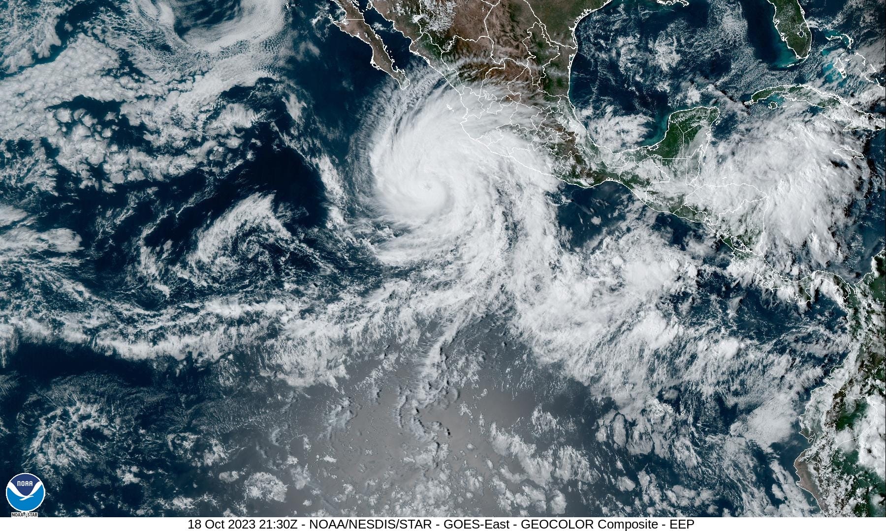
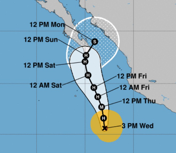
Hurricane Norma (17E) is rapidly intensifying and looks spectacular on visible satellite imagery with beautiful upper-level outflow (divergence aloft). It looks like a textbook almost-major hurricane. NHC forecasts 100-knots in the next 24-hours = Category 3 Hurricane Norma.
The forecast track takes Norma near or over the tip of Baja California as a Category 1 hurricane on Sunday.
2023 Western Pacific Typhoon Season
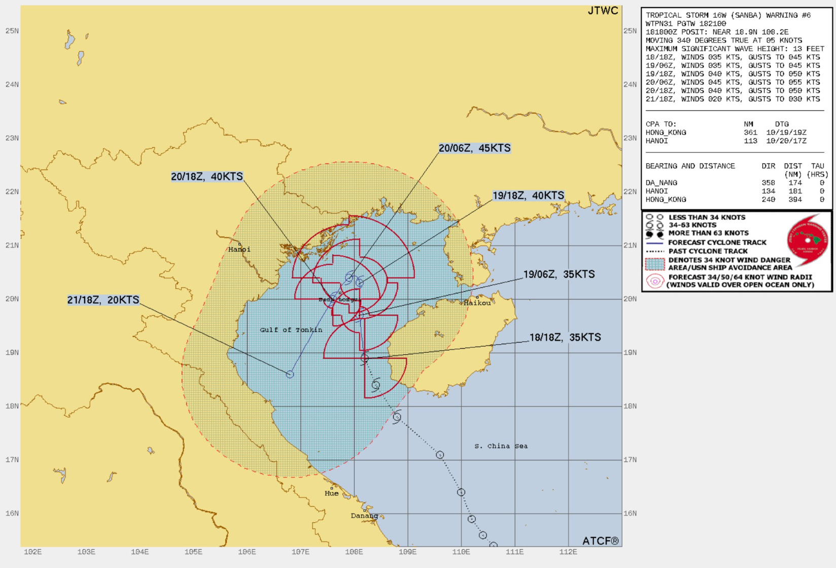
Tropical Storm Sanba (16W) will meander in the Gulf of Tonkin over the next few days, but it is not expected to intensify much over 45-knots before fading away in 3-4 days.
Thank you to my paying subscribers! Your support pays for my servers and product development. Feel free to say hello and follow on Twitter (@RyanMaue)
Hello, I love the analysis. My only issue is that I cannot enlarge the maps (or, at least, not all of the maps) in my email. Is there a way to fix this? Some of the maps (esp. the 3-across maps) are so small as to be impossible to read.