


October 16, 2023 Afternoon Update
Quiet weather week
Aside from an atmospheric river impacting the Pacific Northwest with rain showers today, the rest of the U.S. is under the control of high pressure behind a strong cold front. High temperatures were 15-25°F below normal from the Ohio Valley into Florida — about as cool of a day possible in mid-October in terms of daily maximums.
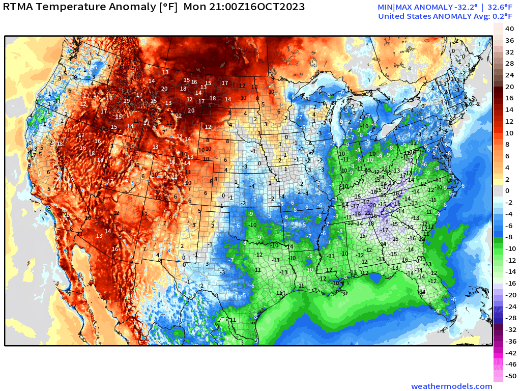
Temperature anomalies when averaged out across the Lower 48 actually come out above average.
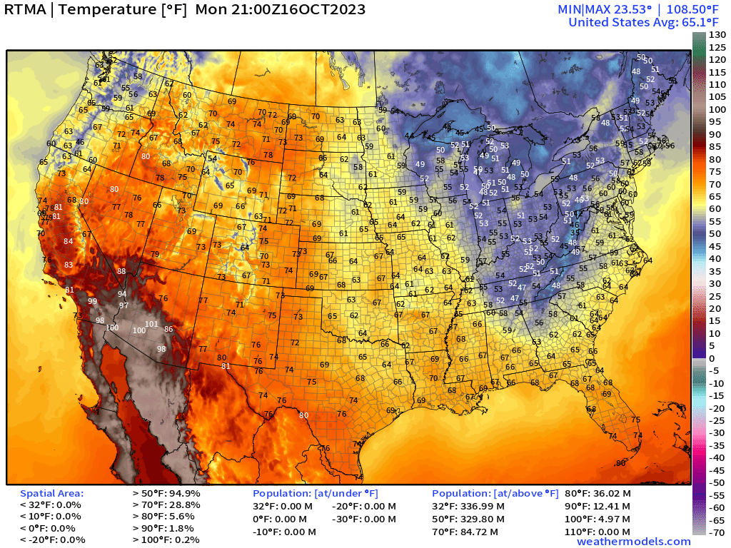
5 pm Temperatures only in the 40s and 50s from Nashville to Atlanta and only finding 70°F down along Interstate 4 in Florida. Very hot in Phoenix — still 100°F+.
The Integrated Vapor Transport shows a moderate band of moisture parallel to the coast attached to a weak low pressure. This is not a major storm but a good sign for the “water year” in the PACNW. Later this weekend and next week, there may be an atmospheric river flowing into California leading to significant mountain snows.

Satellite imagery showed the cold front extending deep into the Caribbean — which is rather rare for mid-October. Puffy stratocumulus field has popped in cloud streets as cooler air moves over the 85-90°F Gulf of Mexico even leading to “ocean effect” instability showers. Clouds eventually socked in Atlanta and Nashville from the “wedge” arriving from the mountains.
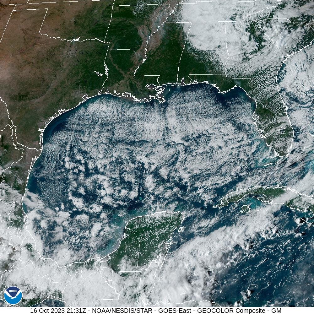
The cold front and gusty winds will cool off the Gulf of Mexico from the coast southward, slowly but surely. Note, the beaches and shelf waters are now under 26°C from Houston almost to Tampa. This is early for such a strong cold front. Hopefully this puts a lid on the Gulf of Mexico hurricane season.

Looking ahead to this weekend, some sort of coastal storm could develop off the Carolinas or Mid-Atlantic coast. The solutions have been all over the place during the last couple days with some ensembles showing a strong Nor’easter or “bomb cyclone” but that may have been taken off the board. Note, by Saturday, ECMWF HRES does not have Invest 94L in the picture as a named storm, instead there is a stretched out frontal boundary in the Atlantic.


2023 Atlantic Hurricane Season | Medium Range Outlook
Keep reading with a 7-day free trial
Subscribe to Weather Trader to keep reading this post and get 7 days of free access to the full post archives.