


October 12, 2023 Afternoon Update
Invest 94L looks more threatening


Updated NWS rainfall [3-day] totals from the powerful storm system still range from 1-3” across a number of states from the Plains to the Mid-Atlantic.
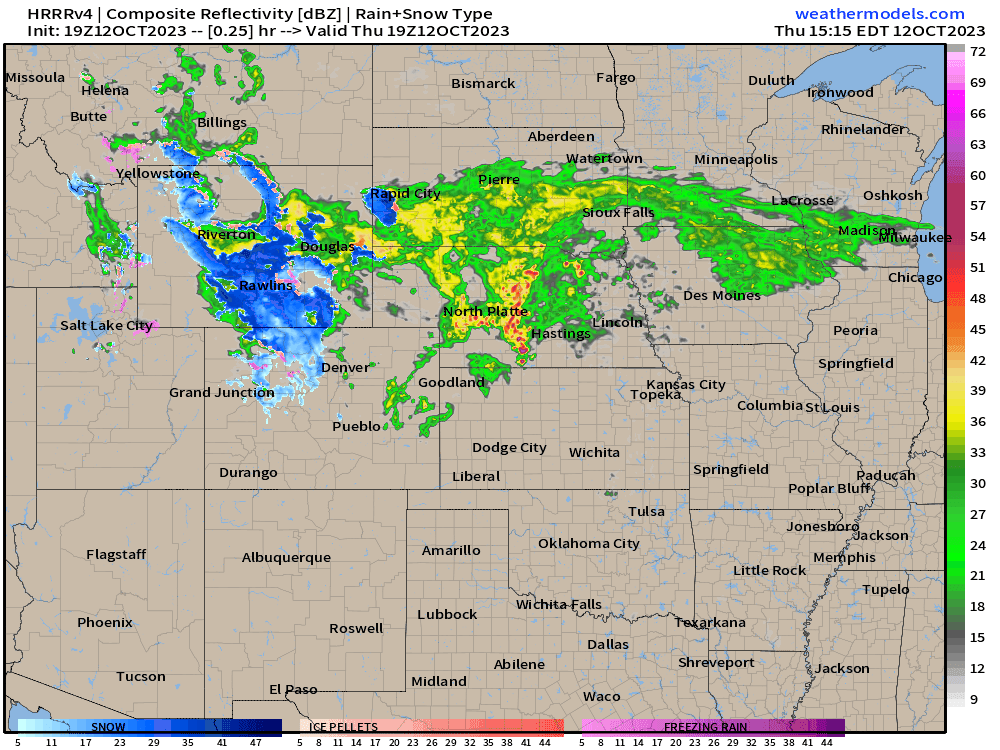
The Plains storm is at full-tilt this evening. Pressure has fallen to 989 mb as the low tracks to the east across Nebraska with blustery conditions on the back side including some snow showers. A couple weeks later and there would be enough cold air to crank a blizzard out of this strong storm.
2023 Atlantic Hurricane Season | Medium Range Outlook
In a major modeling change, Invest 94L is now forecast to develop by ECMWF HRES and the ensembles into a powerful hurricane ( > 50% of members) in 7-days as it approaches the Leeward Islands. Since this is such a shift in guidance, it’s necessary to wait another cycle before latching onto the solution. GFS has nothing (of course) so the consensus remains to be made in the model suites.
Keep reading with a 7-day free trial
Subscribe to Weather Trader to keep reading this post and get 7 days of free access to the full post archives.