


Oct 6, 2024 Hurricane Milton Rapidly Intensifying
Milton forecast to become at least a strong Category 4 hurricane

Weather Trader is a reader supported daily newsletter to keep you updated on extreme weather around the U.S. and world. Please consider upgrading to a paid subscription to receive all updates to your email or click on the Substack App. Yearly subs or upgrades can use this coupon for 20% off [through October 11].
Headline for Sunday
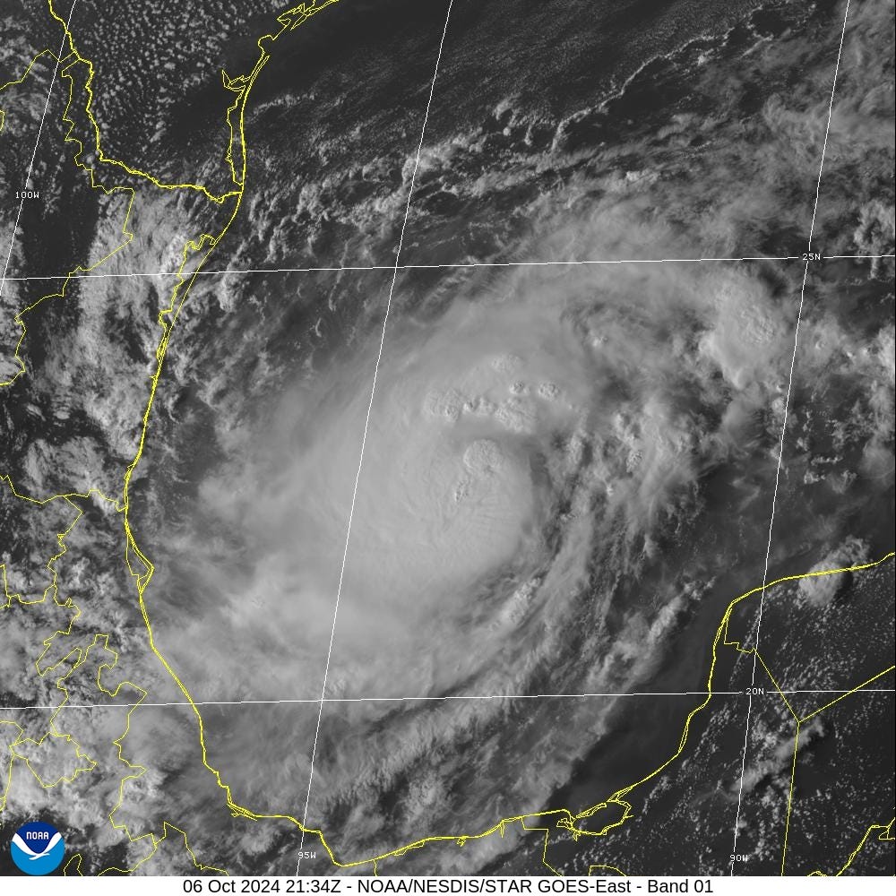
Hurricane Milton [14L] is rapidly intensifying over the very warm Bay of Campeche in the far SW Gulf of Mexico. All indications are for a Category 4 or 5 hurricane in the next 36-48 hours as Milton heads just north of the Yucatan Peninsula. The track turns more northeast until near the Florida coast west of Bradenton but south of Tampa Bay. A rightward turn coincides with a slow-down and rapid transition into an extratropical cyclone.
5 pm: Central Pressure is 983 mb w/maximum sustained winds of 75-knots (Category 1)
Maximum wind forecast by NHC is now 125-knots, mid-range Category 4
Milton will become a very large hurricane with powerful wind gusts extending across the entire Florida peninsula.
Track of Milton
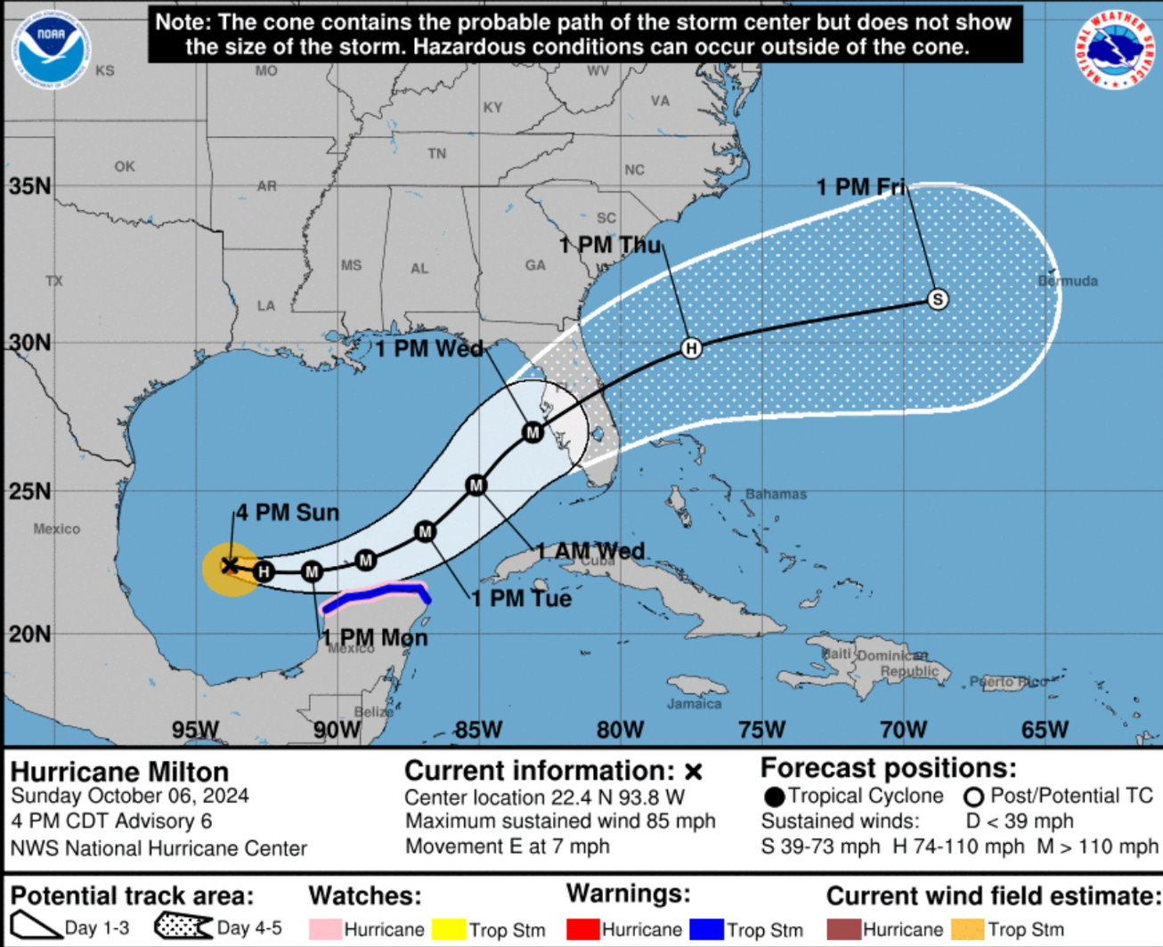
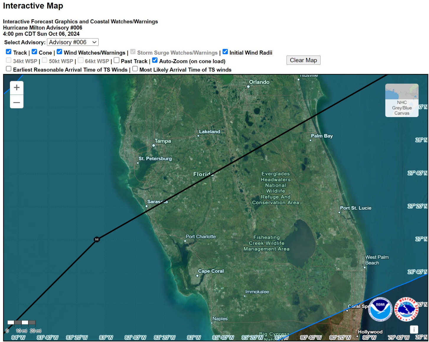
The 5 PM ET track is very close to the previous updates on Sunday with landfall near Sarasota and then ENE across the Florida peninsula.
However, as wind shear and dry air will be disrupting the circulation of Milton prior to reaching the coast, the overall system inner-core may be more like a “half-cane” and transitioning into an extratropical or post-tropical storm. That would mean impacts spread out of a larger area.
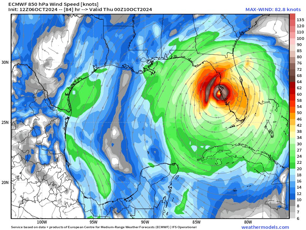
ECMWF 12z Track
NHC is leaning toward the ECMWF HRES and ensemble guidance for the track, while discounting the much further north GFS.

From simulated water vapor imagery, a strong trough digs into the Gulf of Mexico and obliterates the inner-core of Milton coincidentally with landfall.

Landfall inner-core still looks coherent but with a large outer eyewall structure. Milton will be undergoing rapid structural changes late in the afternoon on Wednesday.
ECMWF AIFS 12z
The artificial intelligence (AI) trained version of the ECMWF called AIFS is further south than the HRES probably due to the brush by of the Yucatan Peninsula. We’ll see if this southern jaunt is predictive of the upcoming 18z/00z model cycles.

Intensity and Impacts of Milton
ECMWF 12z ensemble intensity distribution shows the strongest members with central pressure in the 940s and 950s mostly on the western/northern half of the spread envelope. Thus, a slower and more intense Milton — in the model — will be on the left side of the mean track.
Keep reading with a 7-day free trial
Subscribe to Weather Trader to keep reading this post and get 7 days of free access to the full post archives.