


Oct 21, 2024 Monday Weather Update
October continues to be warm and dry across Lower 48

Good morning, brand new week of (no) weather across the Lower 48.
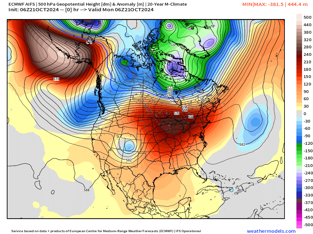
The upper-level pattern for the next 7-10 days is marked by ridging across much of the Lower 48 until a trough can finally dig into the Western US. That means very warm and dry conditions continue across much of the U.S. with only brief disturbances in the Midwest and Great Lakes bringing cooler, Canadian air.
However, at the end of the period into Halloween and November, above average temperatures across the Eastern U.S. remain strongly in place.
ECMWF AIFS 06z | Next 10-days | Height Anomaly
Next 10-Days High Temperatures from NOAA Blend of Models

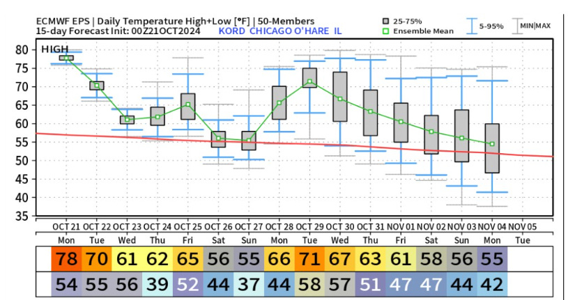
As we head into November, the climatology cools fast across the Lower 48. So when we talk about “warmth” it is relative to the time of year, of course. However, 70s and 80s across the Midwest and Great Lakes during the last third of October is unusually warm.
Temperatures should be in the mid-50s this time of year in Chicago, but much higher — no complaints.
Temperatures 8:00 AM ET
This morning lows were in the 30s and 40s underneath clear, dry high pressure over the eastern U.S. but some 60s into Michigan w/southerly flow.

The anomaly shows the weather pattern nicely. 15-20°F warmer than normal across the Midwest into the Great Lakes.

Fronts at 8 AM
Chance of strong storms over Kansas today, but otherwise, a rather quiet pattern for the next several days.

New and Renewal Subscribers [2025] can upgrade to Annual for 10% off through October 31.
Keep reading with a 7-day free trial
Subscribe to Weather Trader to keep reading this post and get 7 days of free access to the full post archives.