


Oct 2, 2024 Wednesday Tropical Update
Model support for Gulf of Mexico tropical system remains limited

Enormous rainfall amounts fell over the past 7-days across the Southeast U.S. and Ohio River Valley into the Middle Atlantic. All told, well over 40 Trillion gallons of rain fell from combination of a Predecessor Rain Event (PRE) associated with a cut-off low or deep-layer trough + Hurricane Helene.

Looking at the past 30-days compared to normal (%) the extreme rainfall across the Southeast shows up with values 2-7x September climatology.

Actual Rainfall (not anomaly) is incredible for the past 30-days
Total USA: 135 Trillion gallons
Georgia: 9.2T
Florida: 11T
North Carolina: 9.2T
South Carolina: 4.2T
Tennessee: 5.4T
Virginia: 6.0T
Alabama: 6.2T
Texas: 14.2T
Montana: 5.6T

AP Coverage of Total Rainfall
I spoke to Seth Borenstein at the Associated Press about the meteorology behind the PRE + Helene’s extreme rainfall. The article puts the enormous totals into context including Dallas Cowboys Stadium and Olympic Swimming Pool metrics.


Nice description of the methodology using the NWS rainfall analysis.
Headlines for Wednesday

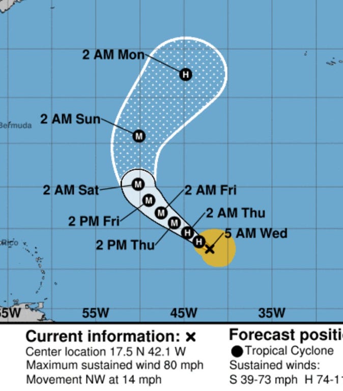
Hurricane Kirk likely to become a major hurricane in next 2-days. The next wave behind Kirk will also develop into a potentially Cat 4 Hurricane Leslie on a similar track as Kirk.
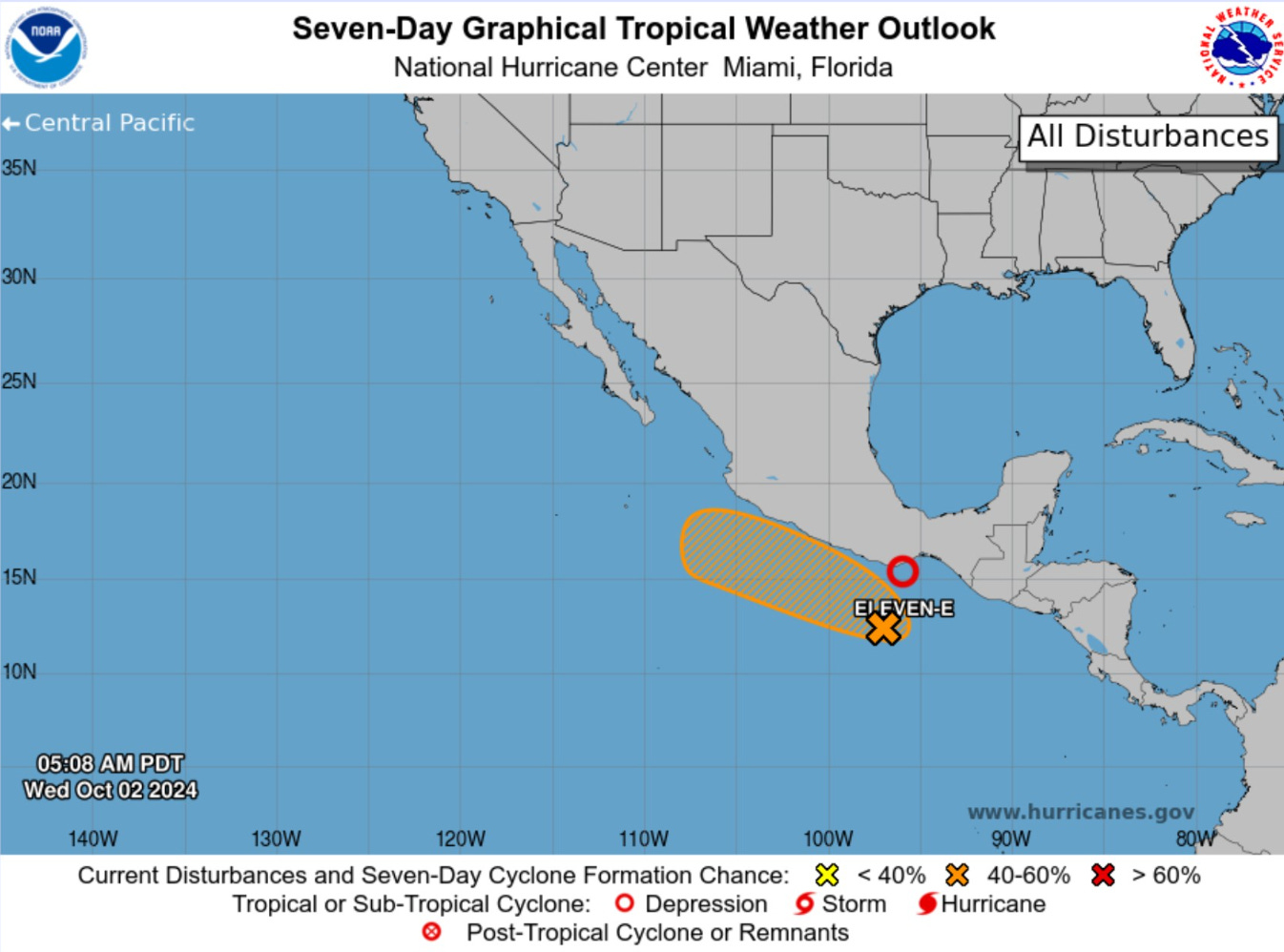
Gulf of Mexico gyre remains at 40% chance of development into a tropical cyclone. Model support remains limited but ensembles do show a large, broad circulation with lower pressure in 7-days mainly drenching Florida.
Typhon Krathon to landfall Taiwan at Category 2 intensity in the next 12-18 hours. Heavy rain is the primary threat with Taiwan’s topography.

ECMWF 00z Integrated Vapor Transport (IVT) shows the massive size of Hurricane Kirk as it recurves north with potential to slam into United Kingdom in 9 to 10-days as a very powerful post-tropical storm. Leslie follows a bit further to the west on a similar recurving track. There could be some upwelling from Kirk that holds Leslie back, similar to how Krathon is weakening near Taiwan.
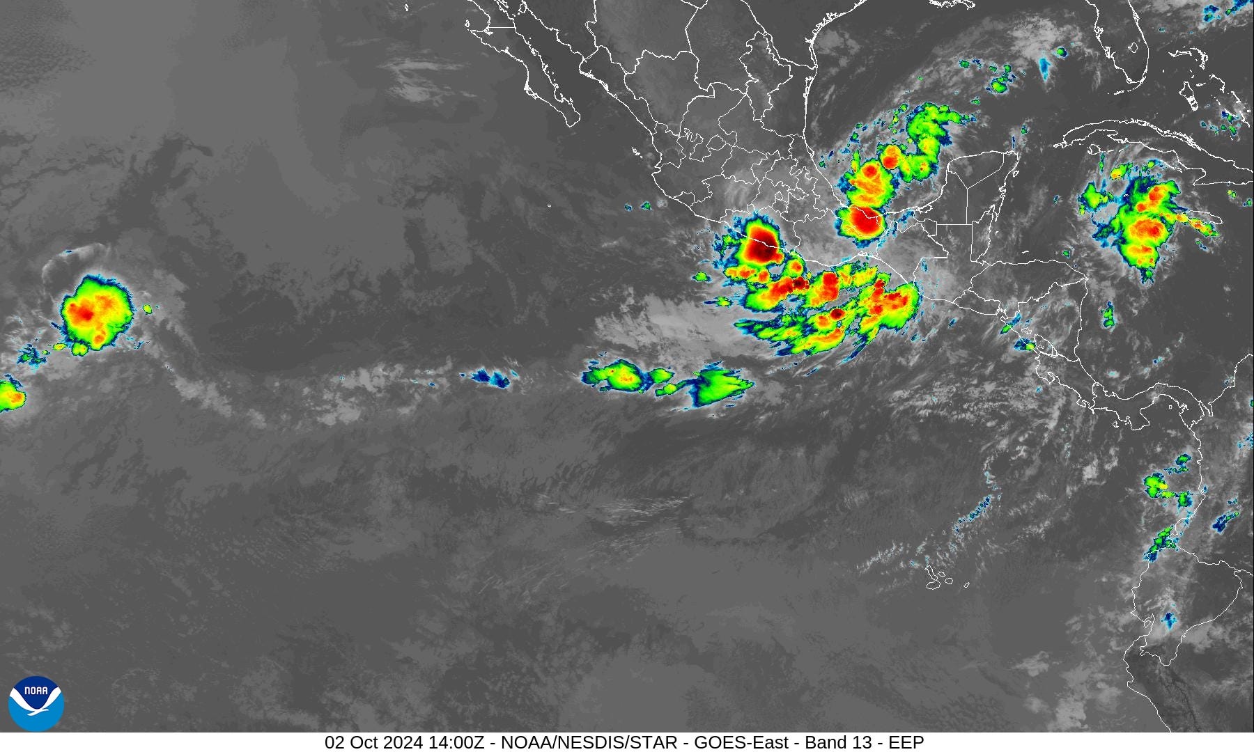
The complicated Central America gyre evolves into a large circulation encompassing the entire Gulf of Mexico but lacking a singular or dominant low-pressure center.
Confusion about Eastern Pacific storm activity including TD 11E (Kristy) maybe merging with Invest 97E and limiting the development of Lane.
Weather Trader is a reader supported daily newsletter to keep you updated on extreme weather around the U.S. and world. Please consider upgrading to a paid subscription to receive all updates to your email or click on the Substack App. Yearly subs or upgrades can use this coupon for 20% off:
Atlantic GeoColor Satellite
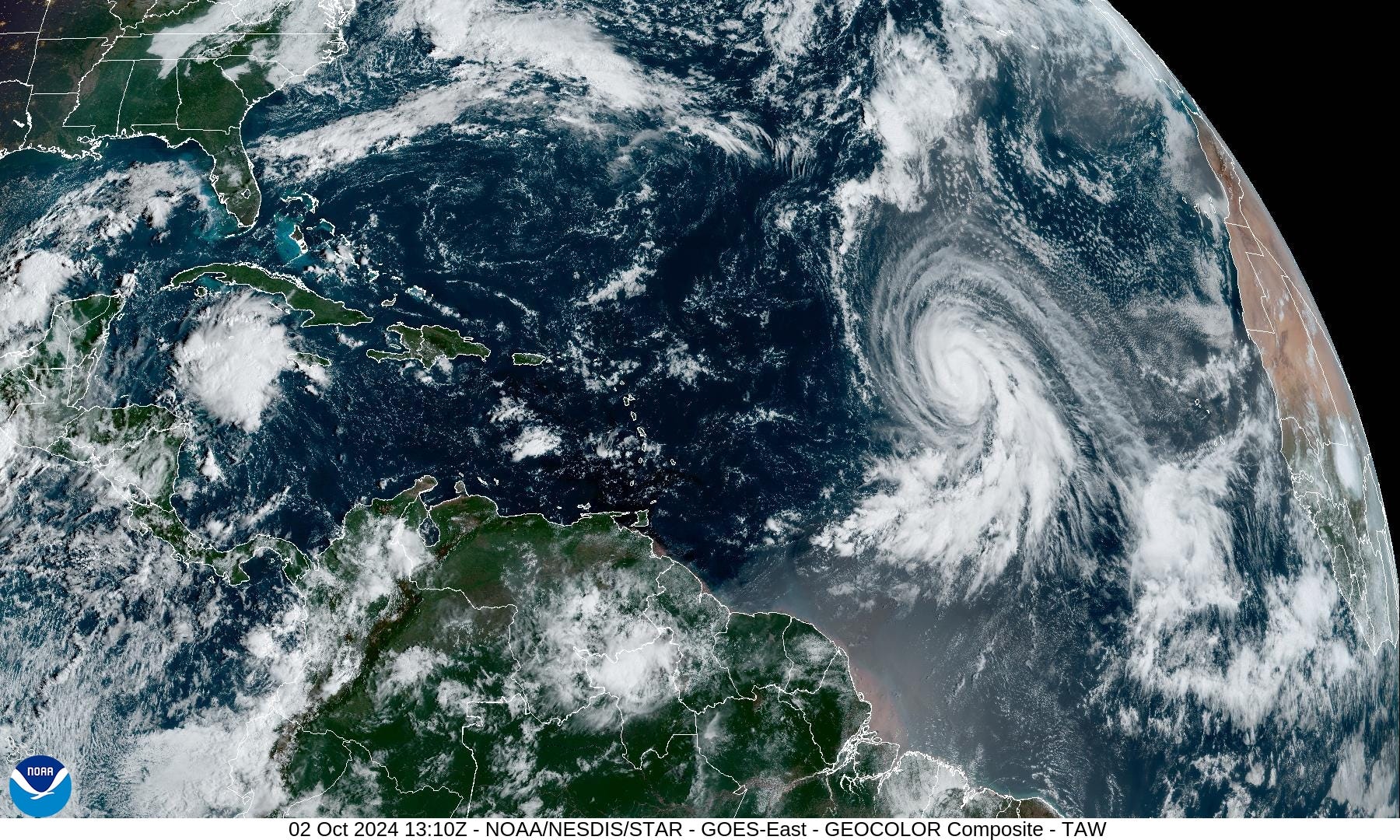
Hurricane Kirk is putting on a show in the central Atlantic with excellent outflow and banding. Kirk is “very large” size and will only get bigger as it gains latitude.
Wave behind Kirk will likely become Leslie [13L] in the next 24-hours.
NHC 7-Day Outlook
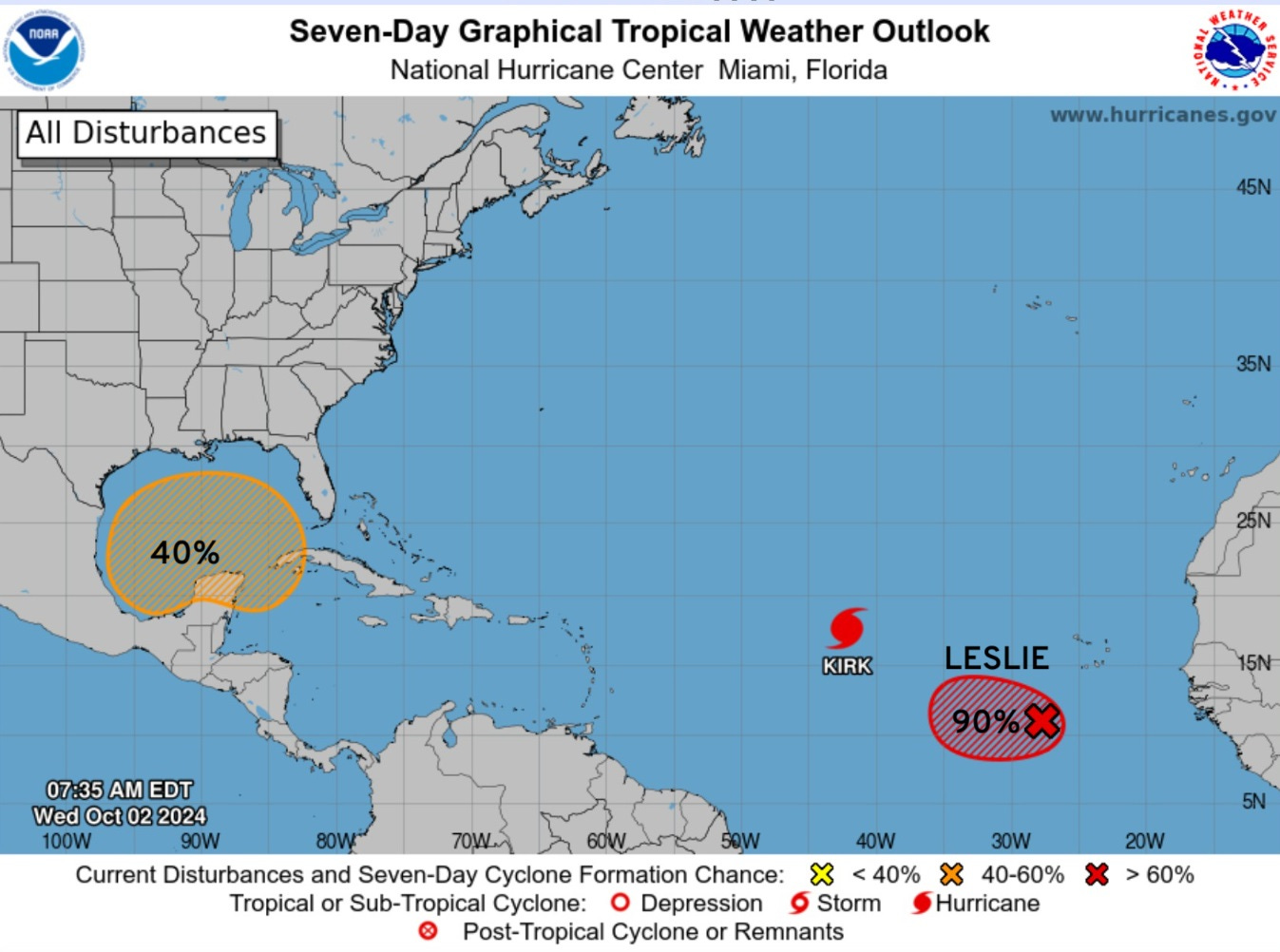
We’re still at 40% with the large Gulf of Mexico gyre through 7-days. Good bet that Leslie will develop, however. NHC upgrades it to TD 13 at 11 AM
Hurricane Kirk
Water Vapor Imagery
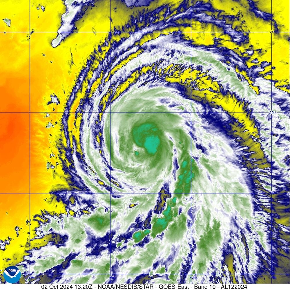
Kirk is very large and has a well-defined inner-core surrounded by sprawling spiral bands.
ECMWF HRES does have a post-tropical Kirk threat to Ireland and the UK in 8-10 days.

IVT shows an atmospheric river directed into Spain, Portugal and France from the low-pressure of post-Hurricane Kirk +8-days

Heavy rainfall is the primary threat along with gusty winds. Nothing they haven’t experienced in previous autumns being at the tail end of the North Atlantic hurricane track corridor.

Tropical moisture with PWAT > 2” will stream into Europe.

Interesting non-tropical —> tropical development possible NW of Kirk in the next 48-hours according to GFS 06z. No impact to land.
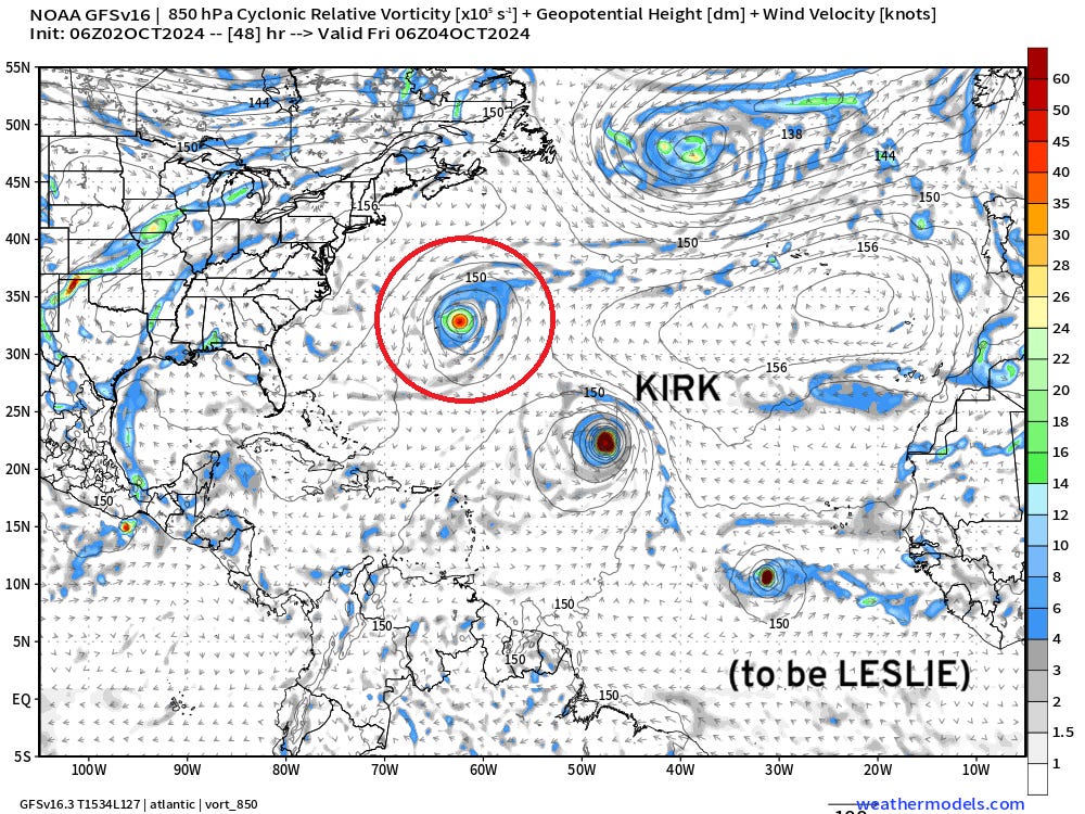
The 3 systems are nicely lined up from NW to SE.
Leslie at 981 mb in 48-hours show rapid intensification is possible way out there.

Gulf of Mexico Model Forecasts at Day 7
Quick round-up of global models (00z) for the Gulf of Mexico. The Canadian model is the only one of the 4 that develops a strong TS/H1.


Typhoon Krathon [20W]
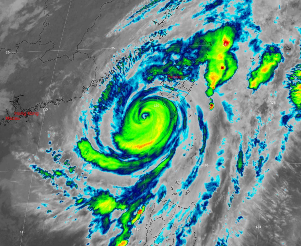
Krathon has weakened to 100-knots under the effects of wind shear and upwelled / cooler SST due to wave mixing.
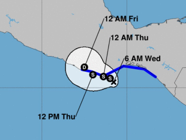
JTWC Forecast Track
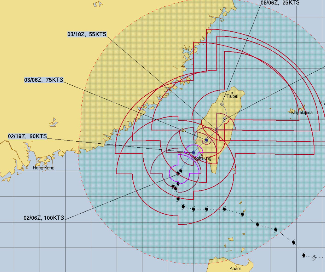
Forecast track still shows landfall along SW coast of Taiwan at 90-knots (Category 2) with extreme rainfall amounts due to the terrain of the island.
Eastern Pacific IR Satellite
A small swirl has been designated TD 11E —> Kristy by Wednesday.
Another area that was expected to become Hurricane Lane may now not develop as it merges with 11E (Kristy). Thus, the chance of development has been significantly knocked down.
Eastern Pacific 7-Day Outlook
ECMWF 00z Tropical Cyclone Tracks
Day 4: October 6 00z

Some hints of development in the Gulf of Mexico at Day 4
Day 7: October 8

About 50/50 chance of development in the Gulf of Mexico with most members in the 990s suggestive of a large, disorganized tropical storm (at worst) with heavy rain as the primary threat.
Day 10: October 11

Blend of Models | 10 Days Total Precipitation

Not seeing much in the way of rainfall across much of the Lower 48 west of the Mississippi, while Florida and the immediate Gulf Coast are drenched.
Coming soon: Weather in My Backyard
Maps sourced from weathermodels.com designed and innovated by yours truly! I actually create all of my content from scratch.
Do you think ny of it's as a result ooof Hunga Tonga?
"Looking at the past 30-days compared to normal (%) the extreme rainfall across the Southeast shows up with values 2-7x September climatology."
What is "normal".
There is average, min and max, people rarely experience normal. Language to confuse.
Any decent size hurricane will blow through the average?
Still no killing frost in sight up here in Calgary, for which i'm grateful even though its a sign of the apocalypse.