


Oct 11, 2024 Friday Weather Update
Tropics quiet for the next week but models hint at a Caribbean development

Finally a break from the 2024 Hurricane Season hopefully for the final 6-weeks.
Hurricane Milton was a Category 3 [954 mb | 120 mph] at landfall and legitimately so with winds of 95-100 knots offshore while the eye crossed at Siesta Key. Remember, the landfall intensity is the maximum sustained wind anywhere in the storm so most likely over water on the backside of the storm. Every storm someone points that no surface observations showed whatever Category winds. Doesn’t matter for the landfall classification. Not every location in the path of the storm would see the maximum anyway.
Wind Gusts in the hour prior to landfall were extreme on the west half of the eye probably up to 145-mph even with the conservative 3-km RTMA analysis. All of that wind energy eventually moved on shore and bombarded Tampa Bay and St. Petersburg with 100-115 mph gusts shredding the fiber glass fabric of Tropicana Field. The structure remained sound and no one was inside. The media went a bit overboard on the coverage of the stadium.
9 PM ET Wind Gusts (Thursday)
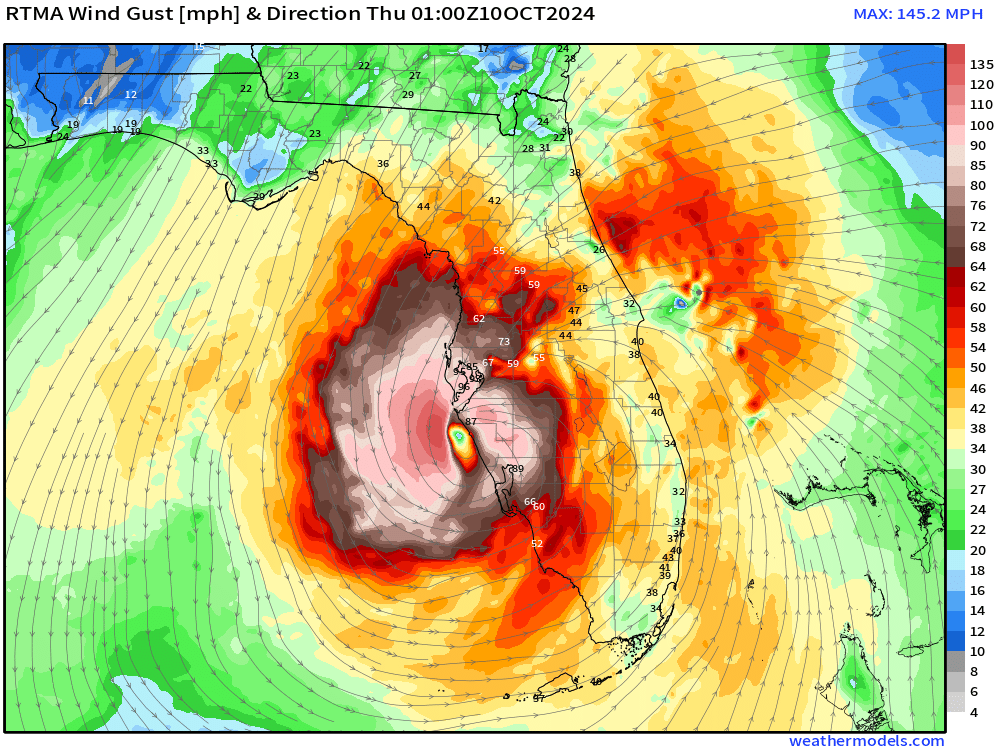
11 PM ET Wind Gusts (Thursday)

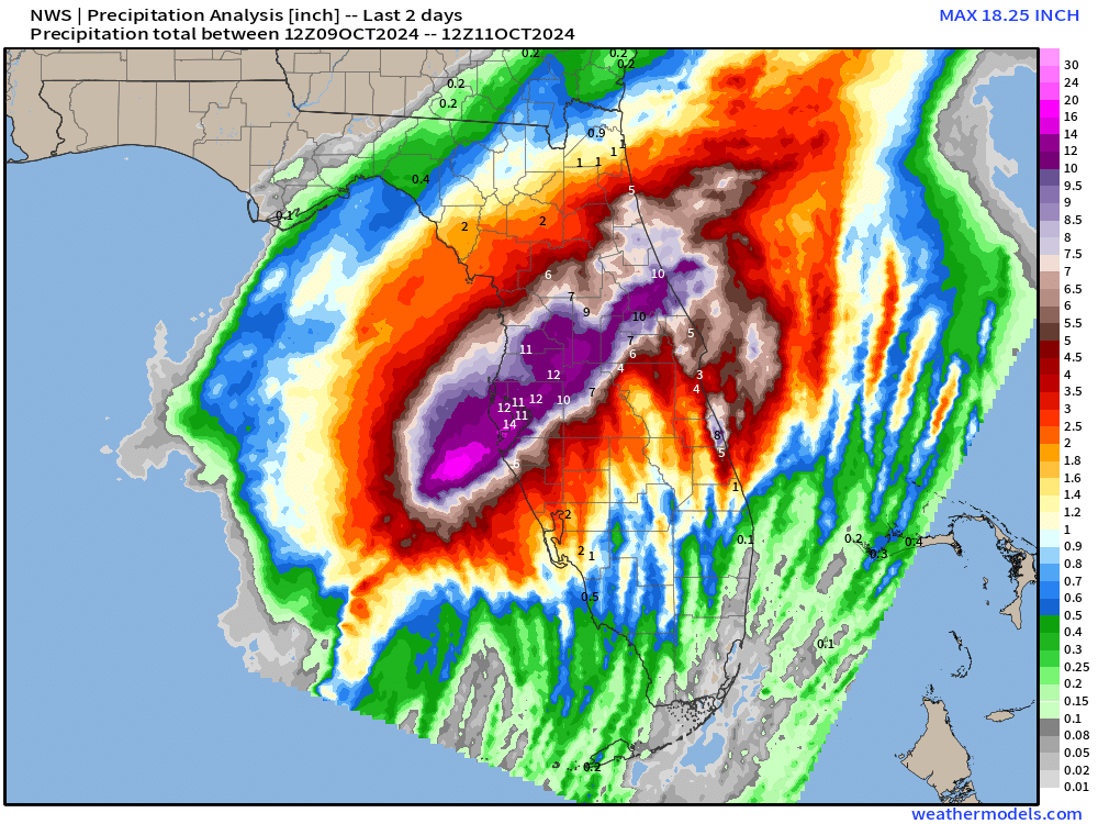
Hurricane Milton was also a rainmaker with significant flooding but thankfully it moved quite fast. Analyzed highest totals over land were 10-14” from Tampa Bay to Daytona Beach, which did receive hurricane conditions as Milton emerged off the Atlantic coast.
Total was 3.4 Trillion gallons of rain for Florida from Milton.
Snowfall Maps Are Back
I’m quite excited to see the ECMWF snowfall maps back for the cold season, and we’re hopefully going to see a LOT of brutal, La Niña fueled winter weather. Not sure about a cold winter, but I will certainty try my hardest.
15-day Ensemble Mean Snowfall Forecast
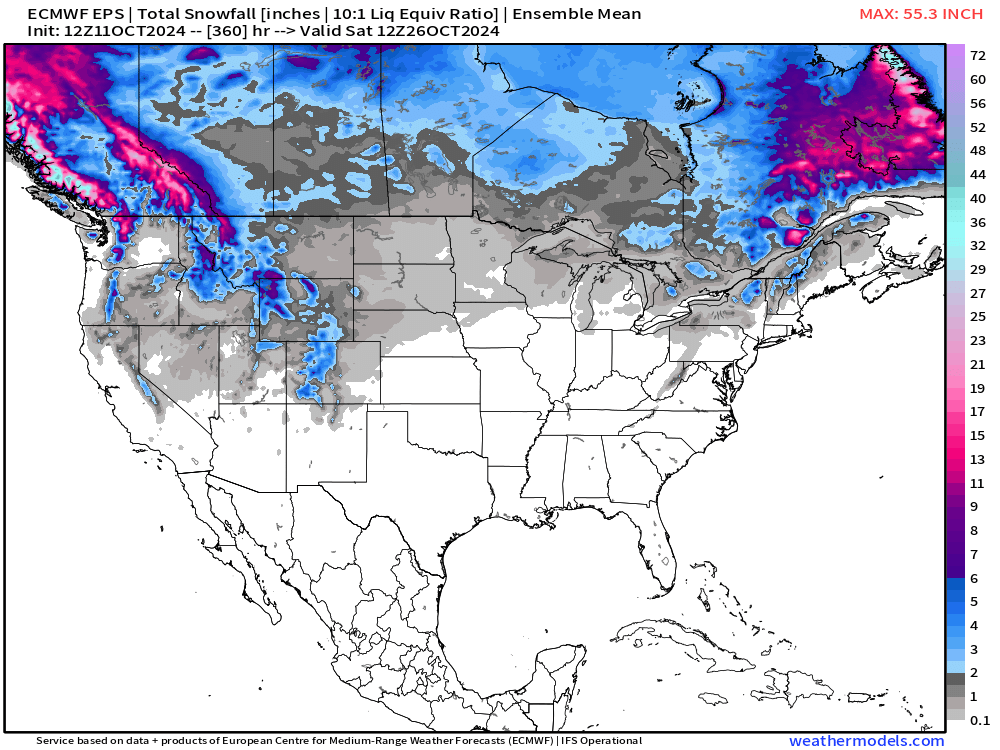
No major storms in the Great Lakes or Northeast, but decent chance for flurries or light accumulations with the cold air blast from Canada next week.
Probability of 0.10” snowfall through 15-days
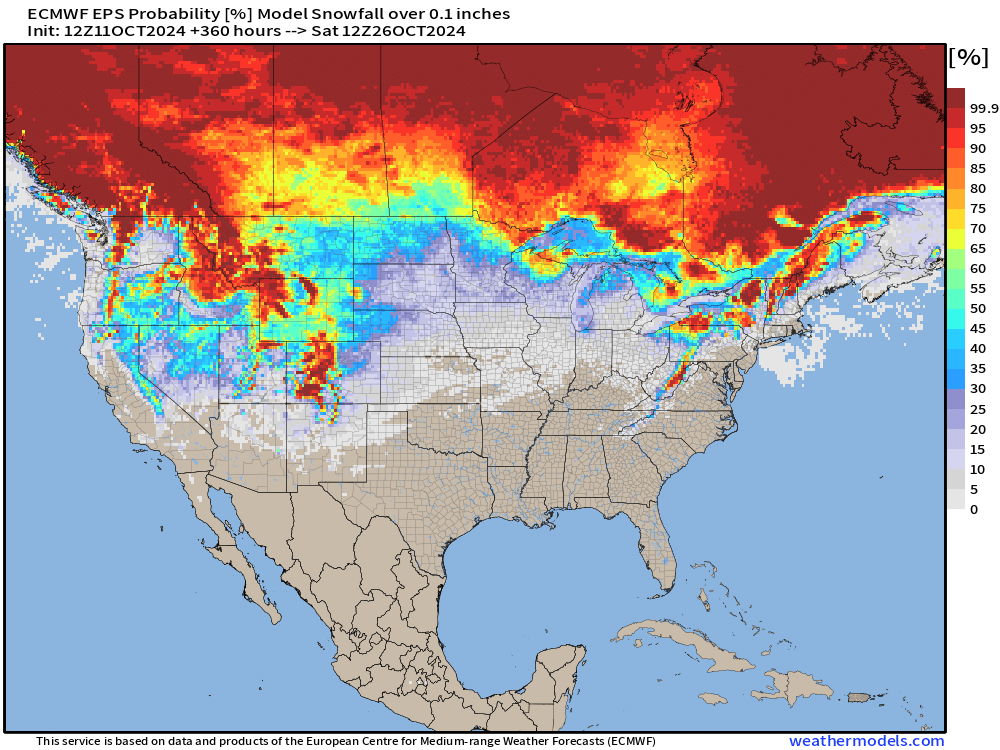
Not so bad for mid-October. We’ve seen Decembers with less excitement!
NHC 7-day Outlook
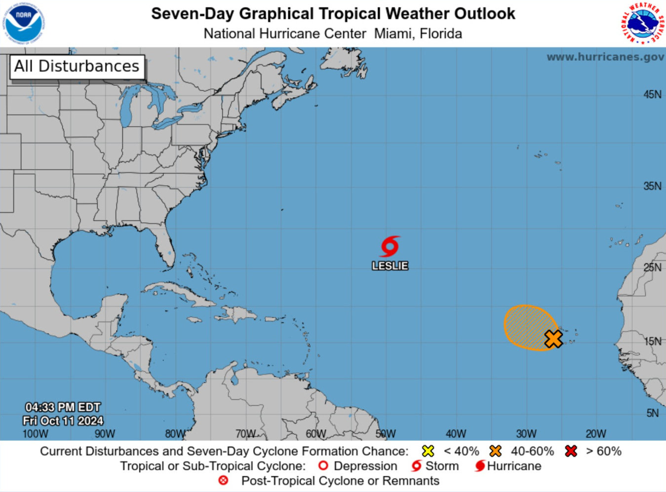
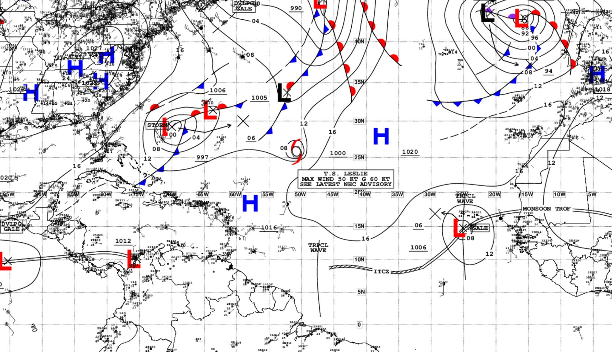
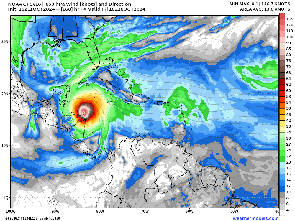
AL94 could become short-lived Tropical Storm Nadine [50% chance]. Leslie will become post-tropical. NHC has not lit up the Caribbean yet with a lemon.
Atlantic Satellite
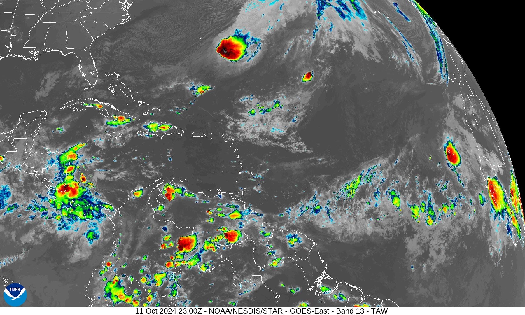
I see Leslie being sheared apart. Invest 94L is a convective puff. The rest of the Atlantic has some scattered storms, but nothing organizing.
Next 10-Days Atlantic Integrated Vapor Transport
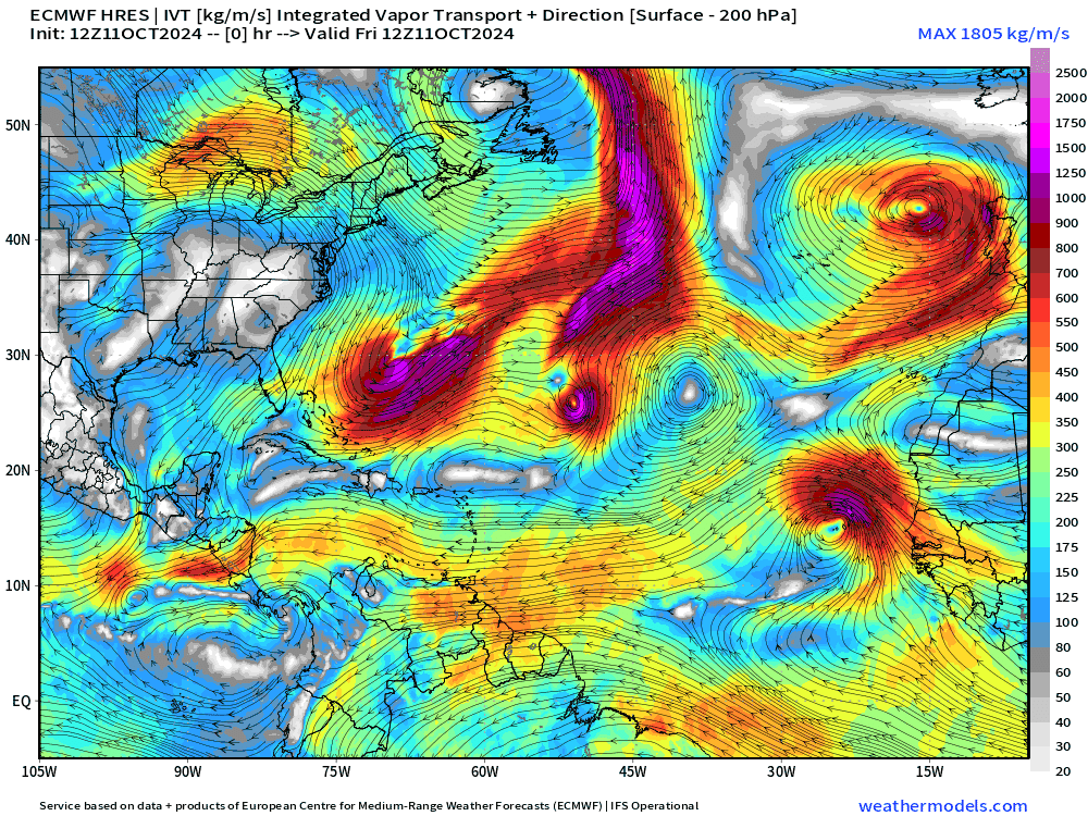
Invest 94L does head on a westerly track for 7-10 days but does not catch fire.
ECMWF HRES has a moisture surge through the Caribbean into the Gulf of Mexico but the Arctic blast instead wipes out the Gulf with northerly winds and transports the vapor through the gap into the Eastern Pacific.
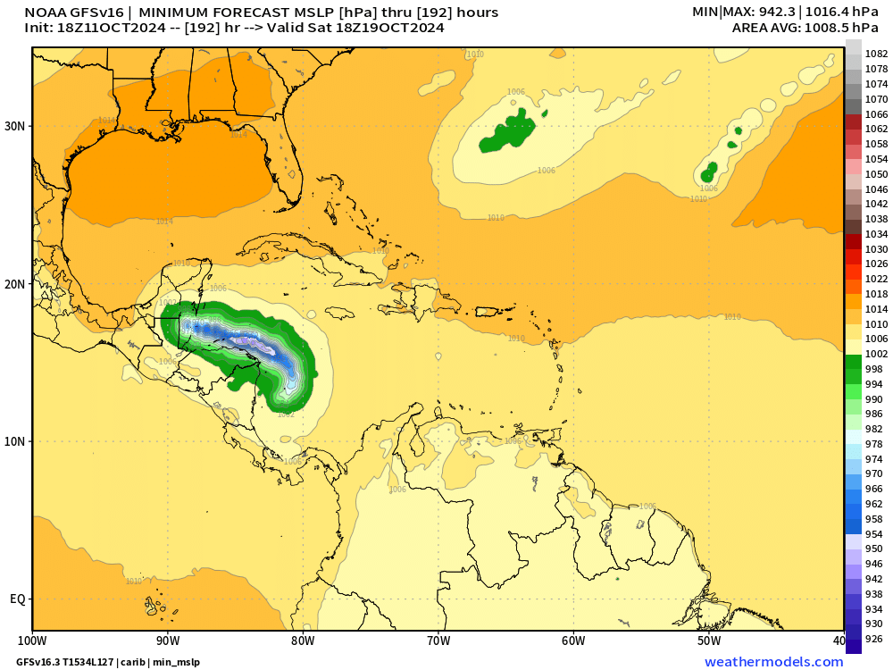
GFS 18z: Next 8-Days Minimum Pressure
The GFS is highly interested in a powerful Category 4 hurricane to develop near Nicaragua and bend around to the Yucatan. Not so sure this is happening in the next 5-days, but we’ll keep an eye on it!
Arctic Blast | Temperature Anomaly next 10-days
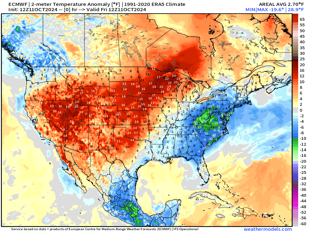
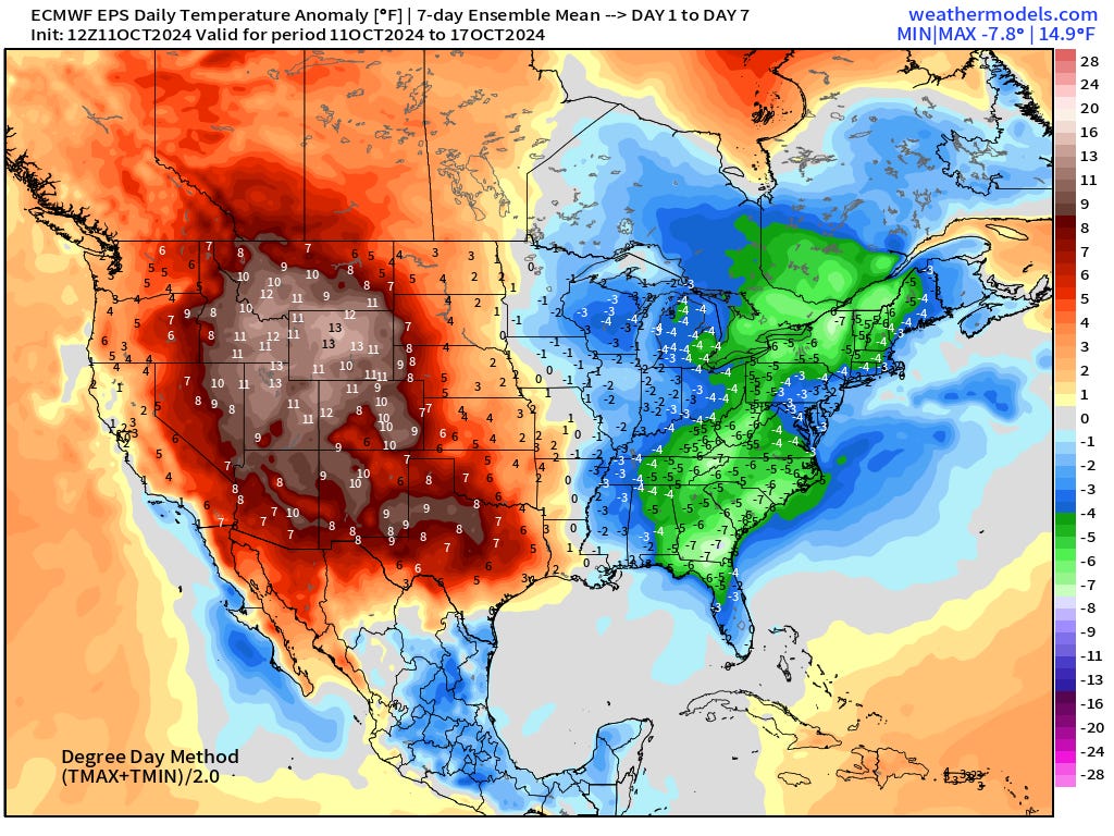
The main upper-level pattern shift is a major trough and Arctic blast bringing much colder than normal temperatures to the Great Lakes, Southeast, and rest of the Eastern U.S. The western U.S. remains well above normal.
Next 10-day Upper Level Pattern | North America
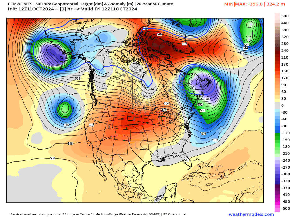
AIFS will be interesting to watch for predictability in the upcoming winter.
Low Temperatures on Saturday
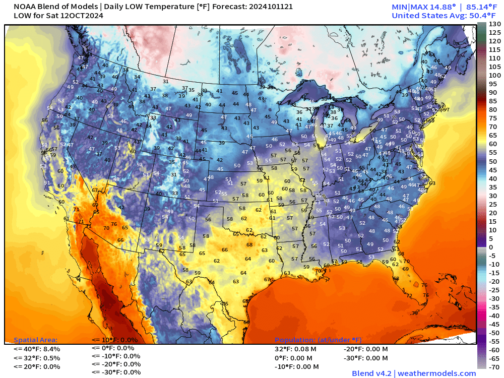
Not so bad with mild temperatures for mid-October across the Lower 48. Maybe a bit cool in the Southeast and mid-Atlantic, but comfortable sleeping weather. 30s in Michigan.
High Temperatures on Saturday
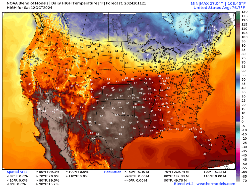
Temperatures rebound nicely. Even plenty of 90s in the central U.S from Texas to St. Louis. Still 50 million Americans at/above 90°F.
Lows on Wednesday
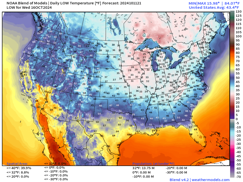
Here comes a frost/freeze into the Southeast into Nashville and North Georgia with 14 million below freezing.
ECMWF EPS Active Tracks
Day 7: October 18
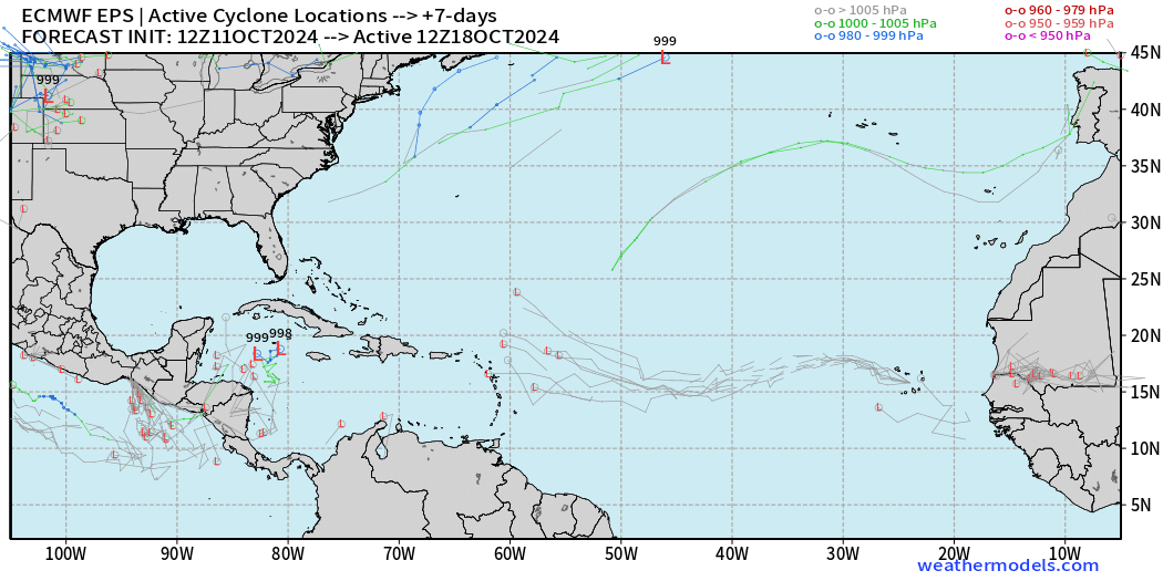
A faint signal in the Caribbean. Invest 94L is very weak.
Day 14: October 25
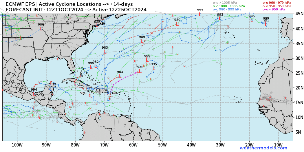
A few scattered tracks but no coherent signals. This is typical with an ensemble of 50-members.
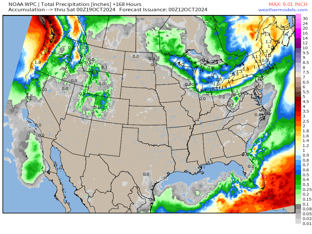
Total Rainfall next 7-Days | NOAA WPC
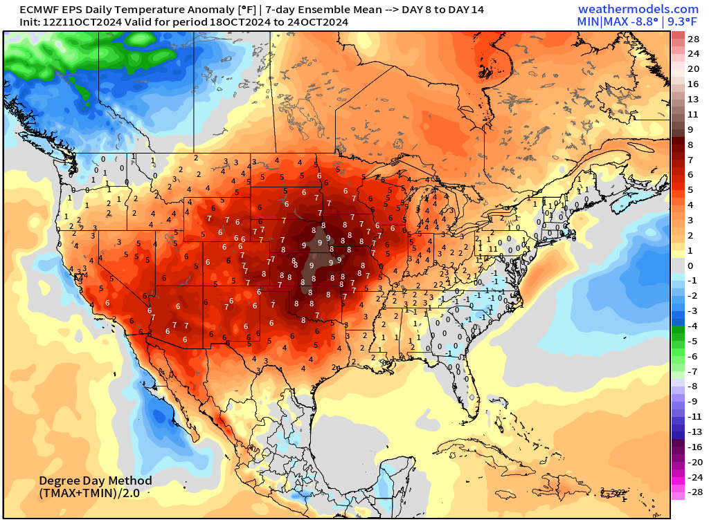
EPS Weekly Temperature Anomaly
Week 1: October 11-17
Week 2: October 18-24
Coming soon: Weather in My Backyard
Maps sourced from weathermodels.com designed and innovated by yours truly! I actually create all of my content from scratch.
I for one am not looking forward to a cold icy winter. Last winter here at PDX was quite cold enough thank you!
“ The media went a bit overboard on the coverage of the stadium.”
Could have stopped at “overboard”.
As a canadian on the prairies if you do anything to make it colder and snowier I’ll be forced to come find you.
😀