


Oct 1, 2024 Tuesday Tropical Update
Still watching Gulf of Mexico for potential development in 7-days

Hurricane Kirk continues to intensify and will become a major hurricane in next 2-days. The next wave behind Kirk will also develop into a potentially Cat 4-5 Hurricane Leslie.
Complicated Caribbean / Gulf of Mexico gyre circulation jas generated its first tropical depression (TD 11E) to become short-lived TS Kristy. Another more powerful Eastern Pacific hurricane (Lane) will come by the weekend. NHC has 40% chance of development in the Gulf of Mexico for next 7-days, but not seeing much signal for consolidation.
Typhon Krathon to landfall Taiwan at Category 2 intensity on Wednesday
Long lasting and intense (dry) heat wave under way across the Western USA and will intensify for next 10-14 days into mid-October.
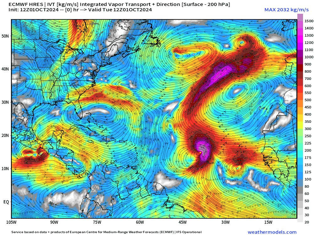
ECMWF 12z Integrated Vapor Transport (IVT) shows the massive size of Hurricane Kirk as it recurves north with potential to slam into United Kingdom in 10-days as a very powerful post-tropical storm. Leslie follows a bit further to the west on a similar recurving track. The complicated Central America gyre evolves into a large circulation encompassing the entire Gulf of Mexico but lacking a singular or dominant low-pressure center.
Weather Trader is a reader supported daily newsletter to keep you updated on extreme weather around the U.S. and world. Please consider upgrading to a paid subscription to receive all updates to your email or click on the Substack App. Yearly subs or upgrades can use this coupon for 20% off:
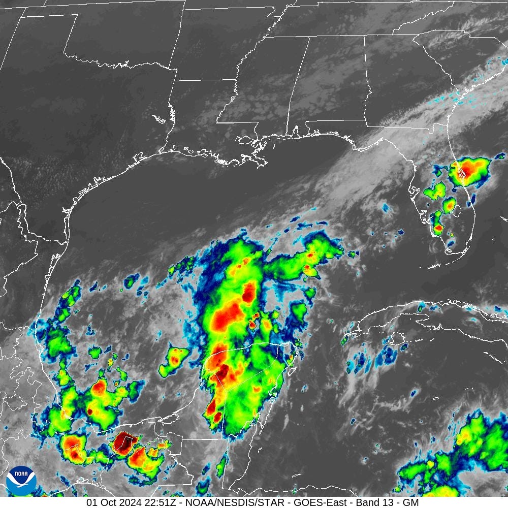
Atlantic IR Satellite

There is disorganized convection over the southern Gulf of Mexico, but pales is comparison to Kirk.
NHC 7-Day Outlook
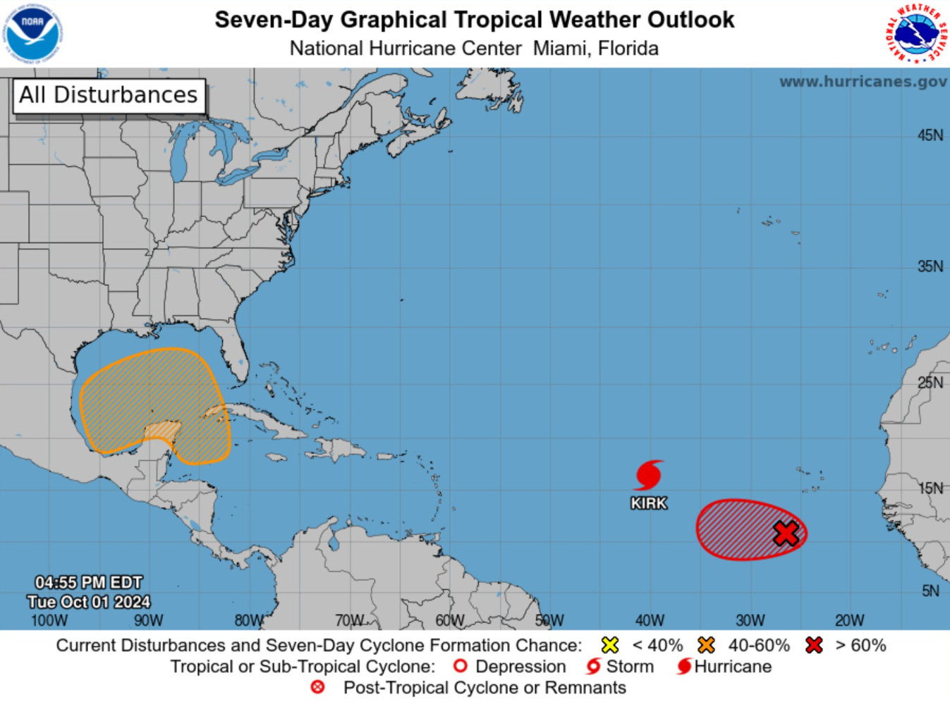
The Gulf of Mexico / Caribbean system is still at 40% development chance. The red area behind Hurricane Kirk will become Leslie in the next 2-3 days.
Hurricane Kirk
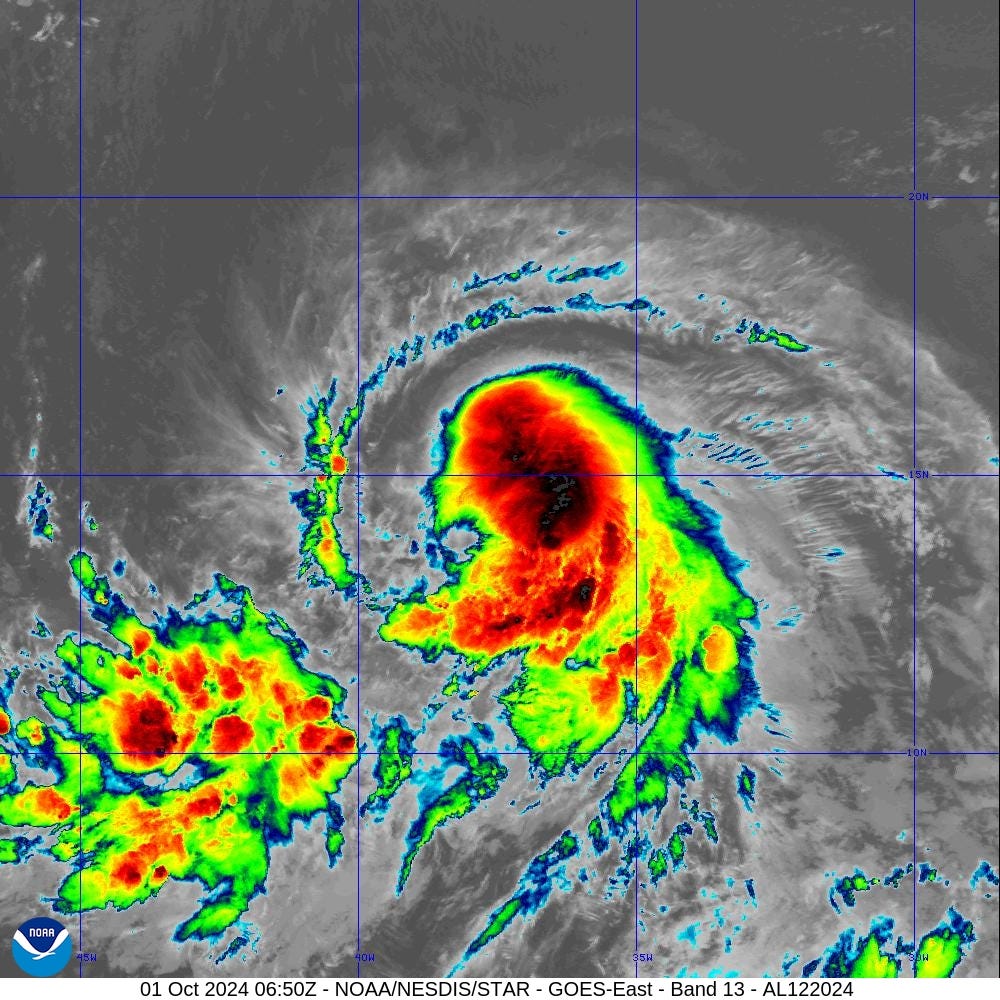
Waiting on an eye to develop with Kirk — might only be 24-hours or so. A very nice outflow regime has set up around Kirk and it should have no trouble reaching Category 4 with warm SSTs.
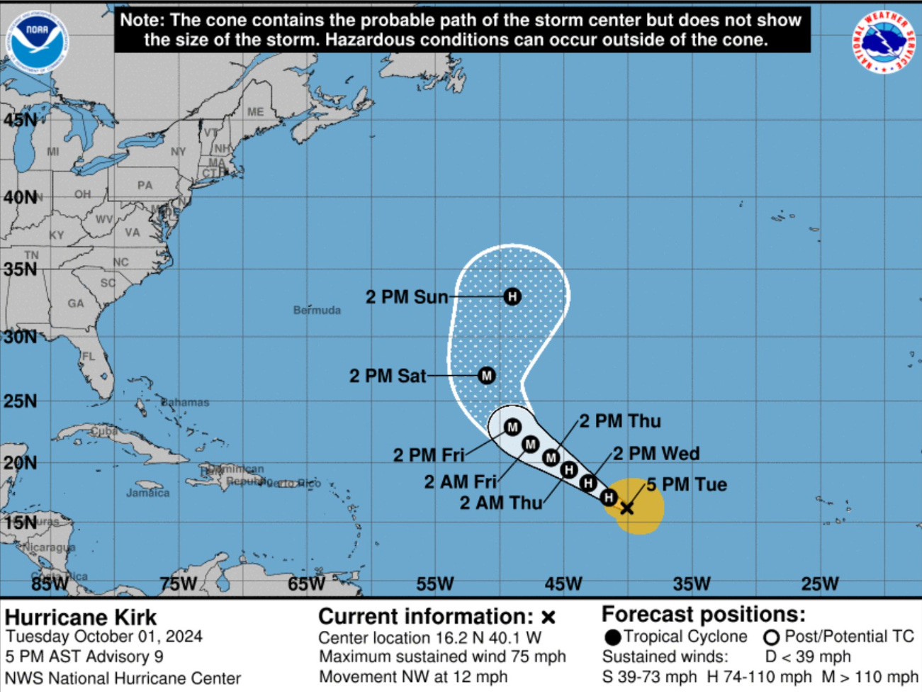
ECMWF Ensemble tracks for Kirk have minimum pressure in the 910s - 930s. Perhaps an outside shot at Category 5?

Next 10-days Upper-Level Pattern | ECMWF AIFS
Keep reading with a 7-day free trial
Subscribe to Weather Trader to keep reading this post and get 7 days of free access to the full post archives.