


November 8, 2023 Afternoon Update
West coast storms early next week to bury California Sierra in snow
A strong ridge of high pressure will develop over the central U.S. and provide wonderfully warm temperatures, well-above average.
The Polar Vortex is bottled up over the Arctic circle but pieces break off out of the Gulf of Alaska and sink down the West Coast bringing chances of heavy rain and snow especially for California during the next 5-15 days. This is a stormy pattern for the West. Depending upon the placement and strength of the ridge, there could be sneaky troughs in the Northeast the middle of next week, but nothing imminent in terms of winter storms.
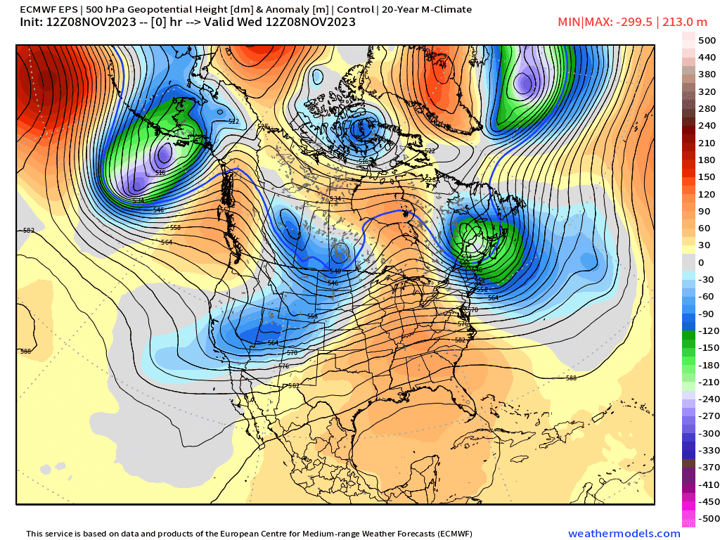
Above Normal Temperatures overall for the next 2-weeks+ across much of Canada and the Lower 48. From the 500 hPa height anomaly animation, we can see troughs sinking from the Gulf of Alaska off the California coast. These are cold-core cut-off lows and will really provide blustery conditions in the Bay Area on some days and heavy mountain snows.
I note troughs in the Northeast that could bring cooler air to NYC and Boston, while the rest of the Lower 48 basks in above-normal warmth.
Week 1: November 8-15 [EPS Control 12z]

Week 2: November 15-22 [EPS Control 12z]

Snowfall over next 15-days
Keep reading with a 7-day free trial
Subscribe to Weather Trader to keep reading this post and get 7 days of free access to the full post archives.