


November 30, 2024 Saturday Weather Update
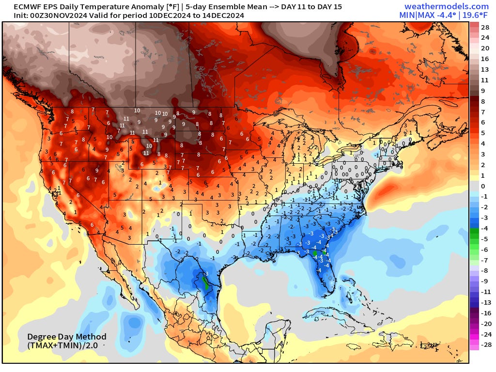
Break in Arctic flow comes in 10 days for the Northeast

Saturday Headlines
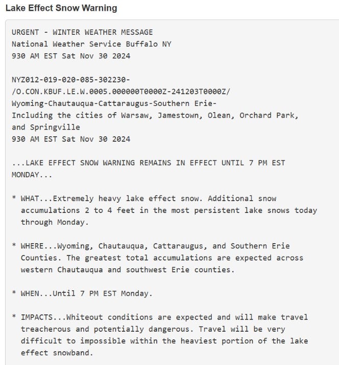
Lake Effect snow machine continues to pile up by the foot along Erie and Ontario with many roads closed and travel impossible. Lake Effect snow warning for 2-4 feet additional snow (Buffalo NWS office)

Cold air behind an Arctic front with strong high pressure settles into the Southeast into next week with cold mornings Mon/Tues/Wed
Break in Arctic air will come in 10-days with relief from the Pacific.
I will have an op-ed in a newspaper published online Sunday [6 AM] with thoughts about U.S. weather forecasting in a second Trump administration.
Current 10% coupon for Annual Subscription [through November 30]. $5/month or $50/year through December 31.
10 AM ET Temperatures across the Lower 48

119 million freezing or colder — average Lower 48 temperature was 28°F
Temperature Anomaly | 10 AM ET

Overall the Lower 48 is -8.5°F (below normal)
Snowfall Forecast Next 24-hours
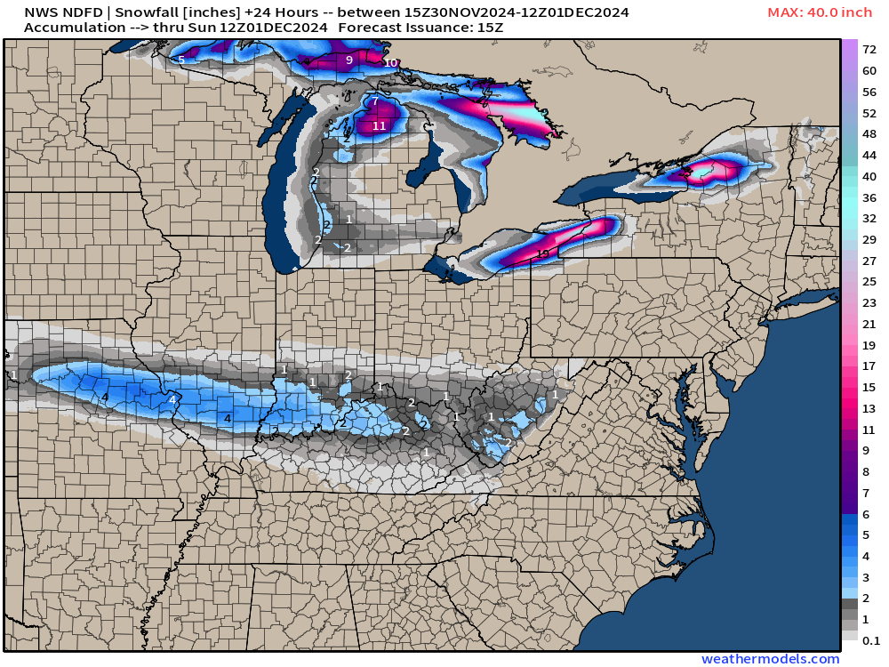
Note the nuisance snowfall from a disturbance heading into the Ohio Valley. 2-4 inches thru Missouri, southern Illinois.
Lake Effect Snow Machine | Next 48-hours | HRRR
A second snowmaker comes out of the Dakotas with some light snowfall into St. Louis by early Monday.
Snowfall Forecast Next 72-hours


San Francisco 49ers at Buffalo Bills (8 PM Sunday)
Sunday afternoon, the Lake Effect snow bands will likely be south of Buffalo through game time, however, a new burst of convective snowfall could arrive from the WNW just past Midnight.

Gusty Winds > 30 mph during the game

Wind Chills 16°-18°F

Upper-Level Pattern | ECMWF 00z | Next 10-days

Animation from ECMWF HRES 00z — evolution of the upper-level height field anomalies. The ridge over the Western U.S. finally breaks down and moves east to replace the persistent troughs across the Northeast.
Note, a small cut-off low is drifting into Mexico and may be quite impactful for Texas bringing Gulf of Mexico moisture into the state by next weekend.
Next 7-days Precipitation Type | ECMWF 00z
A clipper system later next week could phase with intense mid-level trough over New England to bomb out into Canada. The broad wind field around this powerful low (969 mb) will reinforce the cold air into the Great Lakes and Northeast/Mid-Atlantic into next weekend.
To continue supporting Weather Trader into the Winter 2024-25, please consider subscribing or upgrading to an annual commitment with 10% off incentive through November 30.
High Temperatures on Saturday

High Temperatures on Sunday

Low Temperatures on Monday

Low Temperatures on Tuesday

Snowfall Forecasts
10-day Ensemble Median Snowfall | Lake Effect!
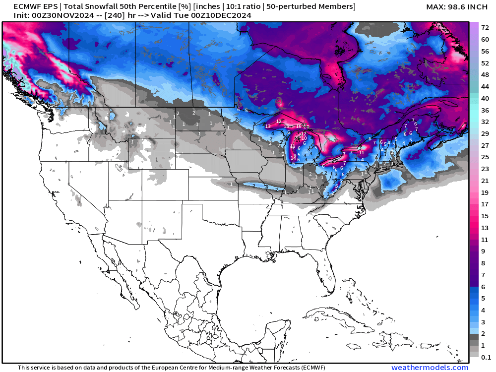
No snow to speak of across the Western U.S. through 15-days except for the northern Rockies, but very little. The only snow show in town at this point is the Lake Effect.
15-day Ensemble % chance of at least 6-inches of snowfall

No significant signal for a winter storm or Nor’easter through December 15.
Blend of Models — 7 day snowfall totals

Total Precipitation next 7-Days | NOAA WPC

Total Precipitation Next 10-Days | ECMWF 00z EPS Median

California is dry (!) for next 10-days.
EPS 00z | 5-Day Chunk Temperature Anomaly
Days 1-5: November 30 - December 4
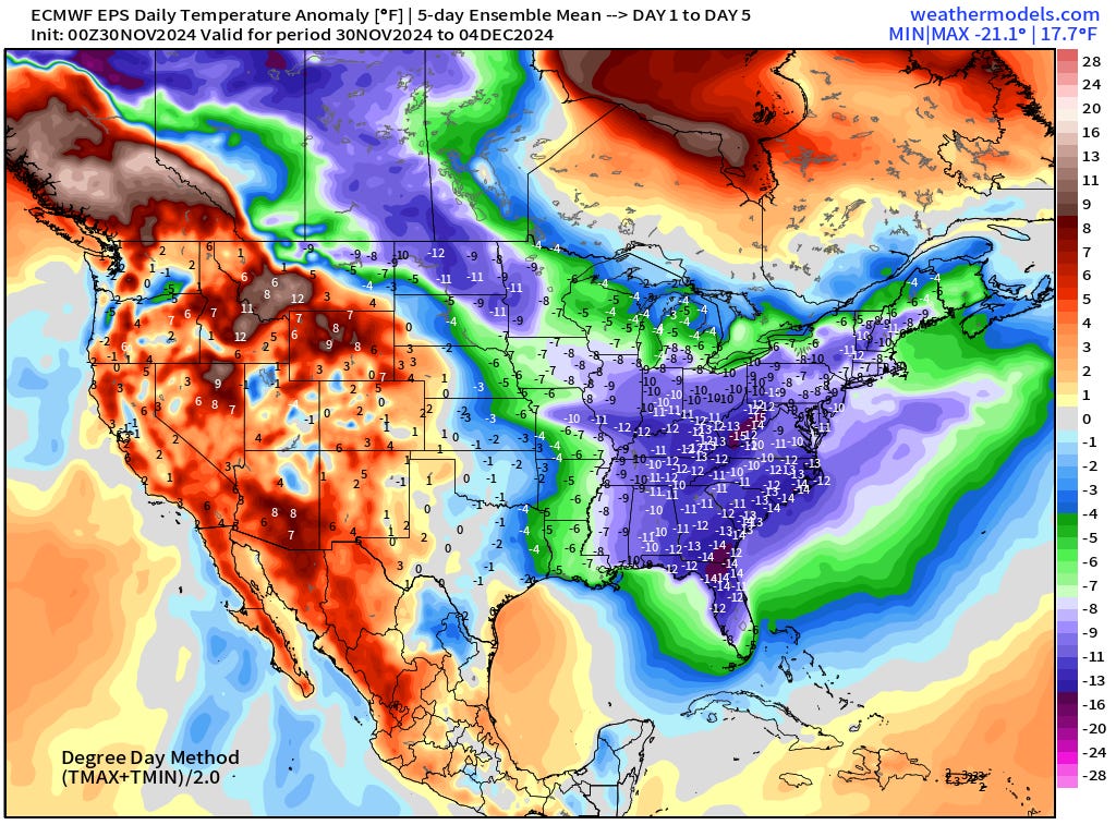
Very impressive 5-day average temperature anomaly!
Days 6-10: December 5 - December 9

Days 11-15: December 10 - December 14
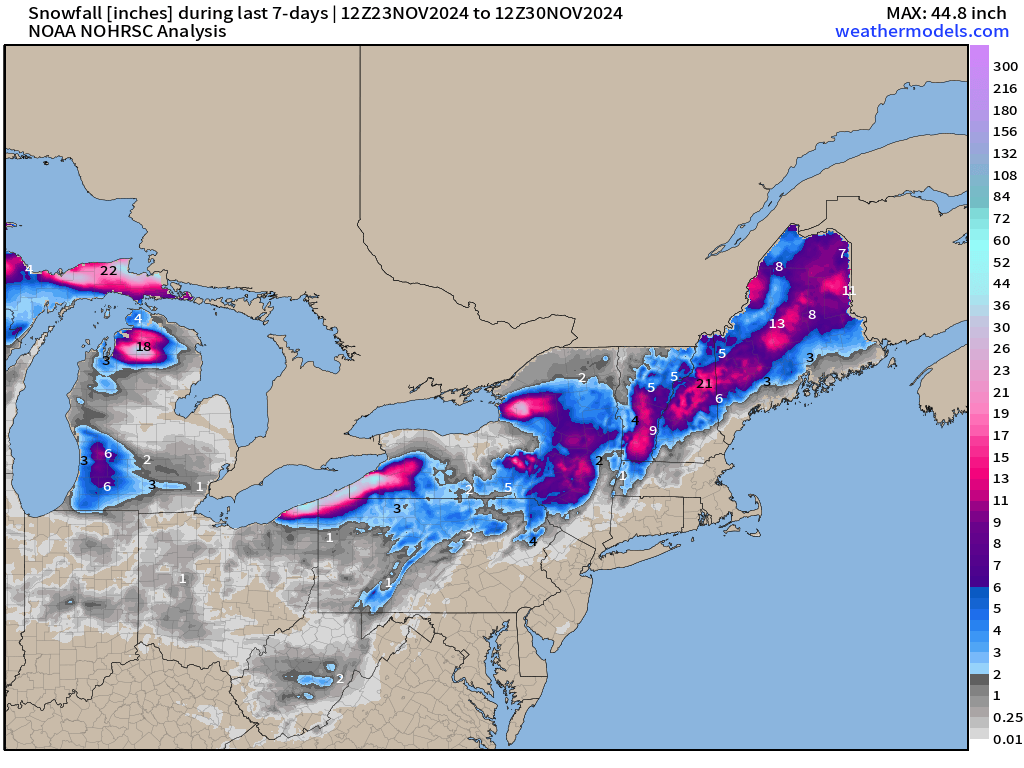
Snowfall Analysis | October 1, 2024 — today

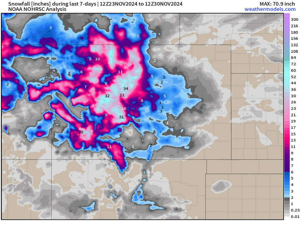
Snowfall Last 7-Days

Maps sourced from weathermodels.com designed and innovated by yours truly! I actually create all of my content from scratch.
Apple pay won't let me renew with the incentive bc I have current subscription... thoughts. Should I just cancel and resubscribe??