


November 3, 2023 Weekend Outlook
Warming temperatures into weekend
The Arctic airmass has broken its grip on the Lower 48 except for North Dakota and northern Minnesota. Warm Pacific origin air will continue to surge across the Rockies with moderate atmospheric river events dumping considerable (mostly) rain across the drought affected Pacific Northwest. Temperatures will continue to warm across the board leading to a really nice weekend for vast majority of Americans.

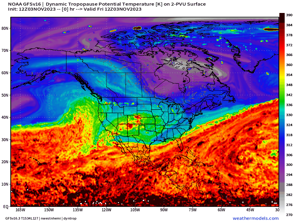
Another favorite parameter from weather models is “dynamic tropopause” potential temperature. This is a way of showing the upper-level features mainly at the jet stream level and how they are evolving and interacting.
Over the Canadian Arctic, the purple/gray/white colors represent the polar air mass north of the jet stream. The most severe cold outbreaks are associated with anomalies on the dynamic tropopause that are associated with troughs or cut-off lows that extend to near the surface e.g. 850 hPa temperature cold pools. Usually behind these troughs are strong Arctic high pressure cells or ridges that lead to extreme cold.
The red colors are associated with the subtropical and tropical air masses. Thankfully, we have an anticyclonic ridge on the tropopause arriving from the Pacific which will keep the colder Arctic air bottled up over Canada for the next 7-days.
Keep reading with a 7-day free trial
Subscribe to Weather Trader to keep reading this post and get 7 days of free access to the full post archives.