


November 26, 2024 Tuesday Winter Weather Update
Long lasting Arctic blast will pile up Lake Effect snowfall by the foot in Great Lakes

Tuesday Headlines
Thanksgiving travel trouble with a storm in the Ohio Valley on Thursday heading into New England into Friday.
Well below normal temperatures from a persistent cold pattern [2-weeks+] with multiple Arctic blasts east of the Rockies — through the first week of December will ramp up Lake Effect snow machine.
Current 10% coupon for Annual Subscription [through November 30]. $5/month or $50/year through December 31.
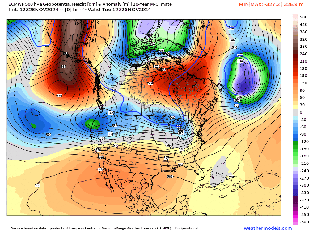
ECMWF 12z showed a very intense reinforcing shot of cold air with a trough out of eastern Canada with the overall Pacific/Western U.S. ridge shifted slightly east. Still uncertainty about the anchor point of the tropospheric polar vortex over Hudson Bay.
Next 8-Days Weather Precipitation Type | ECMWF 12z

No other storms on the horizon in the next 8-10 days after the upcoming Nor’easter.
Into Black Friday: Low Pressure 986 mb in the Gulf of Maine

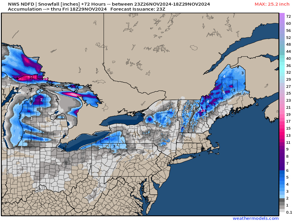
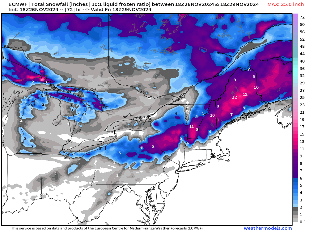
NWS is not buying the heavier snowfall as shown by ECMWF 18z. We’ll see if the totals are adjusted upward in New York.
NWS 3-day Snowfall
ECMWF 18z Snowfall Total | Next 3-days
To continue supporting Weather Trader into the Winter 2024-25, please consider subscribing or upgrading to an annual commitment with 10% off incentive through November 30.
Keep reading with a 7-day free trial
Subscribe to Weather Trader to keep reading this post and get 7 days of free access to the full post archives.