


November 25, 2024 Monday Winter Weather Update
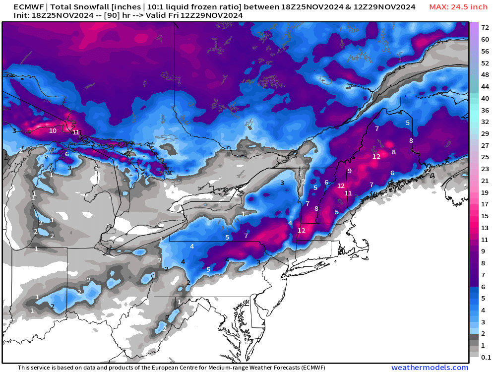
New England snowfall on Thanksgiving followed by Arctic blast and mountains of Lake Effect

Monday Headlines
Thanksgiving travel trouble with a storm in the Ohio Valley on Thursday heading into New England into Friday with 6-12 inches of snow away from the coast.
Well below normal temperatures from a persistent cold pattern with multiple Arctic blasts east of the Rockies — through the first week of December.
Current 10% coupon for Annual Subscription [through November 30]. $5/month or $50/year through December 31.
ECMWF 12z 15-day simulation shows the battle between the Pacific warmth / ridging and northwesterly flow straight out of the Arctic.
A series of troughs keep dragging cold air out of Canada and Alaska until it’s all gone.
Powerful storm systems in the North Pacific push warm and moist air in the Arctic especially into Alaska helping to dislodge any cold air pools.

Next 8-Days Weather Precipitation Type | ECMWF 12z
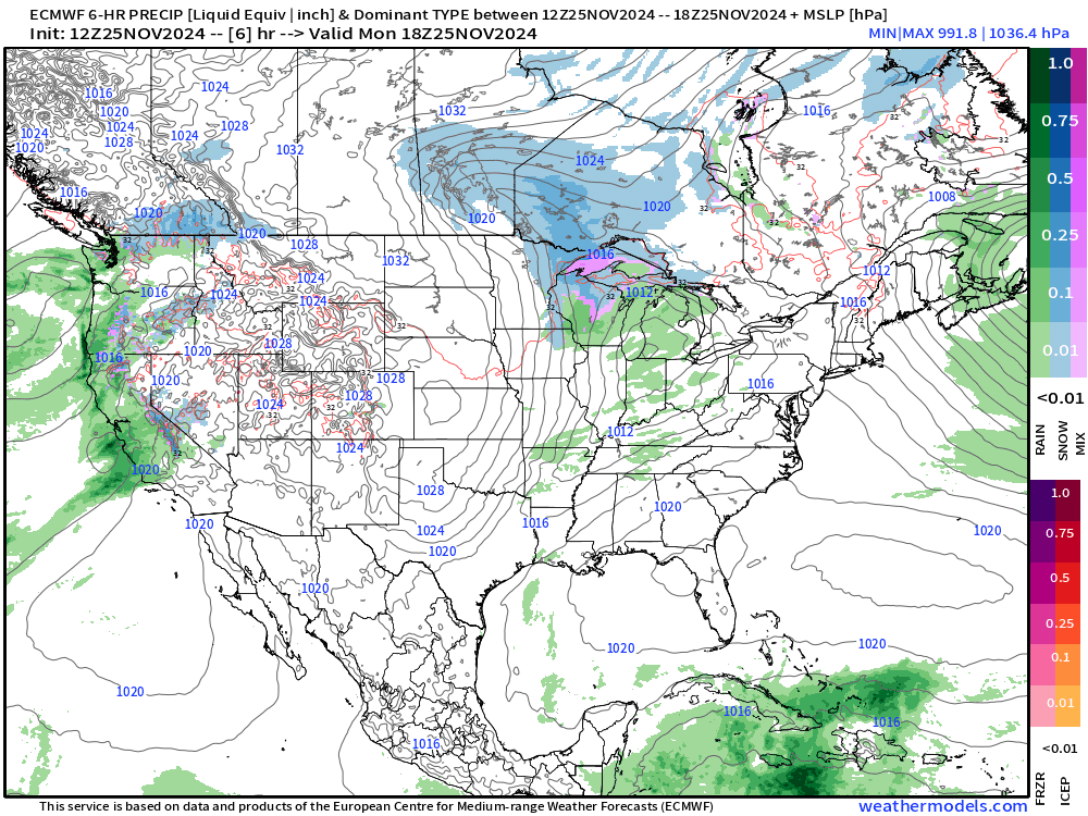
The Canadian high pressure builds into the southeast into early next week for the first major freeze event into North Florida.
Into Black Friday: Low Pressure 985 mb in the Gulf of Maine
Then, the Lake Effect Snow Machine cranks up the dial to maximum.
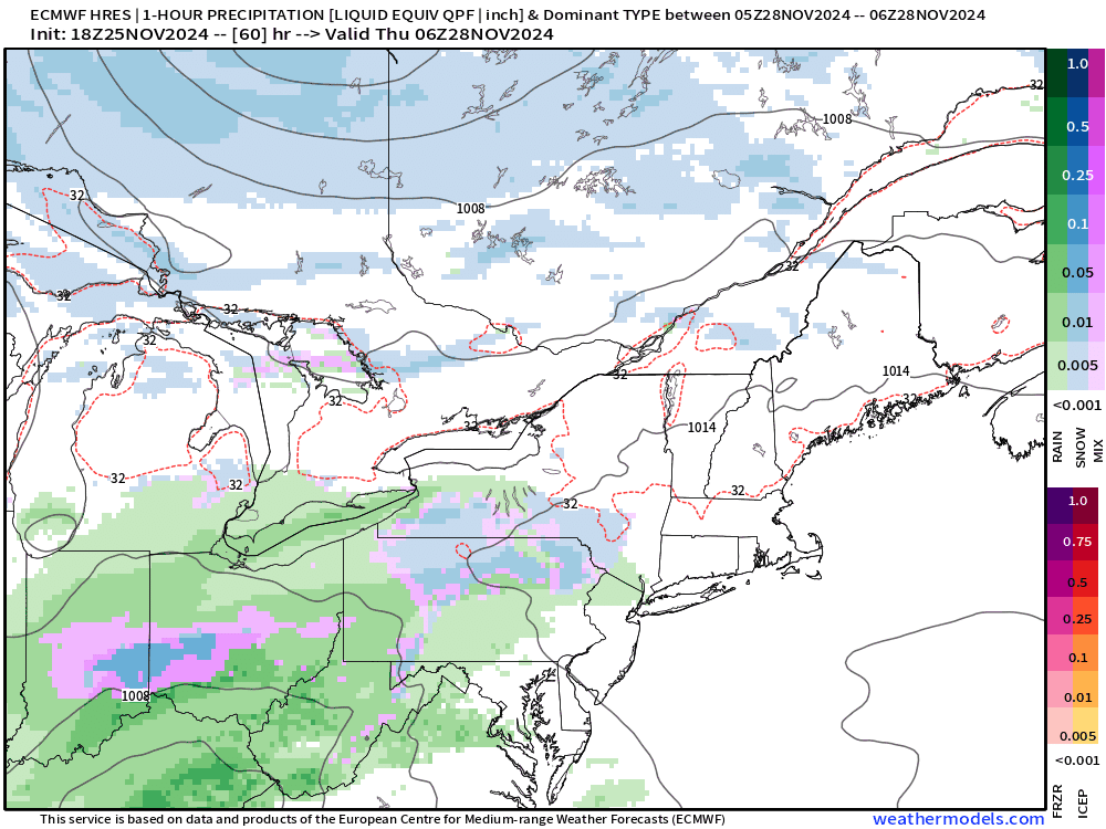
System snow of 6-12” in a band from PA into Maine by Friday morning.
To continue supporting Weather Trader into the Winter 2024-25, please consider subscribing or upgrading to an annual commitment with 10% off incentive through November 30.
Keep reading with a 7-day free trial
Subscribe to Weather Trader to keep reading this post and get 7 days of free access to the full post archives.