


November 21, 2023 Tuesday afternoon
Quiet weather for Thanksgiving after frontal system departs East Coast
Good news for Thanksgiving from coast to coast: quiet weather and seasonable temperatures for last week of November. Highs in the 40s and 50s in New England and Ohio Valley. 50s and 60s from Texas into northern Florida and the Carolinas. That’s a little chilly but should be sunny. Cold in the upper-Midwest only in the 20s.
If you want 80s, then join about 5 million other folks in South Florida.


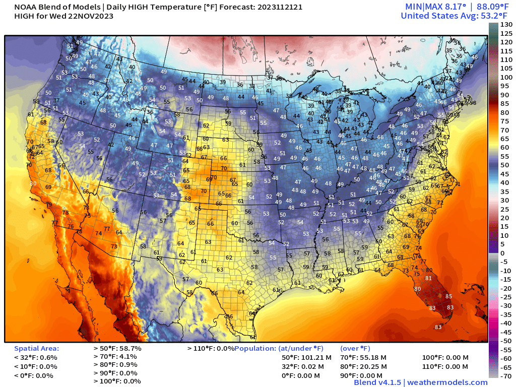
Wednesday’s High Temperatures and Significant Weather
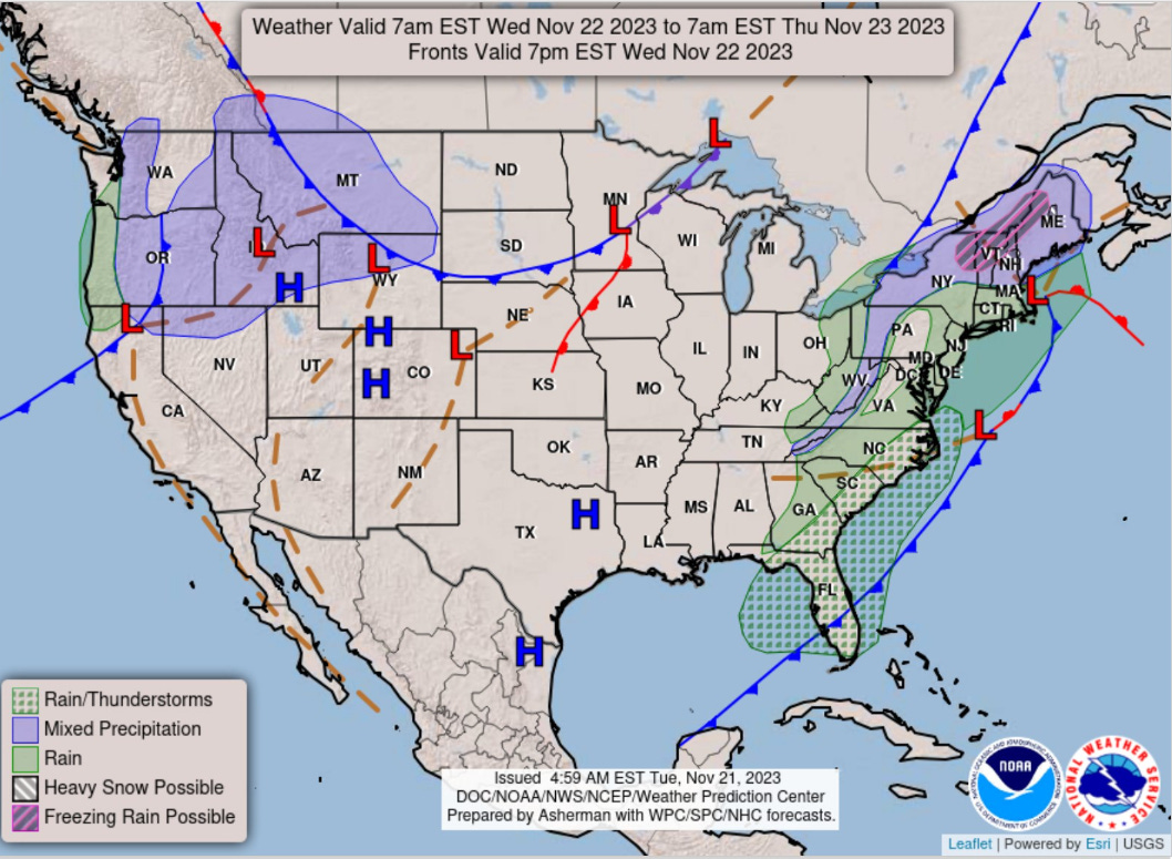
A coastal low develops off the New England coast but does not rapidly develop. The result is steady rain until later on Wednesday with snowfall in northern VT, NH, and Maine. Might see more than a foot in central Maine. No snow along the coast.

Nice and warm in the Plains into the 60s in Denver. The chilly air behind the front will drop highs into the 50s and lower 60s to the Gulf Coast.
Week 1 and Week 2 Temperature Anomaly
Cooler than normal temperatures across the Lower 48 with significant relative warmth over Alaska and Arctic Canada into the first week of December.
Week 1: November 21-28 [EPS Mean 12z]

Week 2: November 28-December 5[EPS Mean 12z]

15-day Total Snowfall 51-member EPS ensembles [median] and Probability of 3-inches of snowfall

The Ensemble Median through 15-days into the first week of December shows Rocky Mountain snowfall — great for the ski resorts. Another chance of snowfall for the Northeast early next week is reflected in the higher numbers across New England, but again, the major cities look left out. As colder air crosses the Great Lakes, certainly a chance of Lake Effect snowfall. However, not seeing any organized Winter Storms or blizzards on the horizon.

7-Day Precipitation Outlook

The precipitation from the ongoing frontal system will dump 1.5-2.5 inches across I-95 corridor including Washington D.C. and NYC over the next 24-48 hours.
New storm system gathers in the Rockies with snowfall.

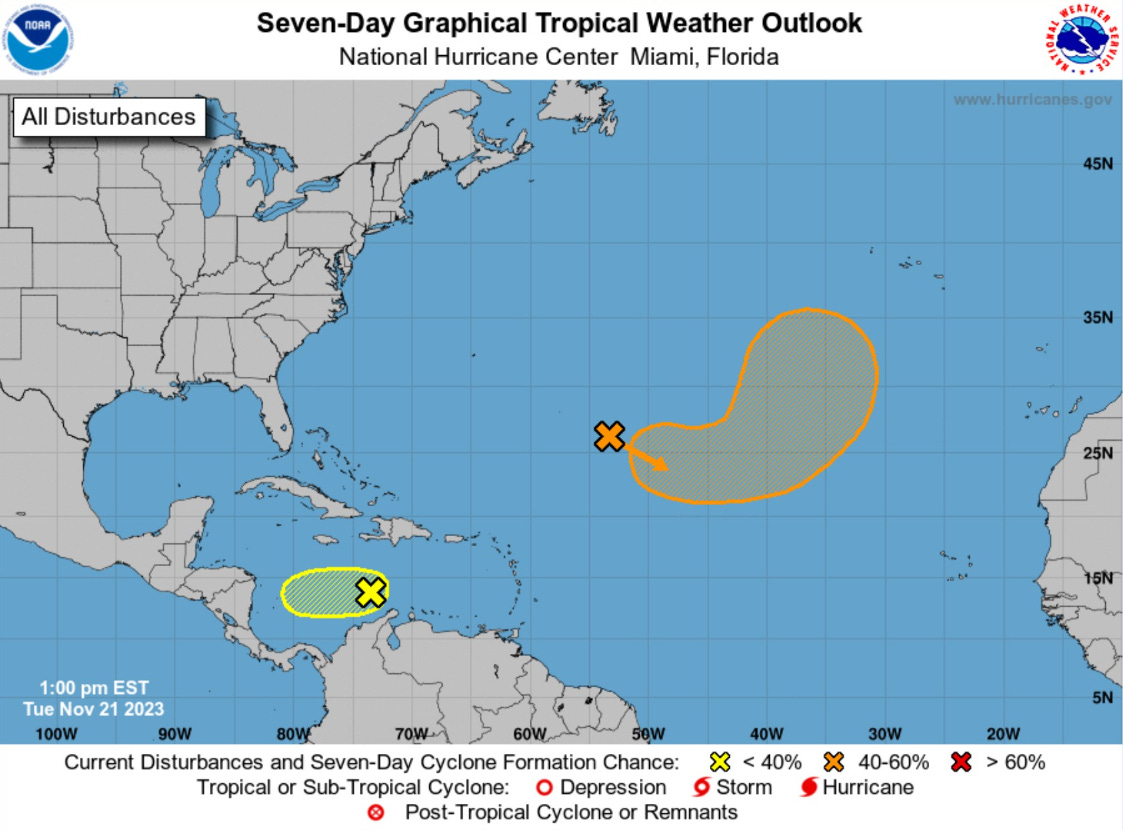
2023 Atlantic Hurricane Season | Medium Range Outlook
The area of interest in the far southern Caribbean is only at 10% and unlikely to develop further. However, the orange hatched area is up to 60% for subtropical storm development in the next several days. Vince is the next name on the list.
The system will have a brief window to detach from frontal boundaries but central pressure should remain rather high. Not much to get excited about.

2023 Eastern & Western Pacific and Northern Indian Ocean
ECMWF model generates a tropical storm in the Eastern Pacific by this weekend. NHC currently has a 20% chance of development. No threat to land.
In the 7-10 days range, a tropical system could track WNW across the Bay of Bengal into India by early December.
2023-24 South Pacific Cyclone Season
Unusually quiet. It’s Hurricane Season in the Southern Hemisphere!
Thank you to my paying subscribers! Your support pays for my Linux servers and product development. Also, it allows me to provide unfiltered commentary on scientific topics on X. Feel free to say hello and follow on X/Twitter (@RyanMaue)