


November 19, 2024 Tuesday Winter Weather Update
Significant snow potential from eastern Great Lakes storm into Friday

Tuesday Headlines
Tuesday — Wednesday: Very intense “bomb cyclone” over the Pacific off the Northwest US coast with pressure falling into the low-940s. A secondary rapidly developing extratropical cyclone will follow on a similar track.
Thursday — Friday: large circulation over Great Lakes with multiple low centers will work with enough cold air for potential heavy, wet snowfall across the Ohio Valley into Pennsylvania and New York.
Very intense “bomb cyclone” 12-hours from minimum pressure
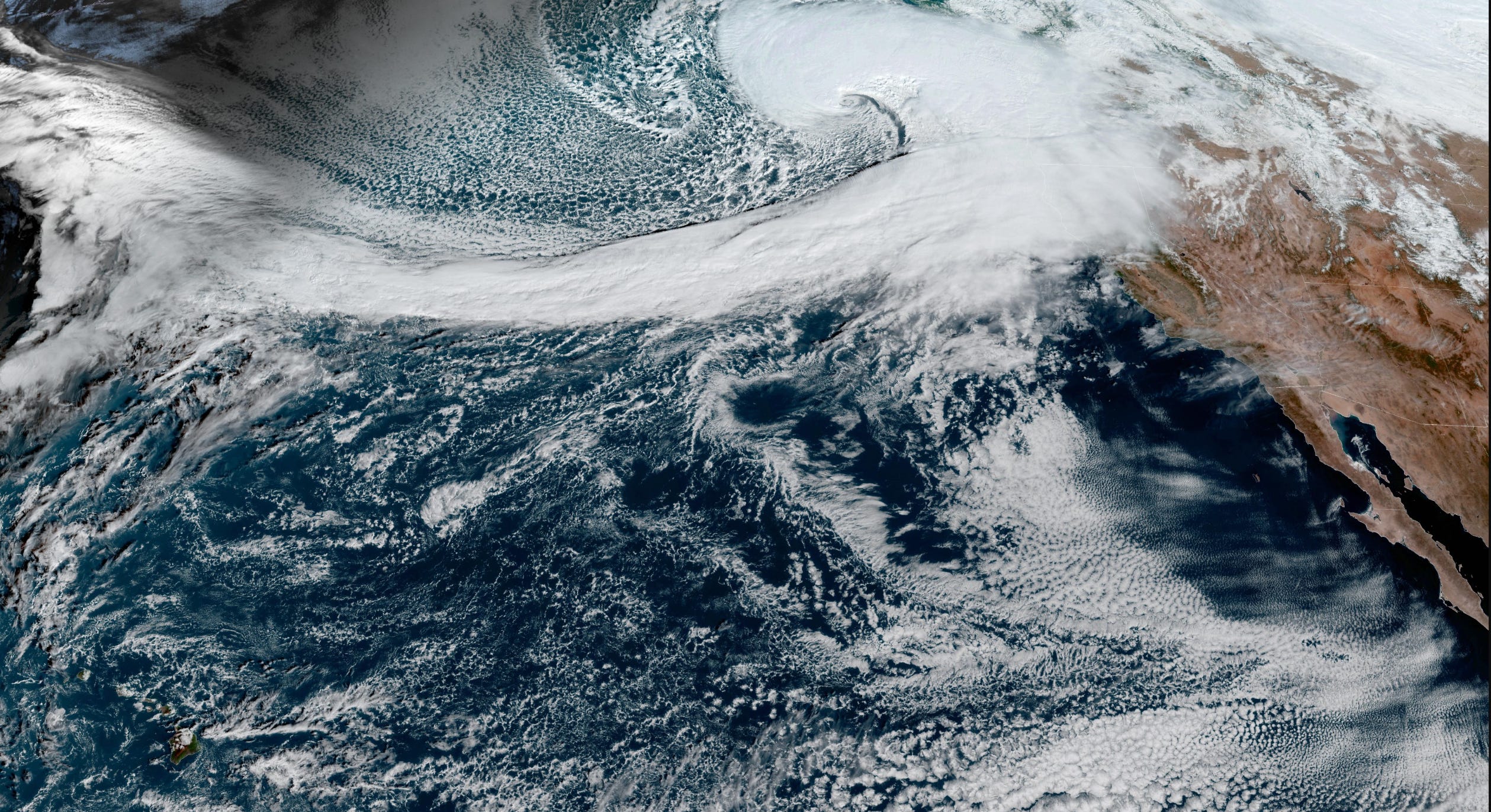
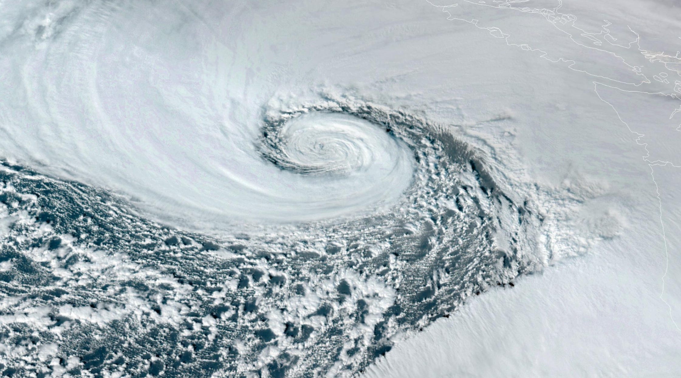
Satellite imagery earlier today showed the T-bone phase of the Shapiro-Keyser cyclone lifecycle (my dissertation topic at FSU!) into a mature “warm core seclusion” that looks like an encircled major hurricane. The dynamics are incredible with these storms with hurricane force winds on the southern/equatorward flank of the “bent-back warm front” which encircles air trapped ahead of the cold front.
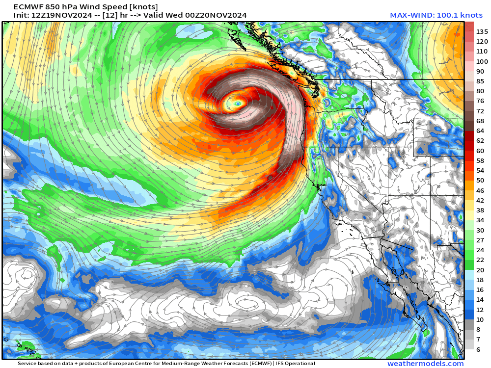
850 mb winds show that chevron shaped wind field along the southern half of the low center — where the “sting jet” would be found with the downward momentum forced by the tropopause fold above. Lots of jargon!
The precipitable water and Integrated Vapor Transport highlight the intense atmospheric river — associated with the feed of moisture out of the subtropics.


Central pressure minimum of 944 mb from ECMWF 18z in a few hours … we’ll see if there’s NOAA OPC analysis that catches the minimum.

Tuesday Evening Across the Lower 48

The western U.S. is much colder than normal heading into the late evening.

To continue supporting Weather Trader into the Winter 2024-25, please consider subscribing or upgrading to an annual commitment with 10% off incentive through November 30.
HRRR | Radar Simulation through Wednesday 11 AM ET
Keep reading with a 7-day free trial
Subscribe to Weather Trader to keep reading this post and get 7 days of free access to the full post archives.