


November 18, 2024 Monday Winter Weather Update
Multiple powerful storms this week

Monday Headlines
Today: Classic mountain lee low pressure moves north into the Plains with central pressure in the 980s mb w/heavy rain and chance of severe weather in Texas.
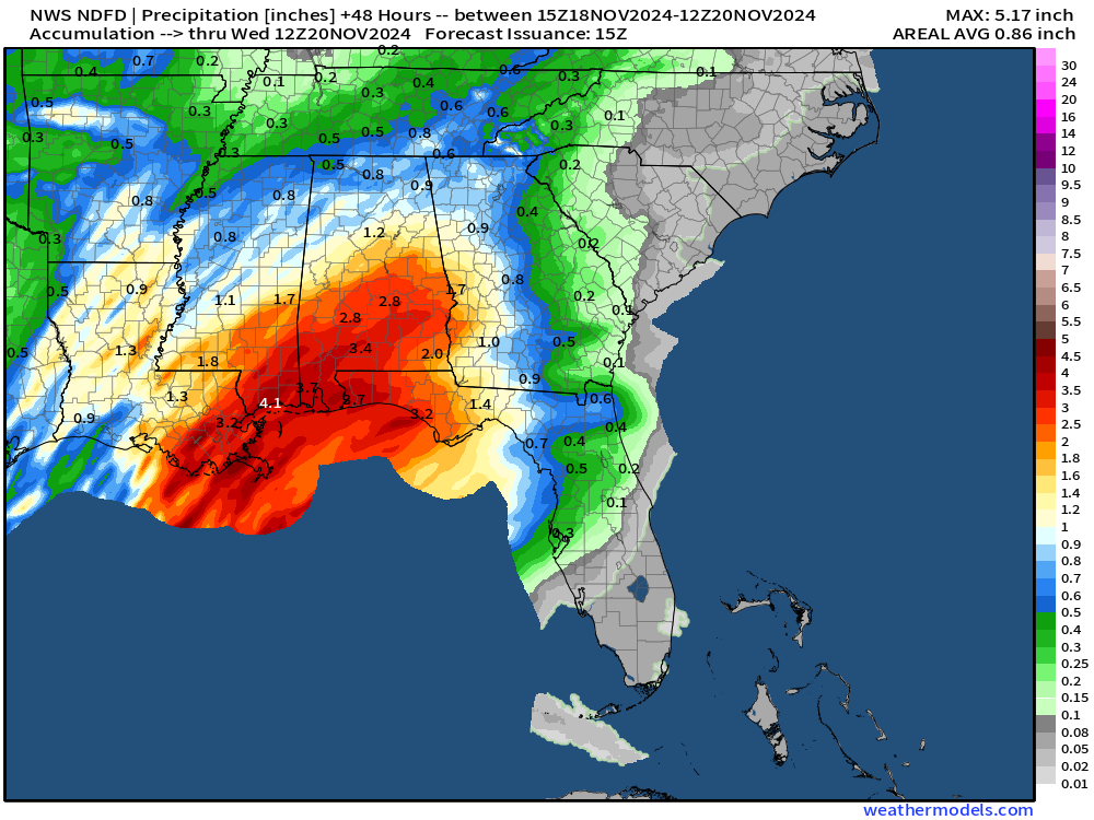
Into Tuesday: Heavy Gulf Coast and Southeast Rainfall from rich, tropical moisture feed out of Gulf of Mexico.
Tuesday — Wednesday: Very intense “bomb cyclone” develops over Pacific off the Northwest US coast with pressure falling from 1010 mb to 943 mb in 24-hours = 67 mb/24 hrs. Intense atmospheric river and heavy precipitation (rain, mountain snow) totals across the Pac NW.
Thursday — Friday: shortwave out of the Lee of the Rockies (Colorado) combines with energy left over from Plains storm —> develops into yet another powerful winter storm [984 mb] over the eastern Great Lakes. Significant snowfall chance over a small area on the southern side of the low pressure center.
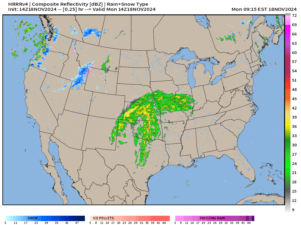
Monday morning across the Lower 48

Powerful storm system ramping up across the central Plains with pressure already falling into the 980s.

Very warm, moist tropical air ahead of the storm system, but not enough cold air on the back side of the low to induce heavy snowfall. This storm system is all rain!
To continue supporting Weather Trader into the Winter 2024-25, please consider subscribing or upgrading to an annual commitment with 10% off incentive through November 30.
Radar Simulation through early Tuesday
Monday evening front positions

West Coast Bomb Cyclone | Tuesday
This is a historical “bomb cyclone” with 67 mb / 24 hour pressure fall with deepest barometric pressure at 946 mb. An intense atmospheric river associated with the cold front will smash into the West Coast mainly Washington and Oregon.
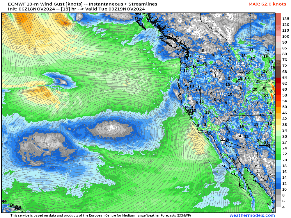


Note there isn’t cold enough air behind the storm system to trigger heavy ocean snowfall. It’s a bit early in the cold/winter season to get thick layer cold air from Alaska/Arctic to maintain its intensity over the still rather warm waters of the NE Pacific.

Impressive wind gusts well in excess of Hurricane Force by late Tuesday into early Wednesday, which may impact the coast at higher elevations.
Great Lakes Winter Storm
Precipitation Type Wed-Thurs | ECMWF 06z HRES

Forecast snowfall from ECMWF 06z
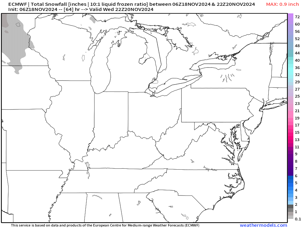
Potential for quite heavy snowfall over areas with high population including Detroit and Cleveland. Might see some jackpot amounts!
6-Day Precipitation Type Forecast | ECMWF 06z

Tuesday morning
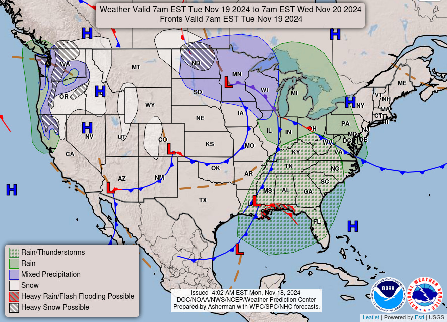
Quite a plume of tropical moisture out of the Gulf of Mexico!

Precipitation through Wednesday morning
ECMWF 06z AIFS | Next 10-days | Height Anomaly

Always cool animation of the upper-level height pattern at 500 mb (anomaly) showing the evolution of troughs across North America
The Eastern U.S. trough is intense with marginal cold air behind it. This brief Arctic blast will quickly abate as the hemisphere remains very warm relative to normal. Still a ways to go before Arctic air builds to the point where the entire Lower 48 is threatened with a “deep freeze”.
High Temperatures on Monday

Low Temperatures on Tuesday

High Temperatures on Tuesday

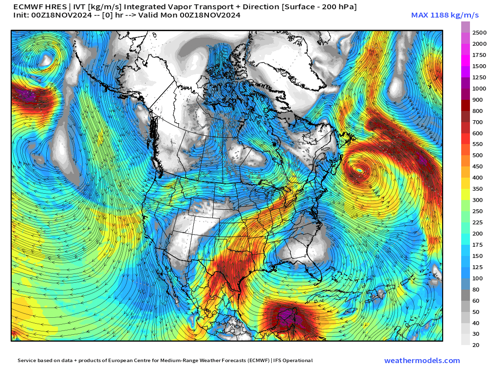
Larger View of Integrated Vapor Transport | Next 8-days
Snowfall Forecasts
ECMWF 00z | 7-day Ensemble Median Snowfall

Good chances of at least 1-inch of snowfall across the eastern Great Lakes into the Appalachians of WV.

Probability of 3-inches or more is in the 40-60% range across northern Ohio.

NOAA Blend of Models 7-day Snowfall Accumulation
Quick peek at the Blend of Models showing the “ensemble” smoothing with significantly less extreme snowfall amounts across the eastern Great Lakes. This tool is of limited use for longer-range snowfall amounts unless you use the range of values like with the ECMWF EPS e.g. median or 25%-75% percentile range (more on that this week).

Total Precipitation next 7-Days | NOAA WPC


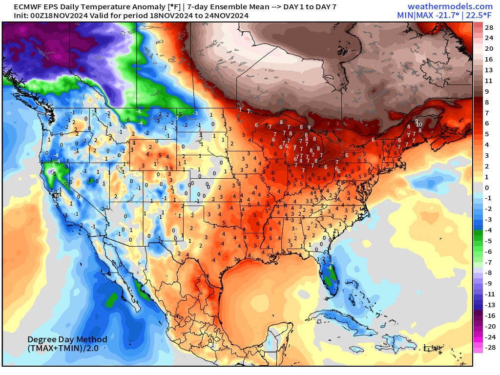
EPS | Weekly Temperature Anomaly
Week 1: November 18 - November 24
Week 2: November 25 - December 01

Quite a load of cold air building over Western Canada with persistent pattern of warmth across the Eastern U.S.
Snowfall Analysis | October 1, 2024 — today

Precipitation Analysis Last 30-days [inches]

Quick trip to Europe!
Significant winter weather — cold air and snowfall for our friends across the pond.
ICON EU model temperature anomaly Thursday morning (06z)

Total snowfall next 7.5-days! More arrives after this juncture, too.

Maps sourced from weathermodels.com designed and innovated by yours truly! I actually create all of my content from scratch.
Heading to Missouri the first weekend of december for duck hunting, would really like to see that cold air get released into the lower 48 to push some duck movement.
We're in for tough conditions here in the PNW.