


November 16, 2024 Saturday Weather Update
Stormy weather pattern for Lower 48 during next week

Saturday Headlines
Plains storm system deepens in the 980s mb w/heavy rain and chance of severe weather in Texas on Monday.
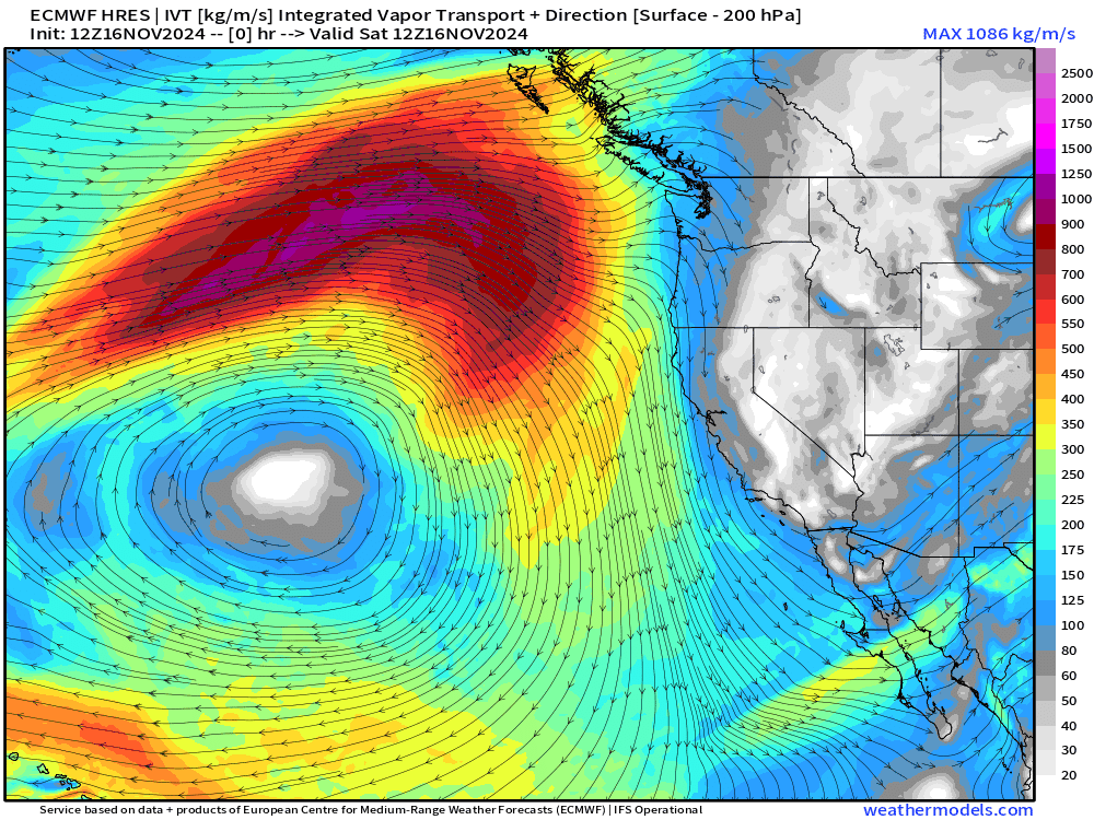
Tuesday — Wednesday: Very intense “bomb cyclone” develops over Pacific off the Northwest US coast with pressure falling from 1010 mb to 946 mb in 24-hours = 64 mb/24 hrs. Whoa! Intense atmospheric river and enormous precipitation (rain, mountain snow) totals across the Pac NW.
Thursday — Friday: shortwave out of the Lee of the Rockies (Colorado) combines with energy left over from Plains storm —> develops into yet another powerful winter storm over the eastern Great Lakes. Significant snowfall chance over a small area on the southern side of the low pressure center, perhaps in Indiana, Ohio, Michigan.
West Coast Bomb Cyclone | Tuesday
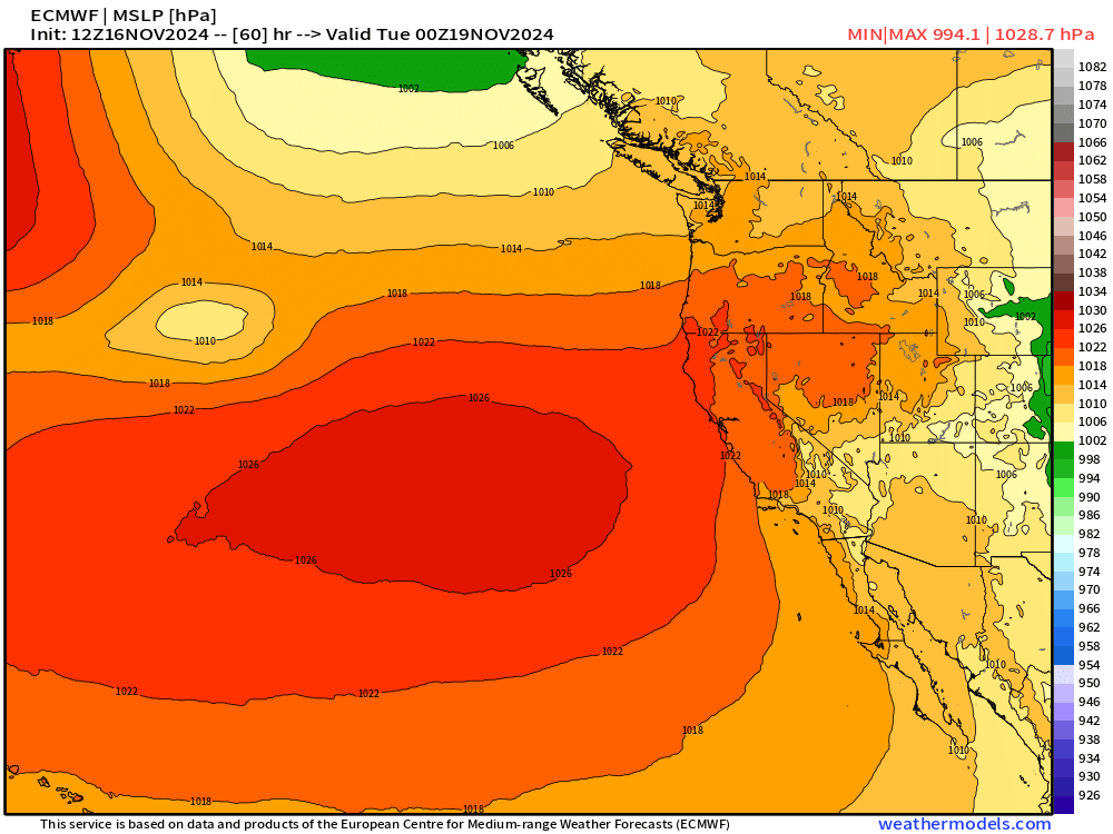
This is a historical “bomb cyclone” with 64 mb / 24 hour pressure fall with deepest barometric pressure at 946 mb. An intense atmospheric river associated with the cold front will smash into the West Coast mainly Washington and Oregon.

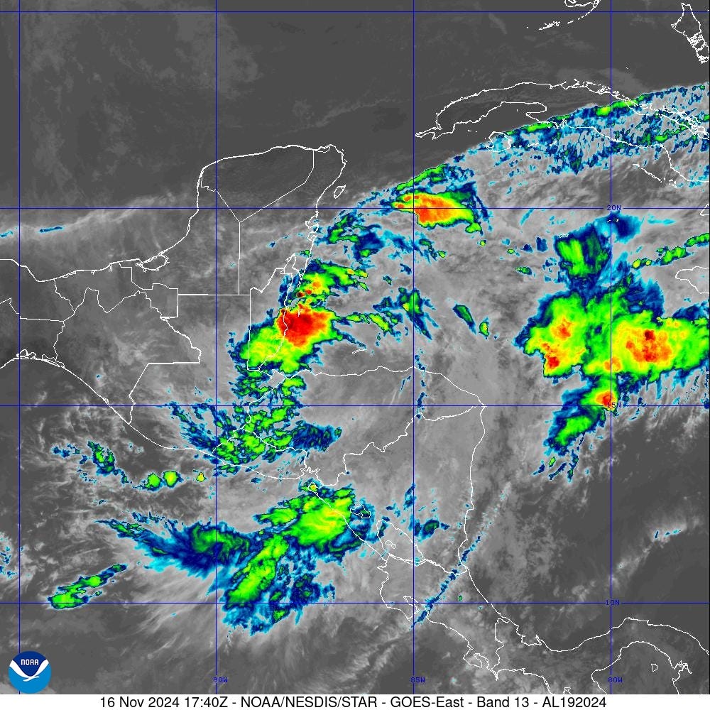
Tropical Storm Sara [19L]
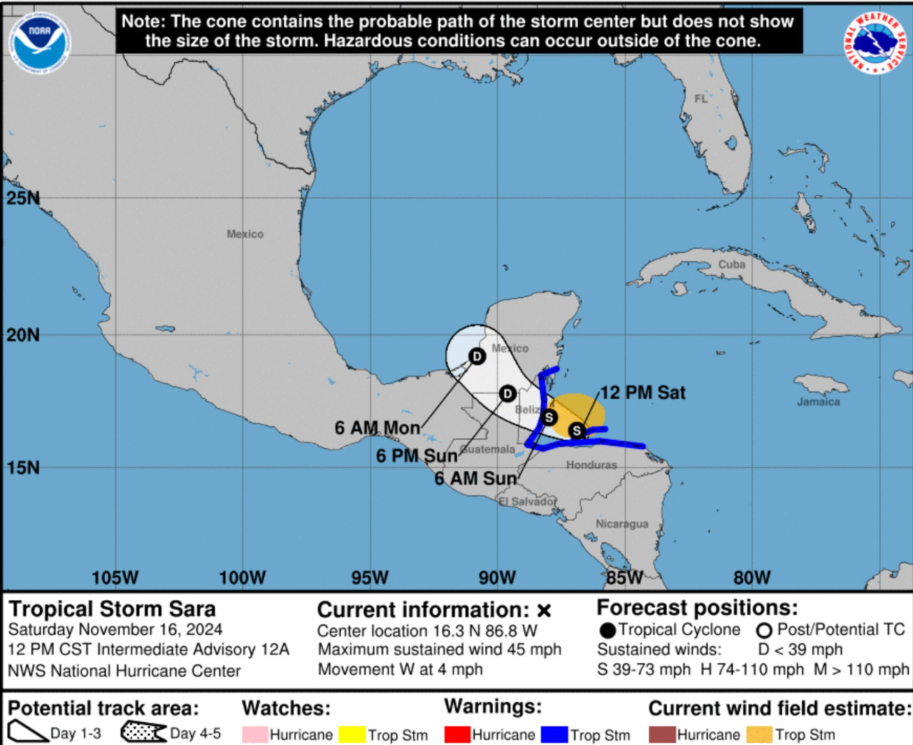
Tropical Storm Sara is still centered over the ocean just north of the coast of Honduras but is not well organized. Convection has waned significantly due to land impacts. Maximum sustained winds are 45 mph. Landfall in Belize is forecast around sunrise on Sunday in Belize. The primary threat with Sara continues to be extreme rainfall leading to flooding and mudslides.
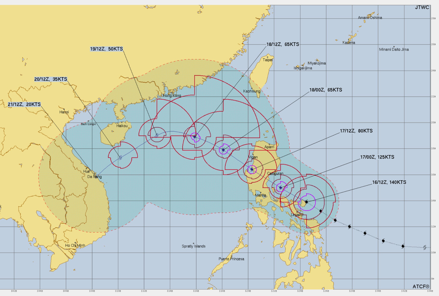
Super Typhoon Man-yi [25W]
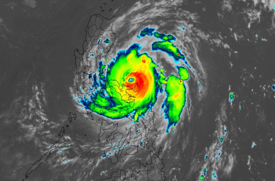
STY Man-yi intensified to 140-knots Category 5 overnight and made landfall over Catanduanes Island, which disrupted the eye, and knocked down the intensity to 115-125 knots. The next stop for Man-yi is Luzon with yet another Philippines landfall of a typhoon — 4th in 2-weeks.
Upcoming Winter Storms
Sunday’s Weather
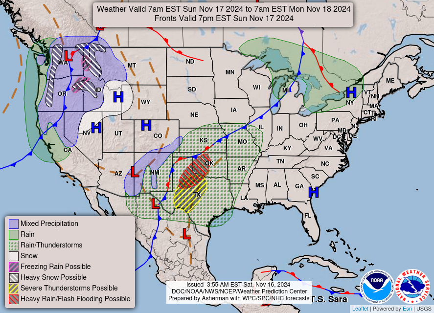
Sunday’s weather looks quite exciting over Texas as a powerful storm develops and heads into the Central Plains and then into the Midwest. Chance of severe weather and heavy rain in Texas and Oklahoma on Sunday.
7-Day Precipitation Type Forecast | ECMWF 12z

Looking to next Thursday across the Great Lakes and Ohio River Valley for a winter storm that will have a brief burst of heavy snow on the southern side of the low. The air over Canada to the north is too warm for snowfall, so only the dynamics associated with the strong cyclonic circulation and complex conveyor belts can yield the necessary cooling for heavy snowfall — system snow.
Quick animation of the extended intense atmospheric river next week across the West Coast | IVT next 7-days
ECMWF 12z HRES | Next 10-days | Height Anomaly
Keep reading with a 7-day free trial
Subscribe to Weather Trader to keep reading this post and get 7 days of free access to the full post archives.