


November 15, 2024 Friday Weather Update
Arctic blast on the way next week for Eastern US

The weather pattern over North America for the past several weeks has featured troughing across the Western U.S. with southerly flow east of the Rockies. That has sustained ridging but also cut-off moisture flow from the Gulf of Mexico to induce storminess. The result has been extremely dry conditions for the past 30-60 days especially in the Mid-Atlantic and Northeast. Some relief has arrived but will take significant rain/snow to overcome the deep deficits.
GFS 12z this afternoon has something different. We see a lobe of the tropospheric polar vortex able to break out of the Canadian Arctic and blast much colder air pooled over Alaska into the Lower 48. However, abnormal warmth still remains locked over Hudson Bay that must be chilled before we can sustained winter weather e.g. Lake Effect snow and winter storms — since the backside of the low pressure systems actually pulls down rather warm (above freezing) air.
Toward the end of next week, the upper-level pattern finally flips — briefly perhaps — with ridging across the west and much cooler conditions across the east.

Snowfall Analysis | October 1, 2024 — today

Precipitation Analysis Last 30-days [% of normal]

We see % of normal on maps, but how does that translate to a deficit w/inches?
Precipitation Analysis Last 30-days [inches]

3 to 5 inches of rainfall during the past month was missed — on average compared to last 30-years.
Precipitation Analysis Last 60-days [inches]

Extending that out to 60-days shows even more significant deficits approaching 7-9 inches across New England.
Tropical Storm Sara
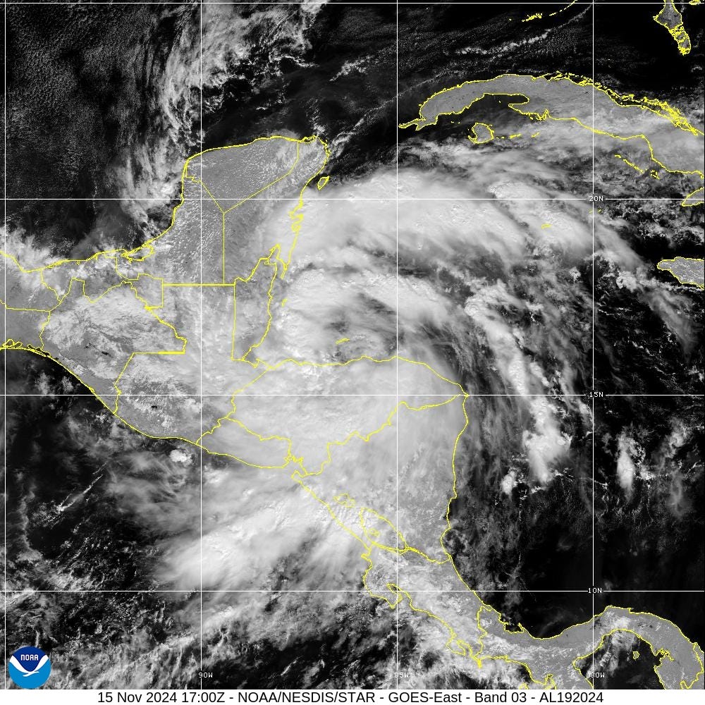
Sara remains a 50 mph tropical storm drenching the coast of Honduras and into Belize. It is forecast to move into the Yucatan with landfall in Belize on Sunday morning. Thereafter it will dissipate over land.
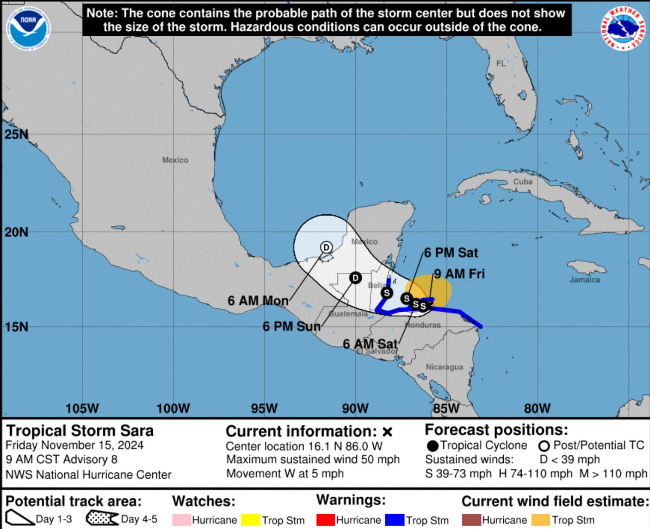
ATCF Track of Tropical Storm Sara

Some of global and mesoscale models may still have a vorticity center or area of low pressure that can be tracked across the Gulf of Mexico. However, Sara is not expected to have the organization necessary to be a named tropical cyclone.
Next Week’s Winter Storms
Keep reading with a 7-day free trial
Subscribe to Weather Trader to keep reading this post and get 7 days of free access to the full post archives.