


November 15, 2023 Afternoon Update
South Florida inundation
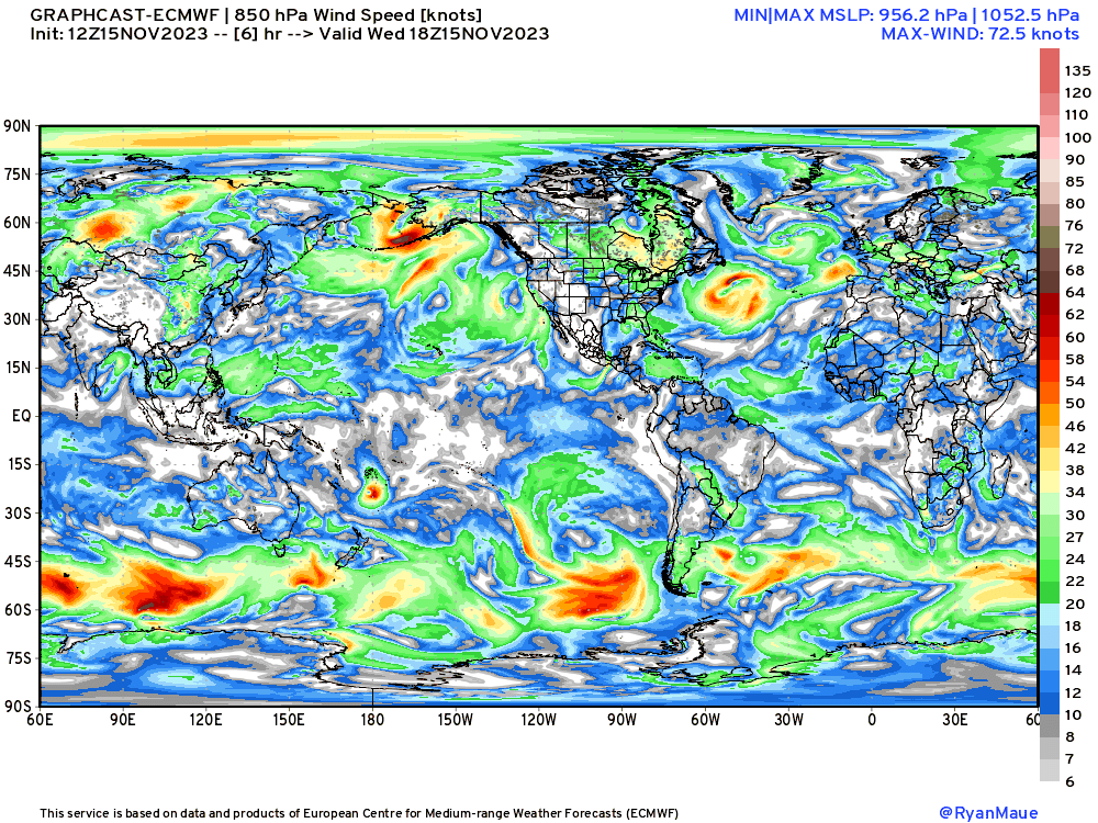
Update: Google has published a paper on their global weather modeling system called GraphCast that uses A.I. to train on historical data (ERA5) and forecast the future.
I processed the last 3-months of GraphCast forecast data initialized off the ECMWF IFS analysis, and holy moly am I astounded by the skill scores for Z500 NH at 5-days — the so-called headline score for NWP agencies around the world.
GraphCast is significantly better then the ECMWF HRES with a solid 0.01margin. That may not seem like much, but it may take GFS 10-years to get from 0.901 to 0.911 for a 365-day average. ECMWF reached 0.90 back in 2010, if I recall correctly, and has only now bumped up to 0.93.

I previously mentioned that A.I. models blur or smooth out the extremes, but based upon the current 10-day forecast, I’m not sure this is that much of any issue for GraphCast as the “smoothness” looks similar from Day 1 to Day 10. I don’t really understand what’s going on yet. The data output includes height, winds, humidity and temperature from the surface to upper-levels (50 mb) and precipitation.
Thursday’s High Temperatures

Back over 100 million Americans hitting at least 70°F. Warmest locations around 80°F in south Florida and Phoenix, only 3 million. 60s into Northern Michigan and Wisconsin! Wow, what a wonderful mid-November autumn day across much of the Lower 48.
Week 1 and Week 2 Temperature Anomaly
Above Normal Temperatures for the next several days but those are replaced with a pattern flip in Week 2 and below average temperatures.
Week 1: November 15-22 [EPS Mean 12z]

Week 2: November 22-29 [EPS Mean 12z]

Snowfall over next 15-days
7-Day Total Snowfall ECMWF EPS Ensemble Mean 12z (weathermodels.com)

Seeing more blue on the map but not much where people live. Just typical mountain snowfall.
15-day Total Snowfall and Probability from 51-member EPS ensembles [median]

I chose the ensemble median here at every grid point from the EPS ensembles. This is a better indication of expected snowfall over the next 15-days, especially week 2 when it’s colder.

7-Day Precipitation Outlook

NWS WFO have 8-inches to go in South Florida including Miami. Based upon the radar, that might be conservative.

NWS WPC precipitation over next 7-days shows widespread 1-inch plus across much of the eastern U.S. east of the Mississippi. The west coast will see rainfall extending all the way into Southern California. While this isn’t the blockbuster atmospheric river than some models suggested, this is pretty good!
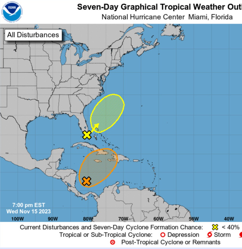
2023 Atlantic Hurricane Season | Medium Range Outlook
NHC has just marked Invest 98L in the Caribbean with 40% to 50% chance of developing in a tropical cyclone. The yellow hatch X off the SE US coast is a 10% “get me over fastball” associated with the swirl off Florida, but appears to be non-tropical or too entangled with frontal boundary.
2023 Western Pacific and Northern Indian Ocean
Invest 97W and Invest 94B are both being watched, but not seeing rapid development of either system. The Western Pacific is conspicuously quiet for a so-called strong El Niño.
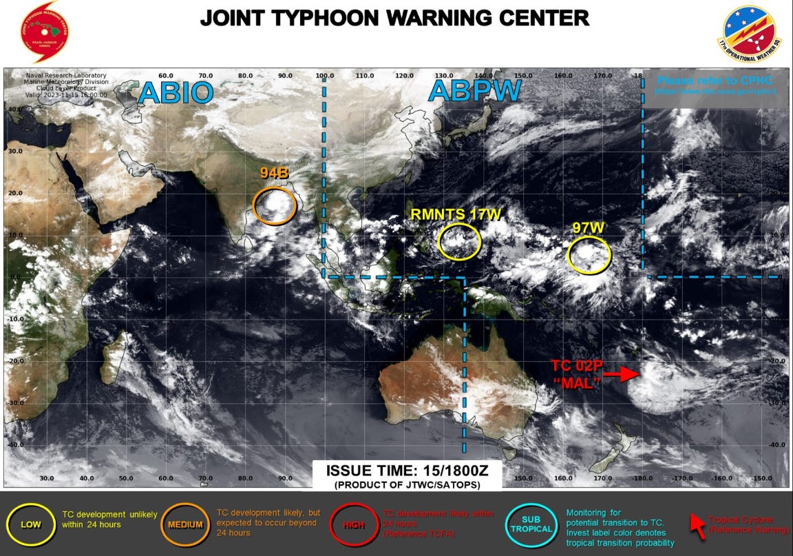
2023-24 South Pacific Cyclone Season
Tropical Cyclone Mal (02P) is still going, but will soon dissipate over colder waters of the SW Pacific.
Thank you to my paying subscribers! Your support pays for my Linux servers and product development. Also, it allows me to provide unfiltered commentary on scientific topics on X. Feel free to say hello and follow on X/Twitter (@RyanMaue)