


November 13, 2023 Week Ahead
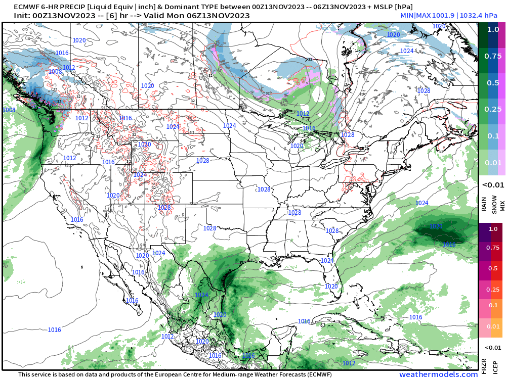
Gulf coast rainfall beneficial for parched Louisiana
Generally quiet weather pattern for much of the U.S. with exceptions along the West and Gulf of Mexico coasts. An area of low pressure develops in the northern Gulf of Mexico and provides considerable moisture transport onshore and beneficial rainfall especially for Louisiana. This low could become an impactful system for the Northeast later this weekend if it can phase with an approaching cold-front. However, that’s about the only major weather threat on the horizon.
Monday’s High Temperatures

Very comfortable across much of the Lower 48 with 60s and lower 70s from Montana to Jacksonville, Florida. If you want heat and some humidity, then Florida south of Interstate 4 still has 85-90°F temperatures. Or, Phoenix in the mid-80s.
New England in the 40s. Washington DC in mid-50s and NYC around 50°F

A weak clipper system will drop a dusting of snowfall across New England into Tuesday with higher elevations with 1-3”

Week 1 and Week 2 Temperature Anomaly
Above Normal Temperatures begin to erode across the eastern U.S. by week 2. The 10-day ensemble mean height anomaly shows a strong trough across the Western U.S. and much colder temperatures are expected to follow.

Week 1: November 13-20 [EPS Mean 00z]
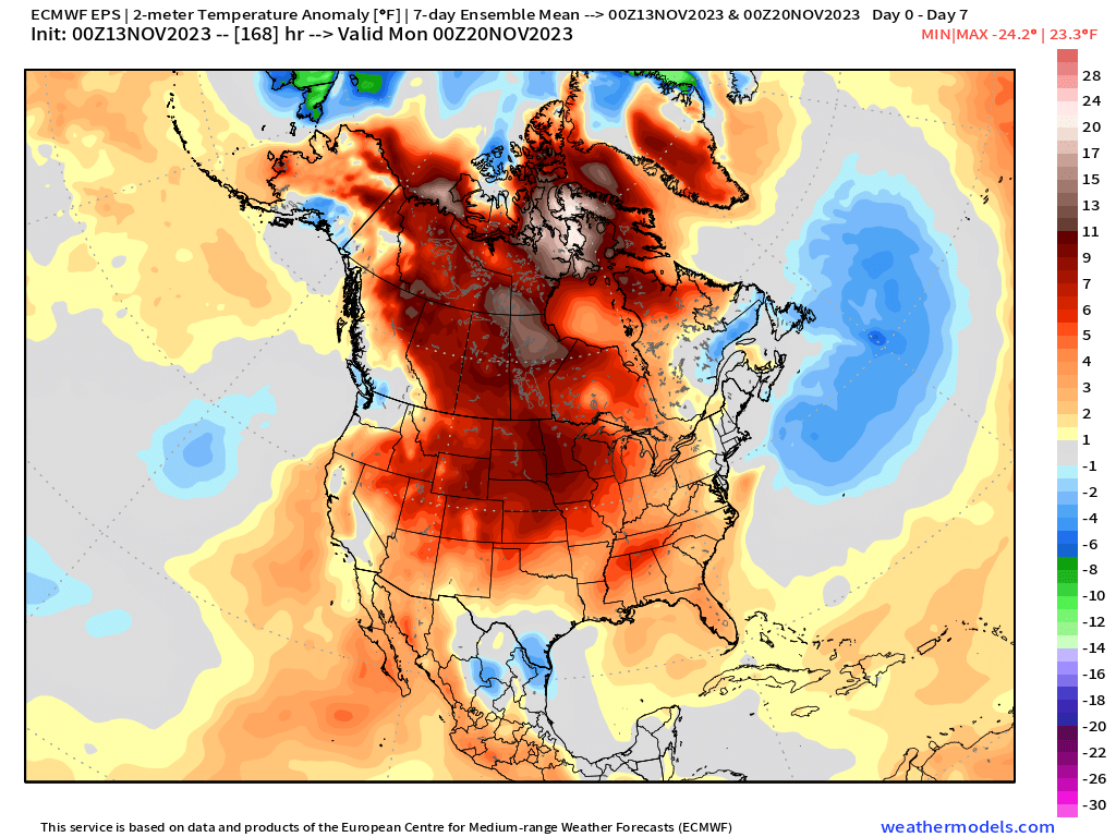
Week 2: November 20-27 [EPS Mean 00z]

Snowfall over next 15-days
Not expecting much in the way of snowfall this week. So, looking ahead through Day 15 from the ECMWF EPS mean (weathermodels.com)
15-Day Total Snowfall ECMWF EPS Ensemble Mean 12z (weathermodels.com)

15-day Total Snowfall Probability from 51-member EPS ensembles
Keep reading with a 7-day free trial
Subscribe to Weather Trader to keep reading this post and get 7 days of free access to the full post archives.