ECMWF Newsletter Link on Upgrade to 49r1
As you know, I’m a big fan of the European (ECMWF) weather forecasting center as their forecasts are highly skillful and the best in the world now for three decades. A new version or cycle of their model suite (HRES, Ensemble / EPS) will come online Tuesday morning (06z) and showcase significantly better 2-meter temperatures and a reduction in the 10-meter wind speed bias (too low) within tropical cyclones.
Much more technical details are at the newsletter link above.
Summary: I am ecstatic at this upgrade as the amount of open-data is vastly increased to include variables that I need to expand Weather Trader greatly to compete with established outfits that are extremely expensive.
Forecast Skill 49r1 upgrade vs. current operational model
The forecast skill of 5-day Northern Hemisphere 500 hPa geopotential height every 12-hours including ECMWF operational (blue), ECMWF-49r1 (black), and GFS v16.3 (red).
GFS has many poor-skill forecasts that we call “drop-outs” because they fall below the running-mean skill on the graph. However, ECMWF HRES is not immune from similar skill degradation usually associated with initial condition errors that grow rapidly. Overall, it appears that upper-level skill scores at 500 hPa are a wash with the new model, but maintain a healthy lead over GFS.
How healthy of a lead?
Comparison of 30-day running mean ECMWF vs. NOAA GFS
I’ve been keeping these data since 2006 — now almost 20-years — in my daily forecasting activities. You’ll note the significant degradation in skill during summer for GFS continues in 2024 and is not improving with 30-day mean dropping to 0.86. ECMWF does drop off as well but only to 0.90. Recent 30-day running means for ECMWF bump up against 0.95.
Comparison of 365-day running mean ECMWF vs. NOAA GFS
Let’s zoom out and look at a 1-year running mean of 5-day (NH Z500) forecast skill comparing ECMWF and GFS.
I see a few things:
ECMWF skill is approaching 0.94 while GFS is stuck along 0.90.
ECMWF skill reached 1-year average of 0.90 in 2011 or more than 13-years ago. GFS is therefore at similar skill levels as ECMWF modeling more than a decade ago.
The gap between ECMWF and GFS is not being bridged or narrowed.
What can be done about the inferior skill of NOAA GFS?
While I have good ideas for the new Trump (*) administration, it remains to be seen who will comprise the new management and what will be the focus of the nominated NOAA administrator. The current Biden-Harris administration doesn’t prioritize NWP — and it shows. We won’t know much for a while as Trump 2.0 transition staffing decisions probably won’t get down to NOAA for quite a while, and well after Trump takes office [again] on January 20, 2025.
(*Note, I was a Trump political appointee from Sep 2020 - Jan 2021)
Atlantic Tropical Update
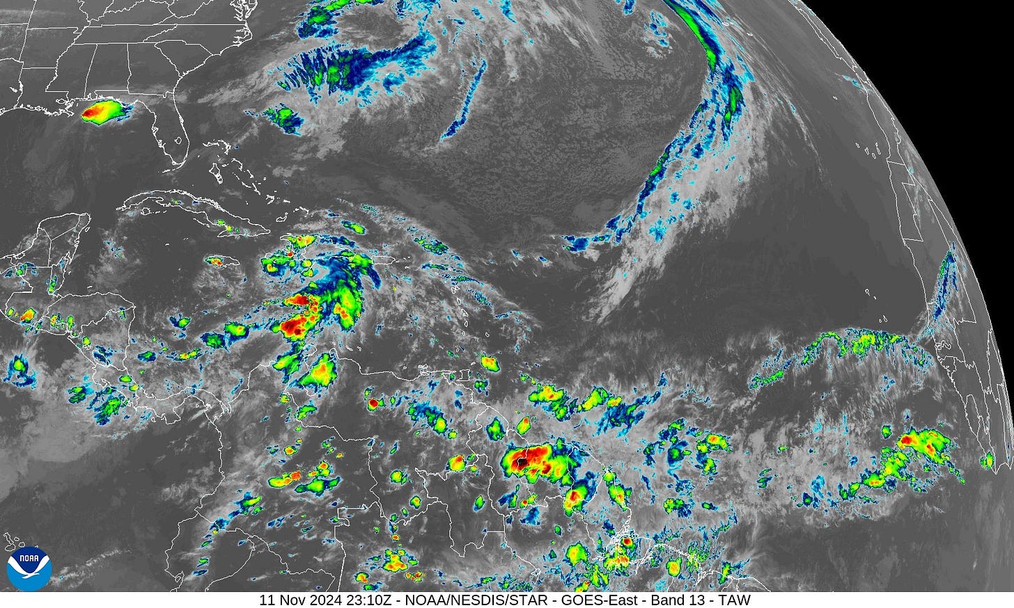
The remnants of Rafael are actually firing up a few showers and thunderstorms of Pensacola, Florida out in the Gulf of Mexico, but redevelopment is not expected.
The next area of low pressure to form (50% NHC) is south of Hispaniola and will move westward in the next few days. Odds are increasing for Tropical Storm Sara to form toward the weekend with considerable model support. However, the track is uncertain with a few scenarios in play.
Keep reading with a 7-day free trial
Subscribe to Weather Trader to keep reading this post and get 7 days of free access to the full post archives.


