


November 10, 2023 Weekend Ahead
Quiet weather weekend
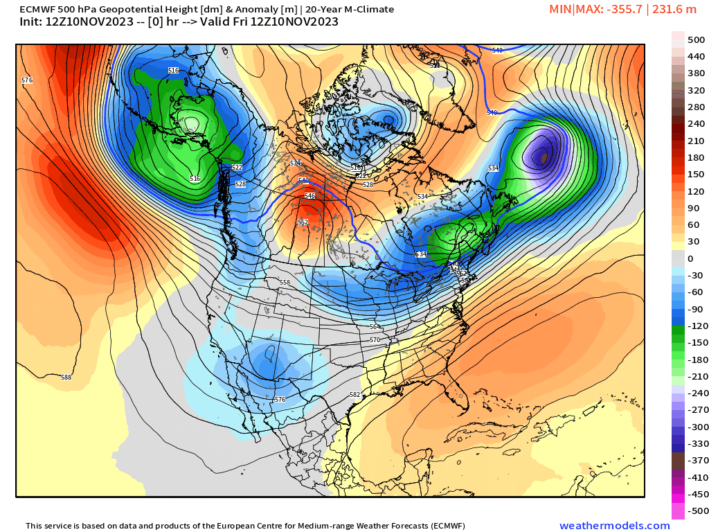
The upper-level pattern for the next 10-days from ECMWF HRES shows generally ridging over the central Lower 48 shutting off the availability of cold air to drop out of Canada onto the Midwest and Great Lakes. The trough off the West Coast next week now retrogrades westward too far to tap into Alaskan cold air which is instead replaced with Pacific warmth. The subtropical jet takes over with 140-150 knot streak into southern California. by next Thursday. Hello El Niño!

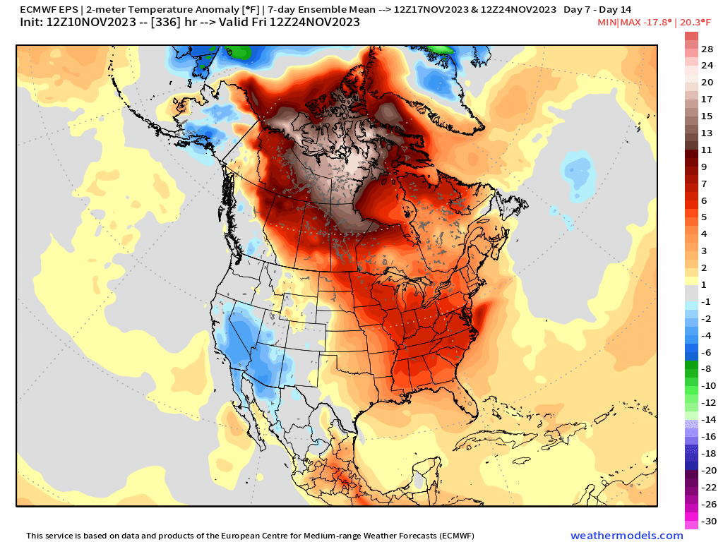
Above Normal Temperatures overall for the next 2-weeks+ across much of Canada and the Lower 48. The Canadian Arctic is very warm and will contribute considerably to the global mean anomaly.
Week 1: November 10-17 [EPS Mean12z]

Week 2: November 17-24 [EPS Mean 12z]
Snowfall over next 15-days
10-Day Total from ECMWF HRES
From the ECMWF HRES has poofed the snowfall through 10-days across much of the Western U.S. However, the event wasn’t suppose to happen until next week leaving the models plenty of time and opportunity to flip back to a snowy solution — or not!

15-Day Total Snowfall ECMWF EPS Control 12z
Keep reading with a 7-day free trial
Subscribe to Weather Trader to keep reading this post and get 7 days of free access to the full post archives.