


Monitoring Gulf of Mexico for Hurricane Development
NHC with high probability of Invest 99L becoming a storm
As new weather model data arrived from GFS/GEFS and ECMWF/EPS during the day, it was hard to not get a sense of déjà vu after last hurricane season. Folks in Louisiana are still recovering from multiple natural disasters, and they certainly do not need another one next week. The next name on the list is Ida.
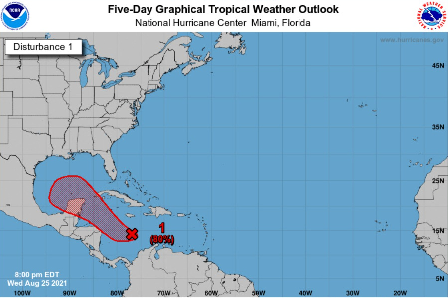
By this weekend, an area of low pressure (Invest 99L designation) will move into the Gulf of Mexico and become a tropical storm. The formation stage of any tropical cyclone is usually a slow and messy process with multiple centers of circulation within clusters of thunderstorms. However, the general motion of the system will be northwest and the environment is highly conducive for hurricane development especially over the warm Gulf of Mexico.
At this juncture, we cannot pinpoint a landfall location of whatever develops, but the current area of concern extends from Texas to Louisiana with intensity ranging from tropical storm to major hurricane — within 4-5 days. That means once the NHC initializes the system, the first forecast out of the gate will have a 5-day forecast cone that includes the best first official prediction of landfall location. And, this means there may be only 72-96 hours to prepare for a powerful hurricane.

The EPS ensembles (weathermodels.com) show the wide spread of potential tracks from northern Mexico to New Orleans. This is a typical ensemble spread for a pre-genesis system which is currently poorly organized. With the warm Gulf of Mexico waters and seemingly lack of any wind shear, I am quite concerned about rapid intensification.
The NOAA model based guidance as well as the Canadian Ensembles are largely focused upon Louisiana.

And, this is just the beginning of a very active period of storm activity in the Atlantic. There could be 3 or 4 named storms at the same time, and in 10-days or so, another major hurricane in the central Atlantic — hopefully heading north to mix fish.

ECMWF is upgrading their global ensemble system to a new cycle (47r3) and some real-time evaluation data has arrived just in time for this hurricane onslaught. We need as much model guidance help as we can get. These products are all available at the WeatherModels.com — a professional level subscription service for models.