


May 9, 2024 Southern Storms Continues Before Cool Down
Quiet weekend and cooler for much of the Lower 48

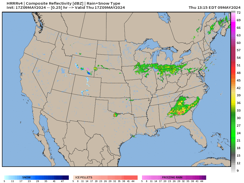
One more day of severe weather across the Southern U.S. from Texas into the Southeast as thunderstorms develop in a moist, Gulf of Mexico fueled atmosphere.
The storms should more scattered today — with initial development in North Texas underway — expanding to southern AL and GA overnight.
Enhanced Risk 3/5 on the SPC scale for convective outlook hazards
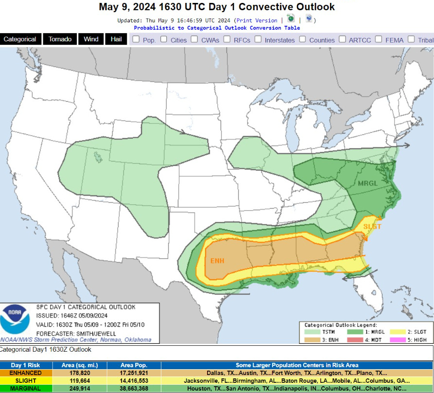
...THERE IS AN ENHANCED RISK OF SEVERE THUNDERSTORMS FROM CENTRAL
   TEXAS EAST ACROSS THE CENTRAL GULF COAST STATES AND INTO SOUTHERN
   GEORGIA AND SOUTHERN SOUTH CAROLINA...

   ...SUMMARY...
   Very large hail with multiple supercells appears probable across
   parts of north and central Texas into the ArkLaTex vicinity this
   afternoon and evening.  A broader corridor of severe hail and
   damaging-wind potential will extend from east Texas into the lower
   Mississippi Valley and Southeast.
Next 10-days Upper-Level Weather Pattern | ECMWF AIFS

Troughing across the Eastern U.S. for the next 7-days only gives away to ridging emanating from Mexico and Texas in the subtropics. This is still an unsettled pattern with thunderstorms likely where these mobile troughs can interact with moisture from the Gulf of Mexico.
The ridging out west is quickly replaced with yet another Alaskan trough — very intense.
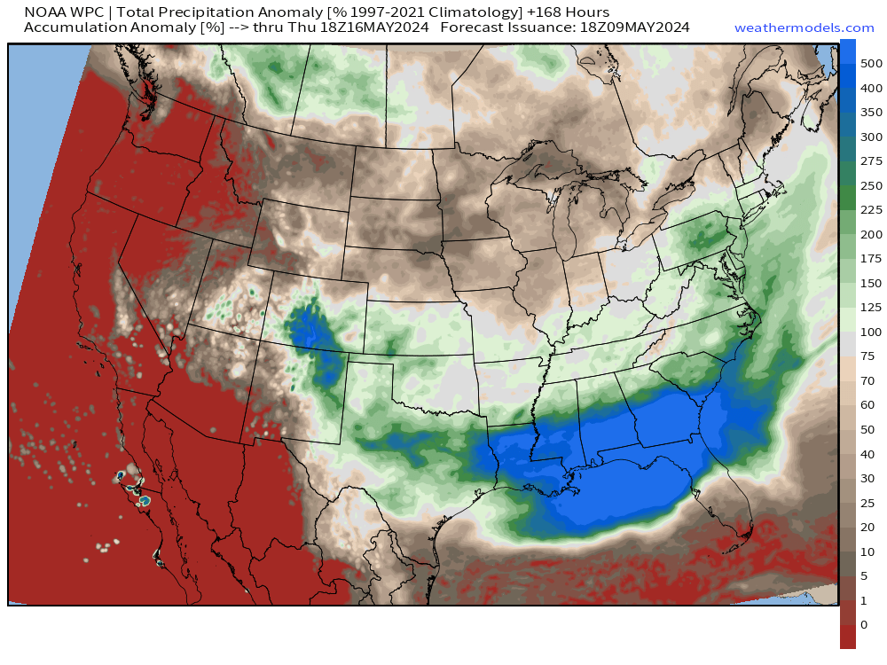
NWS WPC 7-Day Precipitation Forecast | Watering Needs

Rainfall is rather sparse in the Midwest and Great Lakes over the next week in NW flow out of Canada. The subtropical/tropical moisture is confined to the Gulf coast.
Thursday Temperatures 2:45 PM ET

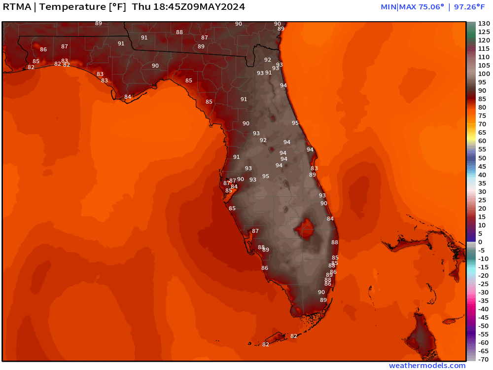
Orlando pushing mid-90s on the way up to 98°F in the next hours.
Friday Low Temperatures

Still quite chilly in the Mountain West. 50s in the Ohio Valley and comfortable 60s in the Southeast. Temperatures continue to cool for Saturday morning behind the cold front.
Friday High Temperatures

Florida in the 90s again. Only 115 Million Americans at/above 80°F
Keep reading with a 7-day free trial
Subscribe to Weather Trader to keep reading this post and get 7 days of free access to the full post archives.