Good morning!
Scattered thunderstorms today in the warm, moist air south of a backdoor cold-front crashing through the Great Lakes.
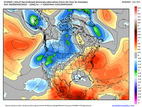
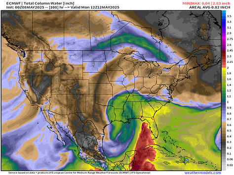
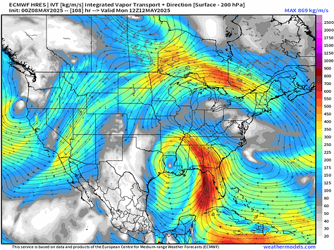
By this weekend and early next week, the upper-level low that was spinning over the U.S. Southwest will slowly track along the Gulf coast and intensify with an assist from the polar front — cutting-off again. The result will be a moisture plume out of the Gulf that we can call a mini-atmospheric river = huge rainfall totals from Louisiana to Florida.
Monday morning depiction from ECMWF 06z


And, the precipitable water animation (my favorite parameter) for the next 6-d
PWAT > 2” across Florida will mean very heavy rain, which is good for the parched state. Dry air finally is replaced in the Great Lakes and Northeast next week as the moisture blob with the trough expands across East of the Mississippi. Along with warming temperatures, looks like days and days of pop-up thunderstorms typical of mid-May. The U.S. Southwest dries out and heats up > 100°F.
High Temperatures Next 8-Days | Thursday May 8 - Friday May 16
mid-90s in the northern Plains by Sunday and then 80s take over the eastern U.S. with 90s showing up in the Southeast by later next week.
Texas goes into the 100s as the ridge over the U.S. Southeast is pushed eastward.
By next Friday, 225 million at/above 80°F.
High Temperatures Today | Thursday May 8, 2025
72.9°F is the Lower 48 average high temperature with 261 million at least 70°F. 90s in Florida and the U.S. Southwest, with about 16 million across the country.
Cooler in the Great Lakes today with the Canadian cold front dipping through. 50s and 60s this afternoon rather than 70s we saw yesterday.
Still nice and warm in D.C. NYC and Boston in the 70s to around 80°F heading south down I-95.
Satellite Imagery This Morning
Quiet satellite picture across much of the Lower 48 with only a few areas of scattered showers.
Weather Today | Fronts 8 AM
Slight chance of severe thunderstorms along the Rio Grande and in Tennessee perhaps slipping into north Georgia. Heavy rain in the Northeast including NYC!
Radar Simulation next 18-hours through Friday morning 2 AM ET
Keep reading with a 7-day free trial
Subscribe to Weather Trader to keep reading this post and get 7 days of free access to the full post archives.


