


May 8, 2024 Stormy Pattern Continues
Moderate Risk of Severe Thunderstorms including Nashville

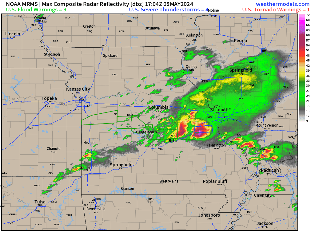
Waves of thunderstorms continue today across the Ozarks into Nashville with the potential again for tornados along with monster hail.
Radar through 2:30 PM ET showed a monster cell with baseball sized hail south of St. Louis.
Moderate Risk is 4/5 on the SPC convective risk scale
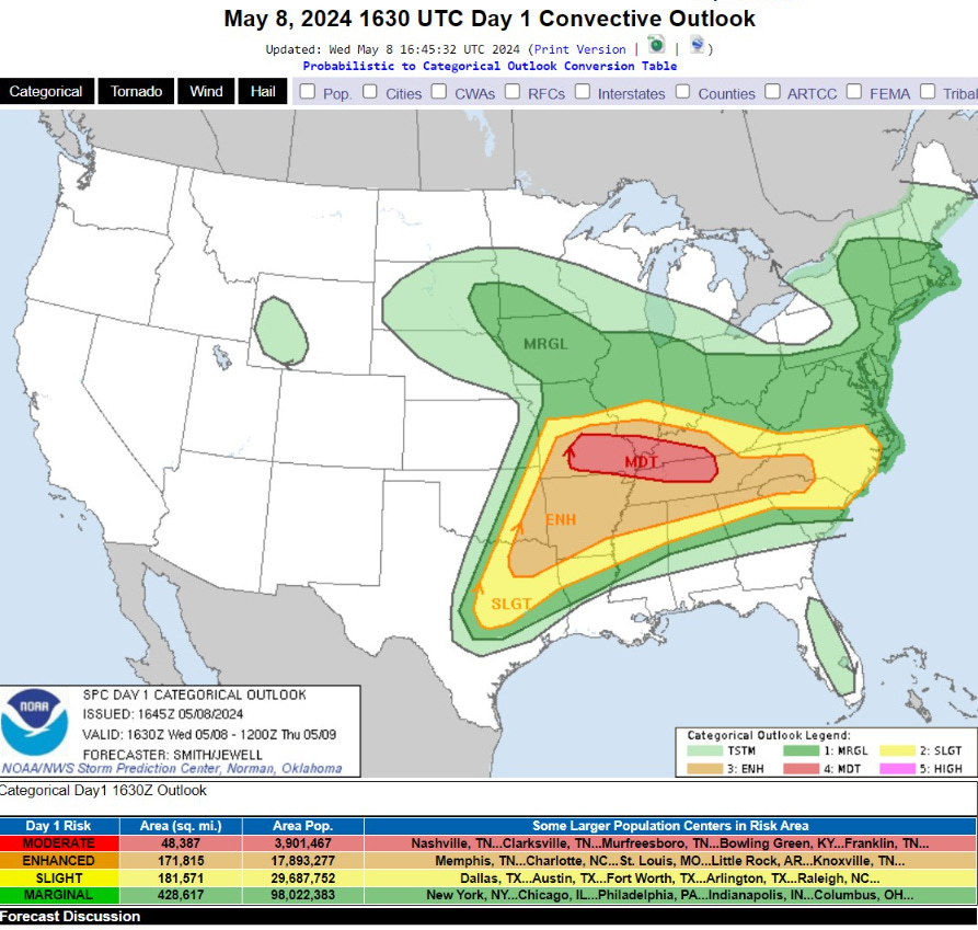
   ..THERE IS A MODERATE RISK OF SEVERE THUNDERSTORMS FROM THE
   MISSOURI OZARKS EASTWARD INTO SOUTH-CENTRAL KENTUCKY AND MIDDLE
   TENNESSEE...

   ...SUMMARY...
   Severe thunderstorms appear likely from parts of the mid
   Mississippi, Ohio, and Tennessee Valleys into the southern Plains.
   All severe hazards, including tornadoes, very large to giant hail,
   and potentially significant damaging winds are possible.  Some
   tornadoes may be strong.

HRRR shows the storms congealing into a line through Tennessee in the overnight hours to threaten North Georgia including Atlanta by the early morning.

Damaging winds would be the primary threat from the squall line early Thursday morning across the Southeast.
Keep reading with a 7-day free trial
Subscribe to Weather Trader to keep reading this post and get 7 days of free access to the full post archives.